Haydraw Topo Map South Dakota
To zoom in, hover over the map of Haydraw
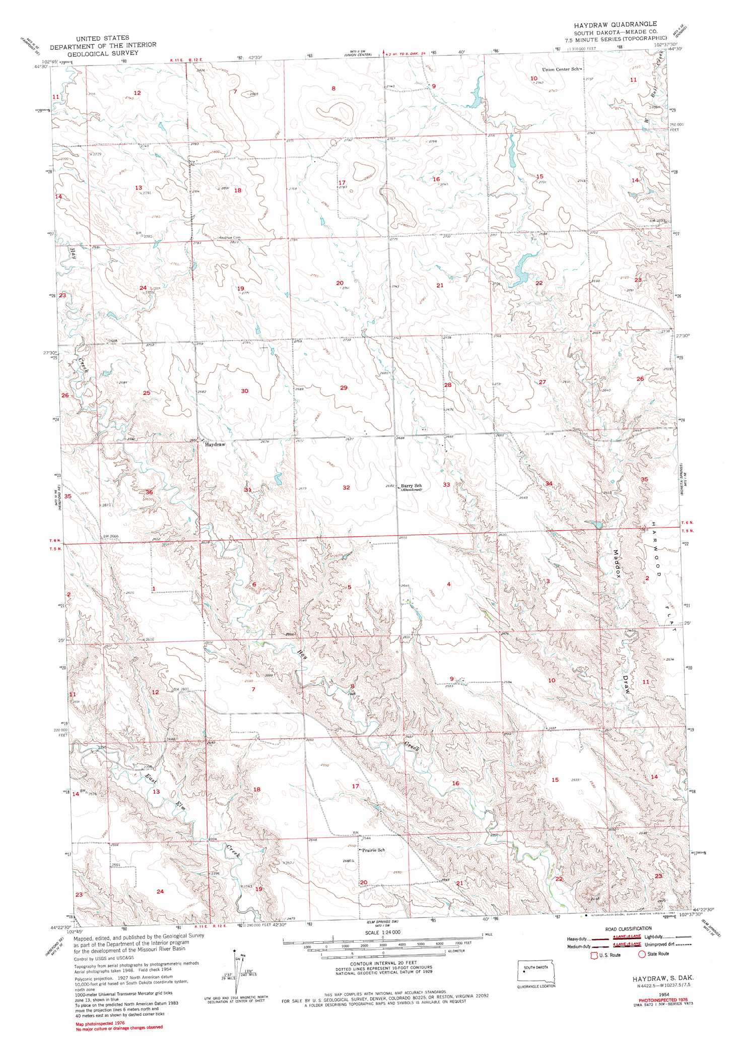
USGS Topo Quad 44102d6 - 1:24,000 scale
| Topo Map Name: | Haydraw |
| USGS Topo Quad ID: | 44102d6 |
| Print Size: | ca. 21 1/4" wide x 27" high |
| Southeast Coordinates: | 44.375° N latitude / 102.625° W longitude |
| Map Center Coordinates: | 44.4375° N latitude / 102.6875° W longitude |
| U.S. State: | SD |
| Filename: | o44102d6.jpg |
| Download Map JPG Image: | Haydraw topo map 1:24,000 scale |
| Map Type: | Topographic |
| Topo Series: | 7.5´ |
| Map Scale: | 1:24,000 |
| Source of Map Images: | United States Geological Survey (USGS) |
| Alternate Map Versions: |
Haydraw SD 1954, updated 1956 Download PDF Buy paper map Haydraw SD 1954, updated 1981 Download PDF Buy paper map Haydraw SD 2012 Download PDF Buy paper map Haydraw SD 2015 Download PDF Buy paper map |
1:24,000 Topo Quads surrounding Haydraw
Fairpoint Nw |
Fairpoint |
Stoneville |
Redowl |
White Owl Nw |
Fairpoint Sw |
Fairpoint Se |
Union Center |
Enning |
White Owl |
Hereford |
Hereford Ne |
Haydraw |
Boneita Springs |
Dalzell Nw |
Hereford Sw |
Hereford Se |
Elm Springs Sw |
Elm Springs |
Dalzell |
New Underwood Nw |
Viewfield |
Owanka Nw |
Owanka Ne |
Wasta Nw |
> Back to 44102a1 at 1:100,000 scale
> Back to 44102a1 at 1:250,000 scale
> Back to U.S. Topo Maps home
Haydraw topo map: Gazetteer
Haydraw: Dams
Mooney 1 Dam elevation 815m 2673′Haydraw: Populated Places
Haydraw elevation 819m 2687′Haydraw digital topo map on disk
Buy this Haydraw topo map showing relief, roads, GPS coordinates and other geographical features, as a high-resolution digital map file on DVD:
Eastern Wyoming & Western South Dakota
Buy digital topo maps: Eastern Wyoming & Western South Dakota