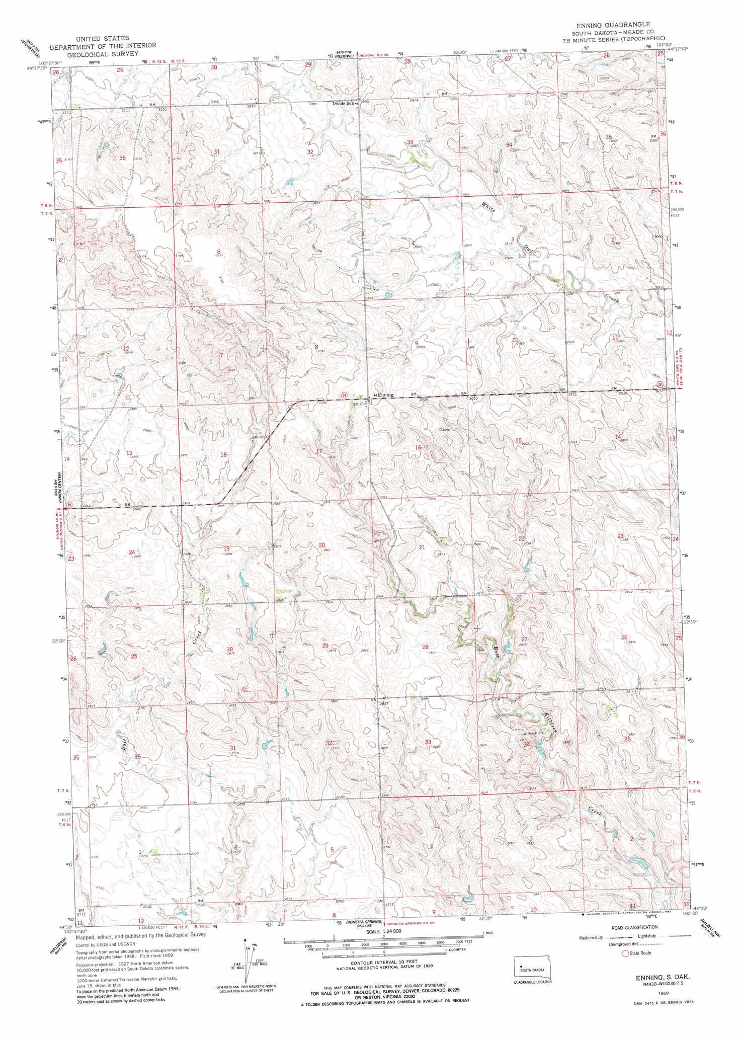
Enning Topo Map South Dakota
To zoom in, hover over the map of Enning
USGS Topo Quad 44102e5 - 1:24,000 scale
| Topo Map Name: | Enning |
| USGS Topo Quad ID: | 44102e5 |
| Print Size: | ca. 21 1/4" wide x 27" high |
| Southeast Coordinates: | 44.5° N latitude / 102.5° W longitude |
| Map Center Coordinates: | 44.5625° N latitude / 102.5625° W longitude |
| U.S. State: | SD |
| Filename: | o44102e5.jpg |
| Download Map JPG Image: | Enning topo map 1:24,000 scale |
| Map Type: | Topographic |
| Topo Series: | 7.5´ |
| Map Scale: | 1:24,000 |
| Source of Map Images: | United States Geological Survey (USGS) |
| Alternate Map Versions: |
Enning SD 1959, updated 1960 Download PDF Buy paper map Enning SD 1959, updated 1983 Download PDF Buy paper map Enning SD 2012 Download PDF Buy paper map Enning SD 2015 Download PDF Buy paper map |
1:24,000 Topo Quads surrounding Enning
Bull Run Creek |
Big Draw |
Opal West Se |
Opal East Sw |
Opal East Se |
Fairpoint |
Stoneville |
Redowl |
White Owl Nw |
Marcus |
Fairpoint Se |
Union Center |
Enning |
White Owl |
White Owl Se |
Hereford Ne |
Haydraw |
Boneita Springs |
Dalzell Nw |
Dalzell Ne |
Hereford Se |
Elm Springs Sw |
Elm Springs |
Dalzell |
Dalzell Se |
> Back to 44102e1 at 1:100,000 scale
> Back to 44102a1 at 1:250,000 scale
> Back to U.S. Topo Maps home
Enning topo map: Gazetteer
Enning: Dams
Freeman Dam elevation 904m 2965′Sanders Dam elevation 878m 2880′
Enning: Populated Places
Enning elevation 925m 3034′Enning digital topo map on disk
Buy this Enning topo map showing relief, roads, GPS coordinates and other geographical features, as a high-resolution digital map file on DVD:
Eastern Wyoming & Western South Dakota
Buy digital topo maps: Eastern Wyoming & Western South Dakota