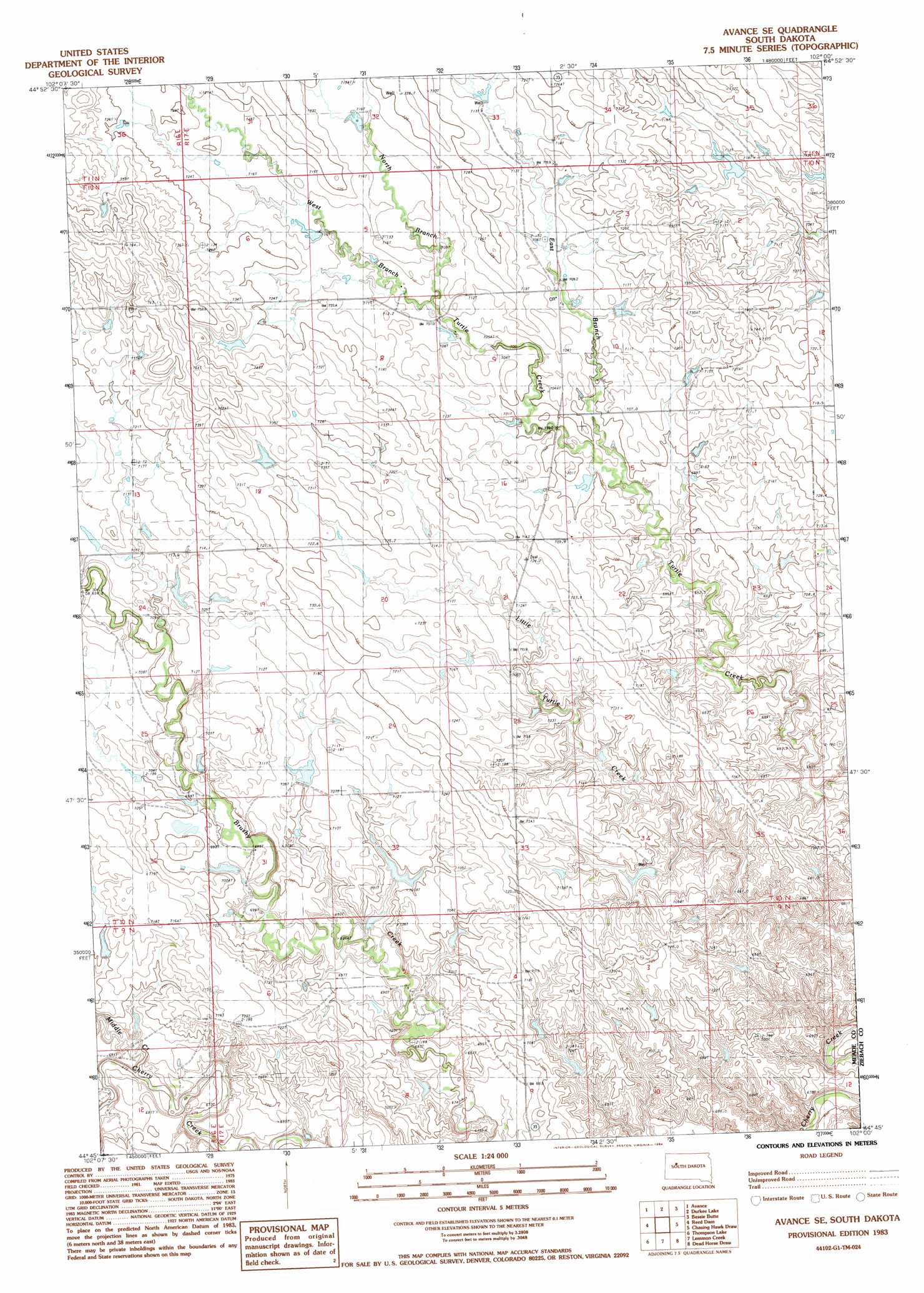
Avance Se Topo Map South Dakota
To zoom in, hover over the map of Avance Se
USGS Topo Quad 44102g1 - 1:24,000 scale
| Topo Map Name: | Avance Se |
| USGS Topo Quad ID: | 44102g1 |
| Print Size: | ca. 21 1/4" wide x 27" high |
| Southeast Coordinates: | 44.75° N latitude / 102° W longitude |
| Map Center Coordinates: | 44.8125° N latitude / 102.0625° W longitude |
| U.S. State: | SD |
| Filename: | o44102g1.jpg |
| Download Map JPG Image: | Avance Se topo map 1:24,000 scale |
| Map Type: | Topographic |
| Topo Series: | 7.5´ |
| Map Scale: | 1:24,000 |
| Source of Map Images: | United States Geological Survey (USGS) |
| Alternate Map Versions: |
Avance SE SD 1983, updated 1984 Download PDF Buy paper map Avance SE SD 2012 Download PDF Buy paper map Avance SE SD 2015 Download PDF Buy paper map |
1:24,000 Topo Quads surrounding Avance Se
Deep Creek Se |
Faith Sw |
Faith |
Red Elm Sw |
Red Elm |
Lemmon Butte |
Avance |
Durkee Lake |
Bessie Butte |
Bull Creek 2 Ne |
Opal East Se |
Reed Dam |
Avance Se |
Chasing Hawk Draw |
Red Scaffold |
Marcus |
Thompson Lake |
Lemmon Creek |
Dead Horse Draw |
Bridger Ne |
White Owl Se |
Plainview |
Howes |
Bridger |
Bridger Se |
> Back to 44102e1 at 1:100,000 scale
> Back to 44102a1 at 1:250,000 scale
> Back to U.S. Topo Maps home
Avance Se topo map: Gazetteer
Avance Se: Dams
A Samuelson Number 1 Dam elevation 722m 2368′Delbridge Dam elevation 710m 2329′
R Compton Dam elevation 683m 2240′
Samuelson Brothers Number 4 Dam elevation 694m 2276′
Samuelson Dam elevation 695m 2280′
Avance Se: Streams
East Branch Turtle Creek elevation 690m 2263′Middle Creek elevation 674m 2211′
North Branch Turtle Creek elevation 705m 2312′
West Branch Turtle Creek elevation 705m 2312′
Avance Se digital topo map on disk
Buy this Avance Se topo map showing relief, roads, GPS coordinates and other geographical features, as a high-resolution digital map file on DVD:
Eastern Wyoming & Western South Dakota
Buy digital topo maps: Eastern Wyoming & Western South Dakota