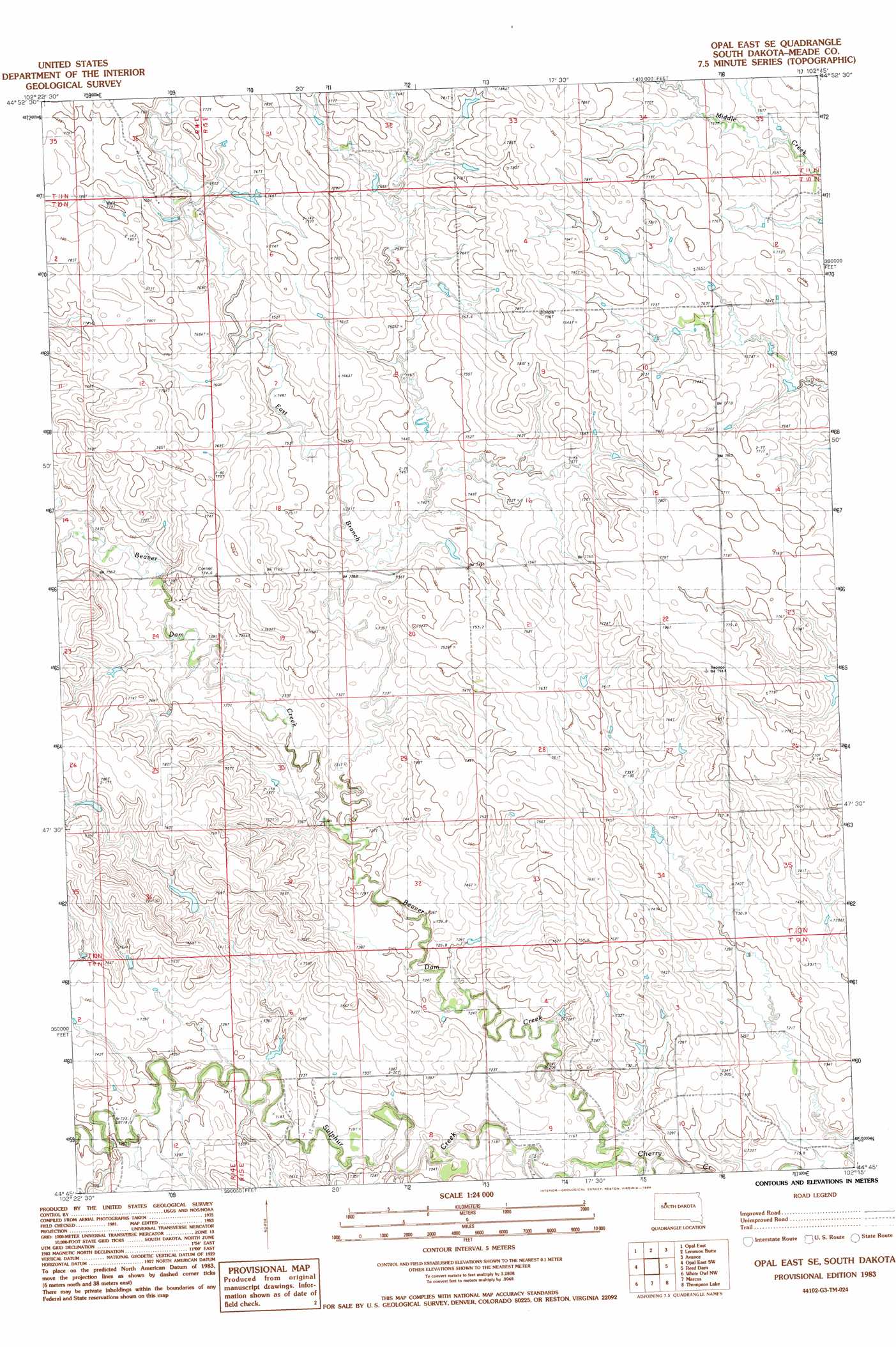
Opal East Se Topo Map South Dakota
To zoom in, hover over the map of Opal East Se
USGS Topo Quad 44102g3 - 1:24,000 scale
| Topo Map Name: | Opal East Se |
| USGS Topo Quad ID: | 44102g3 |
| Print Size: | ca. 21 1/4" wide x 27" high |
| Southeast Coordinates: | 44.75° N latitude / 102.25° W longitude |
| Map Center Coordinates: | 44.8125° N latitude / 102.3125° W longitude |
| U.S. State: | SD |
| Filename: | o44102g3.jpg |
| Download Map JPG Image: | Opal East Se topo map 1:24,000 scale |
| Map Type: | Topographic |
| Topo Series: | 7.5´ |
| Map Scale: | 1:24,000 |
| Source of Map Images: | United States Geological Survey (USGS) |
| Alternate Map Versions: |
Opal East SE SD 1983, updated 1984 Download PDF Buy paper map Opal East SE SD 2012 Download PDF Buy paper map Opal East SE SD 2015 Download PDF Buy paper map |
1:24,000 Topo Quads surrounding Opal East Se
Maurine |
Signal Butte |
Deep Creek Se |
Faith Sw |
Faith |
Opal West |
Opal East |
Lemmon Butte |
Avance |
Durkee Lake |
Opal West Se |
Opal East Sw |
Opal East Se |
Reed Dam |
Avance Se |
Redowl |
White Owl Nw |
Marcus |
Thompson Lake |
Lemmon Creek |
Enning |
White Owl |
White Owl Se |
Plainview |
Howes |
> Back to 44102e1 at 1:100,000 scale
> Back to 44102a1 at 1:250,000 scale
> Back to U.S. Topo Maps home
Opal East Se topo map: Gazetteer
Opal East Se: Dams
D Gifford Number 2 Dam elevation 751m 2463′L Reeves Number 3 Dam elevation 770m 2526′
Opal East Se: Streams
Beaver Creek elevation 711m 2332′Beaver Dam Creek elevation 710m 2329′
East Branch Beaver Dam Creek elevation 725m 2378′
Sulphur Creek elevation 709m 2326′
Opal East Se digital topo map on disk
Buy this Opal East Se topo map showing relief, roads, GPS coordinates and other geographical features, as a high-resolution digital map file on DVD:
Eastern Wyoming & Western South Dakota
Buy digital topo maps: Eastern Wyoming & Western South Dakota