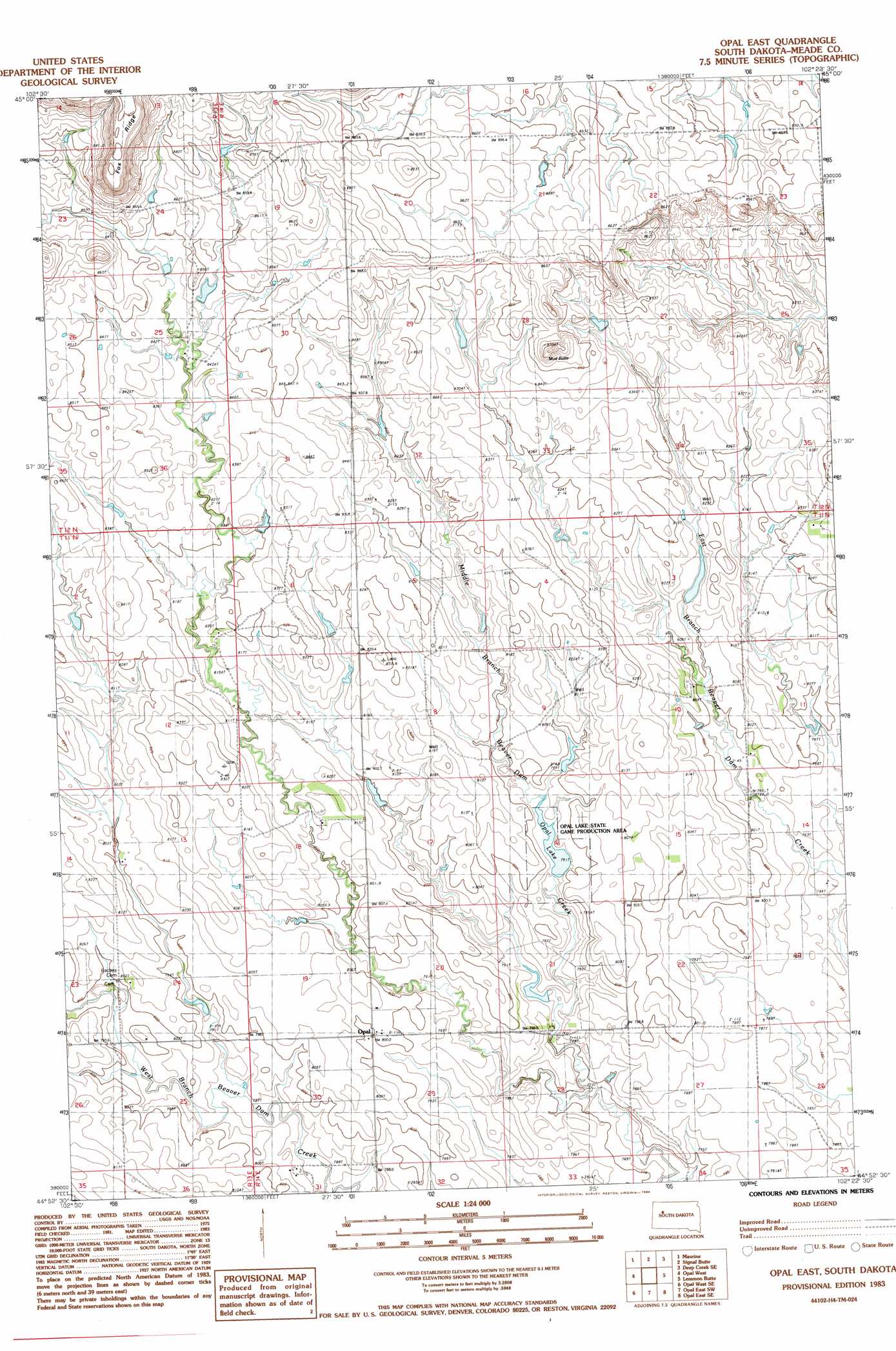
Opal East Topo Map South Dakota
To zoom in, hover over the map of Opal East
USGS Topo Quad 44102h4 - 1:24,000 scale
| Topo Map Name: | Opal East |
| USGS Topo Quad ID: | 44102h4 |
| Print Size: | ca. 21 1/4" wide x 27" high |
| Southeast Coordinates: | 44.875° N latitude / 102.375° W longitude |
| Map Center Coordinates: | 44.9375° N latitude / 102.4375° W longitude |
| U.S. State: | SD |
| Filename: | o44102h4.jpg |
| Download Map JPG Image: | Opal East topo map 1:24,000 scale |
| Map Type: | Topographic |
| Topo Series: | 7.5´ |
| Map Scale: | 1:24,000 |
| Source of Map Images: | United States Geological Survey (USGS) |
| Alternate Map Versions: |
Opal East SD 1983, updated 1984 Download PDF Buy paper map Opal East SD 2012 Download PDF Buy paper map Opal East SD 2015 Download PDF Buy paper map |
1:24,000 Topo Quads surrounding Opal East
Imogene |
Bixby |
Deep Creek Nw |
Deep Creek Ne |
Faith Nw |
Cedar Canyon |
Maurine |
Signal Butte |
Deep Creek Se |
Faith Sw |
Squaw Buttes |
Opal West |
Opal East |
Lemmon Butte |
Avance |
Big Draw |
Opal West Se |
Opal East Sw |
Opal East Se |
Reed Dam |
Stoneville |
Redowl |
White Owl Nw |
Marcus |
Thompson Lake |
> Back to 44102e1 at 1:100,000 scale
> Back to 44102a1 at 1:250,000 scale
> Back to U.S. Topo Maps home
Opal East topo map: Gazetteer
Opal East: Dams
D Talley Dam elevation 816m 2677′E Vansickel Dam elevation 786m 2578′
Opal Dam elevation 793m 2601′
Opal East: Parks
Opal Lake State Game Production Area elevation 804m 2637′Opal East: Populated Places
Opal elevation 800m 2624′Opal East: Reservoirs
Opal Lake elevation 792m 2598′Opal East: Summits
Mud Butte elevation 889m 2916′Opal East digital topo map on disk
Buy this Opal East topo map showing relief, roads, GPS coordinates and other geographical features, as a high-resolution digital map file on DVD:
Eastern Wyoming & Western South Dakota
Buy digital topo maps: Eastern Wyoming & Western South Dakota