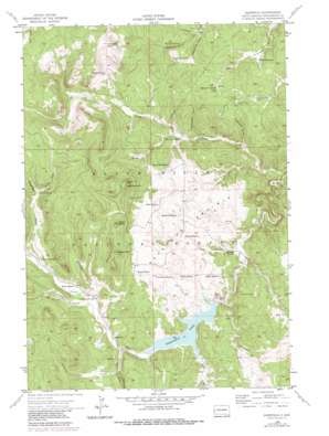
Deerfield Topo Map South Dakota
To zoom in, hover over the map of Deerfield
USGS Topo Quad 44103a7 - 1:24,000 scale
| Topo Map Name: | Deerfield |
| USGS Topo Quad ID: | 44103a7 |
| Print Size: | ca. 21 1/4" wide x 27" high |
| Southeast Coordinates: | 44° N latitude / 103.75° W longitude |
| Map Center Coordinates: | 44.0625° N latitude / 103.8125° W longitude |
| U.S. State: | SD |
| Filename: | o44103a7.jpg |
| Download Map JPG Image: | Deerfield topo map 1:24,000 scale |
| Map Type: | Topographic |
| Topo Series: | 7.5´ |
| Map Scale: | 1:24,000 |
| Source of Map Images: | United States Geological Survey (USGS) |
| Alternate Map Versions: |
Deerfield SD 1956, updated 1958 Download PDF Buy paper map Deerfield SD 1956, updated 1968 Download PDF Buy paper map Deerfield SD 1956, updated 1979 Download PDF Buy paper map Deerfield SD 1956, updated 1979 Download PDF Buy paper map Deerfield SD 1998, updated 2001 Download PDF Buy paper map Deerfield SD 2012 Download PDF Buy paper map Deerfield SD 2015 Download PDF Buy paper map |
| FStopo: | US Forest Service topo Deerfield is available: Download FStopo PDF Download FStopo TIF |
1:24,000 Topo Quads surrounding Deerfield
> Back to 44103a1 at 1:100,000 scale
> Back to 44102a1 at 1:250,000 scale
> Back to U.S. Topo Maps home
Deerfield topo map: Gazetteer
Deerfield: Dams
Deerfield Dam elevation 1800m 5905′Deerfield: Flats
Reynolds Prairie elevation 1826m 5990′Deerfield: Mines
Black Tunnel Mine elevation 1755m 5757′Divide Lode Mine elevation 1887m 6190′
Golden West Mine elevation 1793m 5882′
King of the West Mine elevation 1828m 5997′
Nichols Creek Gravel Pit elevation 2086m 6843′
Yellow Bird Mine elevation 1825m 5987′
Deerfield: Parks
Deerfield Lake Recreation Area elevation 1799m 5902′Deerfield: Pillars
Castle Rock elevation 2067m 6781′Deerfield: Populated Places
Copper Camp (historical) elevation 1880m 6167′Deerfield elevation 1811m 5941′
Deerfield: Reservoirs
Deerfield Lake elevation 1800m 5905′Deerfield: Springs
Kinney Spring elevation 1817m 5961′Lyons Spring elevation 1940m 6364′
Maitland Spring elevation 1775m 5823′
Musser Spring elevation 1978m 6489′
Taylor Spring elevation 1955m 6414′
Deerfield: Streams
Dutchman Creek elevation 1764m 5787′Gold Run elevation 1800m 5905′
Horsethief Creek elevation 1825m 5987′
Nichols Creek elevation 1816m 5958′
Silver Creek elevation 1826m 5990′
South Fork Castle Creek elevation 1805m 5921′
Deerfield: Summits
Flag Mountain elevation 2103m 6899′Nipple Butte elevation 2072m 6797′
White Tail Peak elevation 2123m 6965′
Deerfield: Valleys
Hughes Draw elevation 1871m 6138′Lessering Draw elevation 1737m 5698′
Long Draw elevation 1726m 5662′
Lyons Draw elevation 1938m 6358′
Maitland Draw elevation 1756m 5761′
Mercedes Gulch elevation 1781m 5843′
Sawbuck Draw elevation 1750m 5741′
Deerfield digital topo map on disk
Buy this Deerfield topo map showing relief, roads, GPS coordinates and other geographical features, as a high-resolution digital map file on DVD:
Eastern Wyoming & Western South Dakota
Buy digital topo maps: Eastern Wyoming & Western South Dakota


