Bend Topo Map South Dakota
To zoom in, hover over the map of Bend
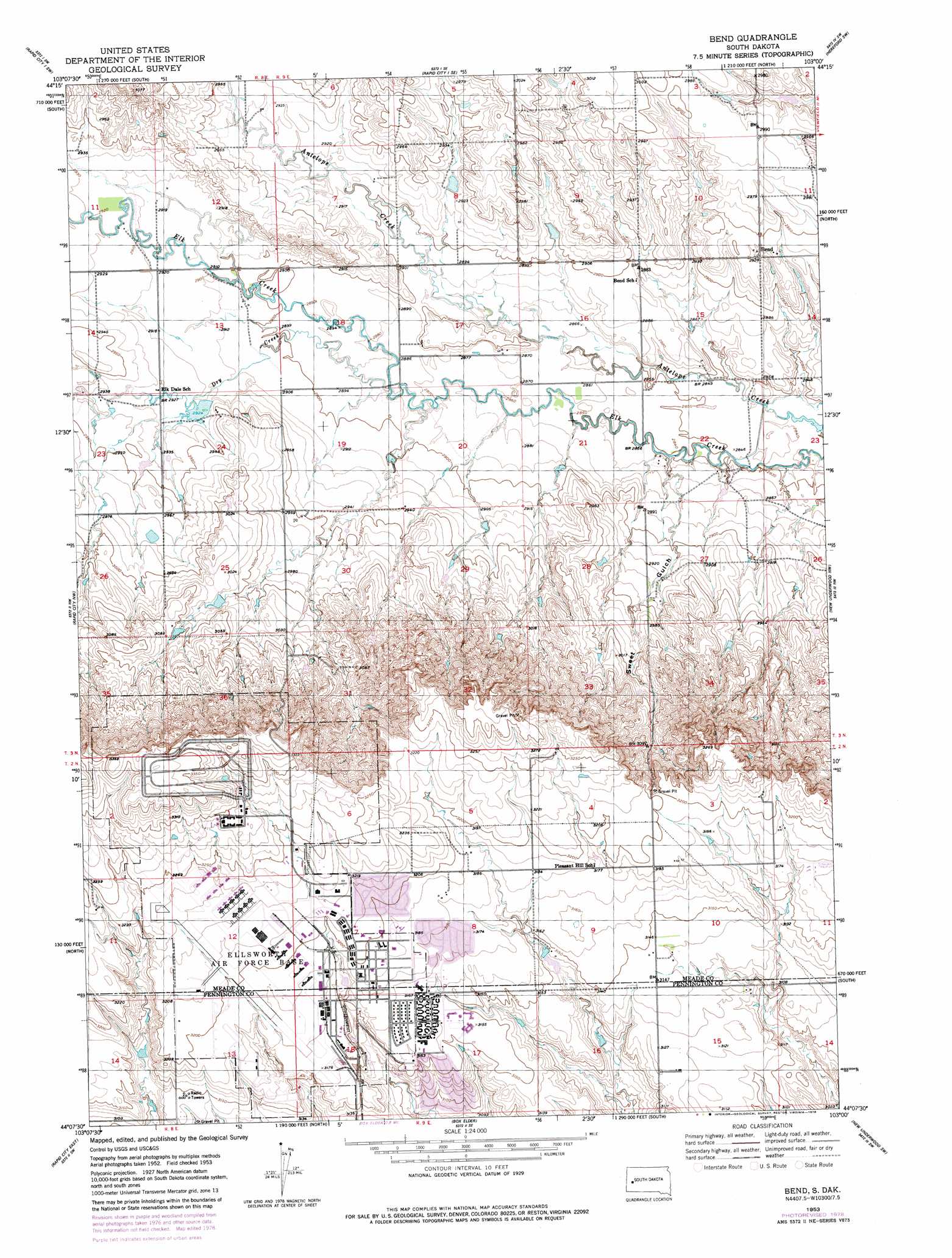
USGS Topo Quad 44103b1 - 1:24,000 scale
| Topo Map Name: | Bend |
| USGS Topo Quad ID: | 44103b1 |
| Print Size: | ca. 21 1/4" wide x 27" high |
| Southeast Coordinates: | 44.125° N latitude / 103° W longitude |
| Map Center Coordinates: | 44.1875° N latitude / 103.0625° W longitude |
| U.S. State: | SD |
| Filename: | o44103b1.jpg |
| Download Map JPG Image: | Bend topo map 1:24,000 scale |
| Map Type: | Topographic |
| Topo Series: | 7.5´ |
| Map Scale: | 1:24,000 |
| Source of Map Images: | United States Geological Survey (USGS) |
| Alternate Map Versions: |
Bend SD 1953, updated 1954 Download PDF Buy paper map Bend SD 1953, updated 1978 Download PDF Buy paper map Bend SD 2012 Download PDF Buy paper map Bend SD 2015 Download PDF Buy paper map |
1:24,000 Topo Quads surrounding Bend
Fort Meade Ne |
Rapid City 1 Nw |
Rapid City 1 Ne |
Hereford |
Hereford Ne |
Fort Meade Se |
Rapid City 1 Sw |
Rapid City 1 Se |
Hereford Sw |
Hereford Se |
Blackhawk |
Rapid City Nw |
Bend |
New Underwood Nw |
Viewfield |
Rapid City West |
Rapid City East |
Box Elder |
New Underwood Sw |
New Underwood |
Rockerville |
Hermosa Nw |
Hermosa Ne |
Caputa |
Caputa Ne |
> Back to 44103a1 at 1:100,000 scale
> Back to 44102a1 at 1:250,000 scale
> Back to U.S. Topo Maps home
Bend topo map: Gazetteer
Bend: Populated Places
Bend elevation 892m 2926′Bend: Streams
Dry Creek elevation 878m 2880′Bend: Valleys
Sweet Gulch elevation 874m 2867′Bend digital topo map on disk
Buy this Bend topo map showing relief, roads, GPS coordinates and other geographical features, as a high-resolution digital map file on DVD:
Eastern Wyoming & Western South Dakota
Buy digital topo maps: Eastern Wyoming & Western South Dakota