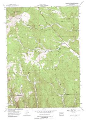
Minnesota Ridge Topo Map South Dakota
To zoom in, hover over the map of Minnesota Ridge
USGS Topo Quad 44103b6 - 1:24,000 scale
| Topo Map Name: | Minnesota Ridge |
| USGS Topo Quad ID: | 44103b6 |
| Print Size: | ca. 21 1/4" wide x 27" high |
| Southeast Coordinates: | 44.125° N latitude / 103.625° W longitude |
| Map Center Coordinates: | 44.1875° N latitude / 103.6875° W longitude |
| U.S. State: | SD |
| Filename: | o44103b6.jpg |
| Download Map JPG Image: | Minnesota Ridge topo map 1:24,000 scale |
| Map Type: | Topographic |
| Topo Series: | 7.5´ |
| Map Scale: | 1:24,000 |
| Source of Map Images: | United States Geological Survey (USGS) |
| Alternate Map Versions: |
Minnesota Ridge SD 1956, updated 1958 Download PDF Buy paper map Minnesota Ridge SD 1956, updated 1966 Download PDF Buy paper map Minnesota Ridge SD 1956, updated 1989 Download PDF Buy paper map Minnesota Ridge SD 2012 Download PDF Buy paper map Minnesota Ridge SD 2015 Download PDF Buy paper map |
| FStopo: | US Forest Service topo Minnesota Ridge is available: Download FStopo PDF Download FStopo TIF |
1:24,000 Topo Quads surrounding Minnesota Ridge
> Back to 44103a1 at 1:100,000 scale
> Back to 44102a1 at 1:250,000 scale
> Back to U.S. Topo Maps home
Minnesota Ridge topo map: Gazetteer
Minnesota Ridge: Areas
Black Hills Experimental Forest elevation 1819m 5967′Minnesota Ridge: Dams
Roubaix Lake Dam elevation 1664m 5459′Minnesota Ridge: Mines
Montana Mine elevation 1749m 5738′Minnesota Ridge: Populated Places
Diamond City (historical) elevation 1739m 5705′Gregory (historical) elevation 1770m 5807′
Minnesota Ridge: Reservoirs
Roubaix Lake elevation 1664m 5459′Minnesota Ridge: Ridges
Minnesota Ridge elevation 1904m 6246′Minnesota Ridge: Streams
North Fork Rapid Creek elevation 1635m 5364′South Fork Rapid Creek elevation 1635m 5364′
Minnesota Ridge: Summits
Custer Peak elevation 2071m 6794′Green Mountain (historical) elevation 1906m 6253′
Minnesota Ridge: Valleys
Greens Gulch elevation 1728m 5669′Irish Gulch elevation 1626m 5334′
Solomon Gulch elevation 1660m 5446′
Minnesota Ridge digital topo map on disk
Buy this Minnesota Ridge topo map showing relief, roads, GPS coordinates and other geographical features, as a high-resolution digital map file on DVD:
Eastern Wyoming & Western South Dakota
Buy digital topo maps: Eastern Wyoming & Western South Dakota


