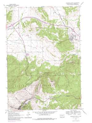
Deadwood North Topo Map South Dakota
To zoom in, hover over the map of Deadwood North
USGS Topo Quad 44103d6 - 1:24,000 scale
| Topo Map Name: | Deadwood North |
| USGS Topo Quad ID: | 44103d6 |
| Print Size: | ca. 21 1/4" wide x 27" high |
| Southeast Coordinates: | 44.375° N latitude / 103.625° W longitude |
| Map Center Coordinates: | 44.4375° N latitude / 103.6875° W longitude |
| U.S. State: | SD |
| Filename: | o44103d6.jpg |
| Download Map JPG Image: | Deadwood North topo map 1:24,000 scale |
| Map Type: | Topographic |
| Topo Series: | 7.5´ |
| Map Scale: | 1:24,000 |
| Source of Map Images: | United States Geological Survey (USGS) |
| Alternate Map Versions: |
Deadwood North SD 1961, updated 1963 Download PDF Buy paper map Deadwood North SD 1961, updated 1972 Download PDF Buy paper map Deadwood North SD 1961, updated 1979 Download PDF Buy paper map Deadwood North SD 1961, updated 1979 Download PDF Buy paper map Deadwood North SD 2012 Download PDF Buy paper map Deadwood North SD 2015 Download PDF Buy paper map |
| FStopo: | US Forest Service topo Deadwood North is available: Download FStopo PDF Download FStopo TIF |
1:24,000 Topo Quads surrounding Deadwood North
> Back to 44103a1 at 1:100,000 scale
> Back to 44102a1 at 1:250,000 scale
> Back to U.S. Topo Maps home
Deadwood North topo map: Gazetteer
Deadwood North: Dams
Glen Baker Irrigation Dam elevation 1205m 3953′Deadwood North: Flats
Centennial Prairie elevation 1197m 3927′Mountain Meadow elevation 1428m 4685′
Deadwood North: Populated Places
Centennial City (historical) elevation 1225m 4019′Chinatown elevation 1476m 4842′
Crook City elevation 1131m 3710′
Deadwood elevation 1381m 4530′
Elizabethtown (historical) elevation 1362m 4468′
Whitewood elevation 1114m 3654′
Deadwood North: Ranges
Black Hills elevation 1370m 4494′Deadwood North: Streams
City Creek elevation 1396m 4580′Miller Creek elevation 1121m 3677′
Sandy Creek elevation 1195m 3920′
Spring Creek elevation 1365m 4478′
Two Bit Creek elevation 1278m 4192′
Deadwood North: Summits
Crook Mountain elevation 1479m 4852′Elkhorn Peak elevation 1372m 4501′
White Rocks elevation 1599m 5246′
Whitewood Peak elevation 1555m 5101′
Deadwood North: Valleys
Peedee Gulch elevation 1395m 4576′Polo Gulch elevation 1320m 4330′
Slaughterhouse Gulch elevation 1315m 4314′
Spruce Gulch elevation 1360m 4461′
Deadwood North digital topo map on disk
Buy this Deadwood North topo map showing relief, roads, GPS coordinates and other geographical features, as a high-resolution digital map file on DVD:
Eastern Wyoming & Western South Dakota
Buy digital topo maps: Eastern Wyoming & Western South Dakota


