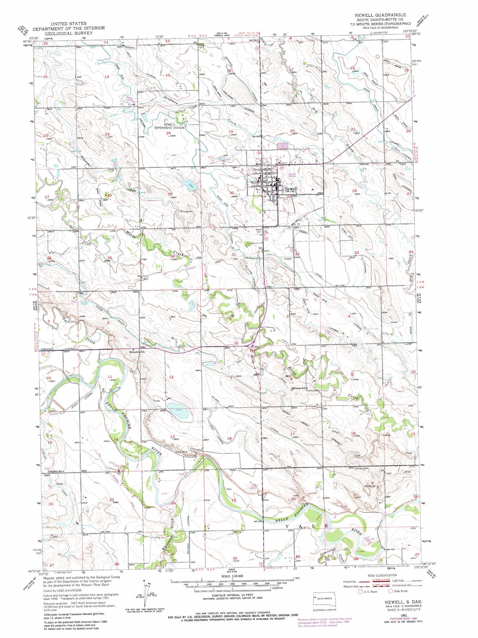
Newell Topo Map South Dakota
To zoom in, hover over the map of Newell
USGS Topo Quad 44103f4 - 1:24,000 scale
| Topo Map Name: | Newell |
| USGS Topo Quad ID: | 44103f4 |
| Print Size: | ca. 21 1/4" wide x 27" high |
| Southeast Coordinates: | 44.625° N latitude / 103.375° W longitude |
| Map Center Coordinates: | 44.6875° N latitude / 103.4375° W longitude |
| U.S. State: | SD |
| Filename: | o44103f4.jpg |
| Download Map JPG Image: | Newell topo map 1:24,000 scale |
| Map Type: | Topographic |
| Topo Series: | 7.5´ |
| Map Scale: | 1:24,000 |
| Source of Map Images: | United States Geological Survey (USGS) |
| Alternate Map Versions: |
Newell SD 1951, updated 1953 Download PDF Buy paper map Newell SD 2012 Download PDF Buy paper map Newell SD 2015 Download PDF Buy paper map |
1:24,000 Topo Quads surrounding Newell
Two Top Butte West |
Two Top Butte East |
Castle Rock |
Sulphur Butte |
Deers Ears Butte South |
Arpan |
Two Top Butte Se |
Newell Lake |
Schoepp Flat |
Owl Butte |
Fruitdale |
Nisland |
Newell |
Vale Ne |
Volunteer Nw |
Saint Onge |
Saint Onge Se |
Vale |
Vale Se |
Volunteer |
Deadwood North |
Sturgis |
Fort Meade |
Fort Meade Ne |
Rapid City 1 Nw |
> Back to 44103e1 at 1:100,000 scale
> Back to 44102a1 at 1:250,000 scale
> Back to U.S. Topo Maps home
Newell topo map: Gazetteer
Newell: Airports
Newell Airfield elevation 861m 2824′Newell: Canals
Baldwin Lateral elevation 857m 2811′Beresford Lateral elevation 874m 2867′
Calhoun Ditch elevation 870m 2854′
Deadman Lateral elevation 869m 2851′
Deer Creek Lateral elevation 871m 2857′
Jenks Lateral elevation 854m 2801′
Long Canal elevation 869m 2851′
McLung Lateral elevation 862m 2828′
South Canal elevation 872m 2860′
Town Site Lateral elevation 876m 2874′
Town Site Lateral A elevation 873m 2864′
Town Site Lateral B elevation 861m 2824′
Town Site Lateral C elevation 858m 2814′
Van Horn Lateral elevation 865m 2837′
Wilson Lateral elevation 869m 2851′
Wolf Lateral elevation 876m 2874′
Newell: Populated Places
Newell elevation 864m 2834′Newell: Streams
Cottonwood Creek elevation 832m 2729′Deadman Creek elevation 845m 2772′
Owl Creek elevation 848m 2782′
Owl Creek elevation 848m 2782′
Owl Creek elevation 848m 2782′
Whitewood Creek elevation 845m 2772′
Newell digital topo map on disk
Buy this Newell topo map showing relief, roads, GPS coordinates and other geographical features, as a high-resolution digital map file on DVD:
Eastern Wyoming & Western South Dakota
Buy digital topo maps: Eastern Wyoming & Western South Dakota