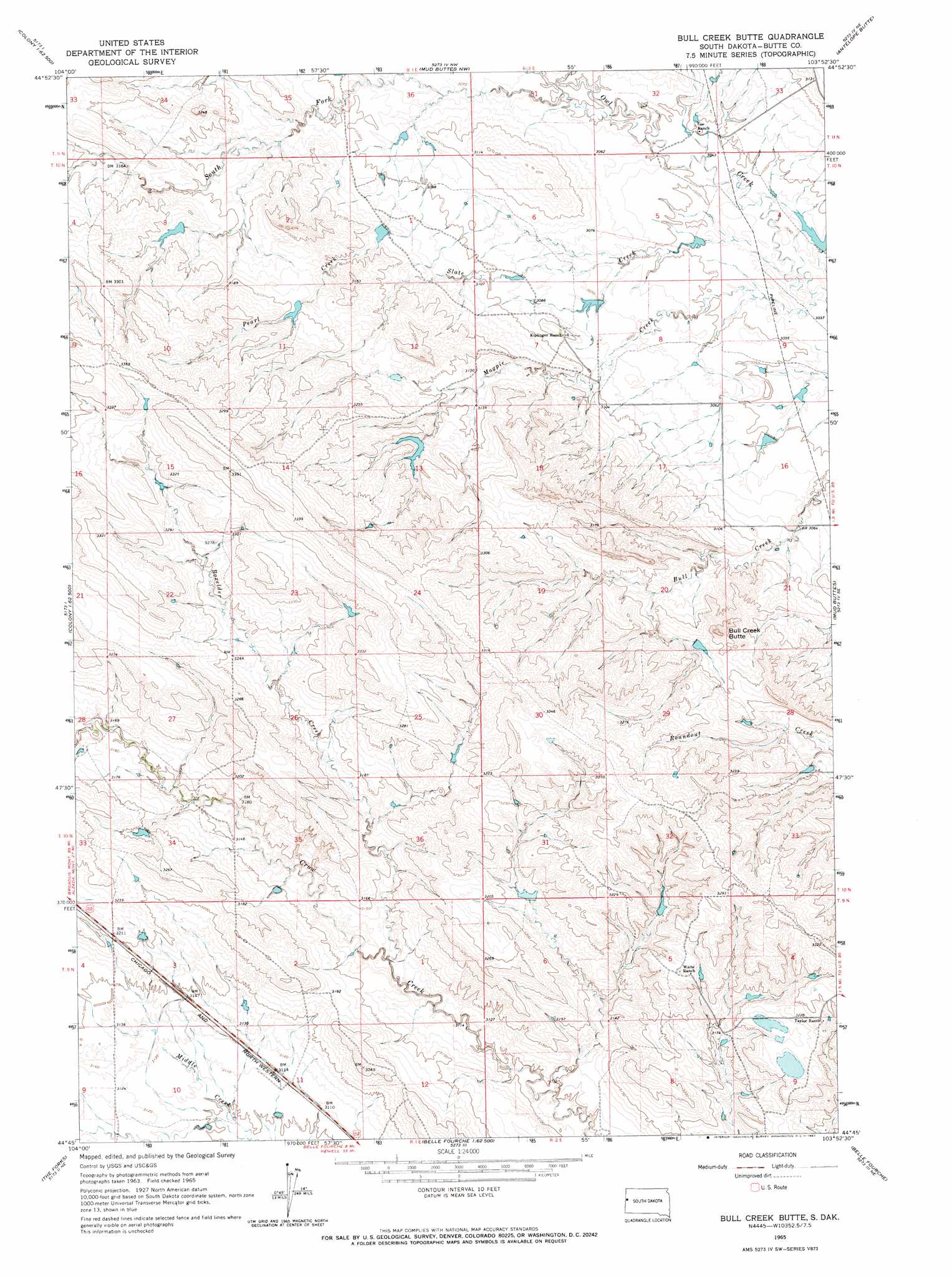
Bull Creek Butte Topo Map South Dakota
To zoom in, hover over the map of Bull Creek Butte
USGS Topo Quad 44103g8 - 1:24,000 scale
| Topo Map Name: | Bull Creek Butte |
| USGS Topo Quad ID: | 44103g8 |
| Print Size: | ca. 21 1/4" wide x 27" high |
| Southeast Coordinates: | 44.75° N latitude / 103.875° W longitude |
| Map Center Coordinates: | 44.8125° N latitude / 103.9375° W longitude |
| U.S. State: | SD |
| Filename: | o44103g8.jpg |
| Download Map JPG Image: | Bull Creek Butte topo map 1:24,000 scale |
| Map Type: | Topographic |
| Topo Series: | 7.5´ |
| Map Scale: | 1:24,000 |
| Source of Map Images: | United States Geological Survey (USGS) |
| Alternate Map Versions: |
Bull Creek Butte SD 1965, updated 1967 Download PDF Buy paper map Bull Creek Butte SD 2012 Download PDF Buy paper map Bull Creek Butte SD 2015 Download PDF Buy paper map |
1:24,000 Topo Quads surrounding Bull Creek Butte
Elkhorn Creek Sw |
Elkhorn Creek Se |
Greasewood Draw |
Battle Creek Butte |
Antelope Creek West |
Shepard Reservoir |
Gravel Draw |
Mud Buttes Nw |
Antelope Butte |
Two Top Butte West |
Kruger Lake |
Middle Creek Butte |
Bull Creek Butte |
Mud Buttes |
Arpan |
Aladdin |
The Forks |
Sourdough Flats |
Belle Fourche |
Fruitdale |
Schoolmarm Butte |
Beulah |
Chicken Creek |
Jolly |
Saint Onge |
> Back to 44103e1 at 1:100,000 scale
> Back to 44102a1 at 1:250,000 scale
> Back to U.S. Topo Maps home
Bull Creek Butte topo map: Gazetteer
Bull Creek Butte: Streams
Boxelder Creek elevation 949m 3113′Magpie Creek elevation 924m 3031′
Pearl Creek elevation 933m 3061′
Slate Creek elevation 924m 3031′
South Fork Owl Creek elevation 927m 3041′
Bull Creek Butte: Summits
Bull Creek Butte elevation 993m 3257′Bull Creek Butte digital topo map on disk
Buy this Bull Creek Butte topo map showing relief, roads, GPS coordinates and other geographical features, as a high-resolution digital map file on DVD:
Eastern Wyoming & Western South Dakota
Buy digital topo maps: Eastern Wyoming & Western South Dakota