Sulphur Butte Topo Map South Dakota
To zoom in, hover over the map of Sulphur Butte
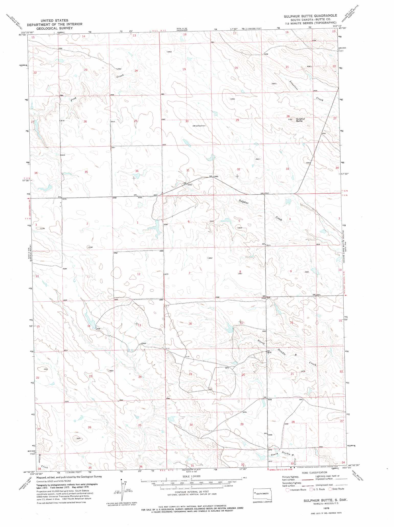
USGS Topo Quad 44103h3 - 1:24,000 scale
| Topo Map Name: | Sulphur Butte |
| USGS Topo Quad ID: | 44103h3 |
| Print Size: | ca. 21 1/4" wide x 27" high |
| Southeast Coordinates: | 44.875° N latitude / 103.25° W longitude |
| Map Center Coordinates: | 44.9375° N latitude / 103.3125° W longitude |
| U.S. State: | SD |
| Filename: | o44103h3.jpg |
| Download Map JPG Image: | Sulphur Butte topo map 1:24,000 scale |
| Map Type: | Topographic |
| Topo Series: | 7.5´ |
| Map Scale: | 1:24,000 |
| Source of Map Images: | United States Geological Survey (USGS) |
| Alternate Map Versions: |
Sulphur Butte SD 1978, updated 1978 Download PDF Buy paper map Sulphur Butte SD 2012 Download PDF Buy paper map Sulphur Butte SD 2015 Download PDF Buy paper map |
1:24,000 Topo Quads surrounding Sulphur Butte
Lone Tree Draw West |
Lone Tree Draw East |
Granger Creek |
Porter Creek |
Fish Draw |
Antelope Creek East |
Haystack Butte |
Hoover |
Deers Ears Butte North |
Tomato Can Buttes |
Two Top Butte East |
Castle Rock |
Sulphur Butte |
Deers Ears Butte South |
Owl Butte Ne |
Two Top Butte Se |
Newell Lake |
Schoepp Flat |
Owl Butte |
Owl Butte Se |
Nisland |
Newell |
Vale Ne |
Volunteer Nw |
Volunteer Ne |
> Back to 44103e1 at 1:100,000 scale
> Back to 44102a1 at 1:250,000 scale
> Back to U.S. Topo Maps home
Sulphur Butte digital topo map on disk
Buy this Sulphur Butte topo map showing relief, roads, GPS coordinates and other geographical features, as a high-resolution digital map file on DVD:
Eastern Wyoming & Western South Dakota
Buy digital topo maps: Eastern Wyoming & Western South Dakota