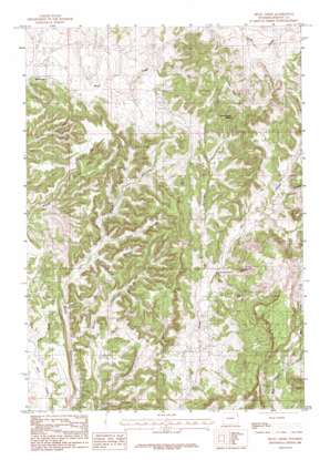
Skull Creek Topo Map Wyoming
To zoom in, hover over the map of Skull Creek
USGS Topo Quad 44104a3 - 1:24,000 scale
| Topo Map Name: | Skull Creek |
| USGS Topo Quad ID: | 44104a3 |
| Print Size: | ca. 21 1/4" wide x 27" high |
| Southeast Coordinates: | 44° N latitude / 104.25° W longitude |
| Map Center Coordinates: | 44.0625° N latitude / 104.3125° W longitude |
| U.S. State: | WY |
| Filename: | o44104a3.jpg |
| Download Map JPG Image: | Skull Creek topo map 1:24,000 scale |
| Map Type: | Topographic |
| Topo Series: | 7.5´ |
| Map Scale: | 1:24,000 |
| Source of Map Images: | United States Geological Survey (USGS) |
| Alternate Map Versions: |
Skull Creek WY 1984, updated 1984 Download PDF Buy paper map Skull Creek WY 2012 Download PDF Buy paper map Skull Creek WY 2015 Download PDF Buy paper map |
1:24,000 Topo Quads surrounding Skull Creek
> Back to 44104a1 at 1:100,000 scale
> Back to 44104a1 at 1:250,000 scale
> Back to U.S. Topo Maps home
Skull Creek topo map: Gazetteer
Skull Creek: Dams
Big Delaney Dam elevation 1476m 4842′Perino Dam elevation 1562m 5124′
V E Lissolo Dam elevation 1573m 5160′
Skull Creek: Mines
Holwell Prospects One and Two Mine elevation 1621m 5318′Oil Creek Mine elevation 1509m 4950′
Red Creek Area Mine elevation 1560m 5118′
Skull Creek: Populated Places
Skull Creek elevation 1467m 4812′Skull Creek: Reservoirs
Big Delaney Reservoir elevation 1476m 4842′Perino Reservoir elevation 1562m 5124′
V E Lissolo Reservoir elevation 1573m 5160′
Skull Creek: Springs
Grand Stump Spring elevation 1626m 5334′Skull Creek: Streams
Red Creek elevation 1491m 4891′Skull Creek: Valleys
Delaney Canyon elevation 1453m 4767′Horse Canyon elevation 1394m 4573′
Love Canyon elevation 1457m 4780′
Pine Gulch elevation 1371m 4498′
Skull Creek digital topo map on disk
Buy this Skull Creek topo map showing relief, roads, GPS coordinates and other geographical features, as a high-resolution digital map file on DVD:
Eastern Wyoming & Western South Dakota
Buy digital topo maps: Eastern Wyoming & Western South Dakota


