Cedar Draw Topo Map Wyoming
To zoom in, hover over the map of Cedar Draw
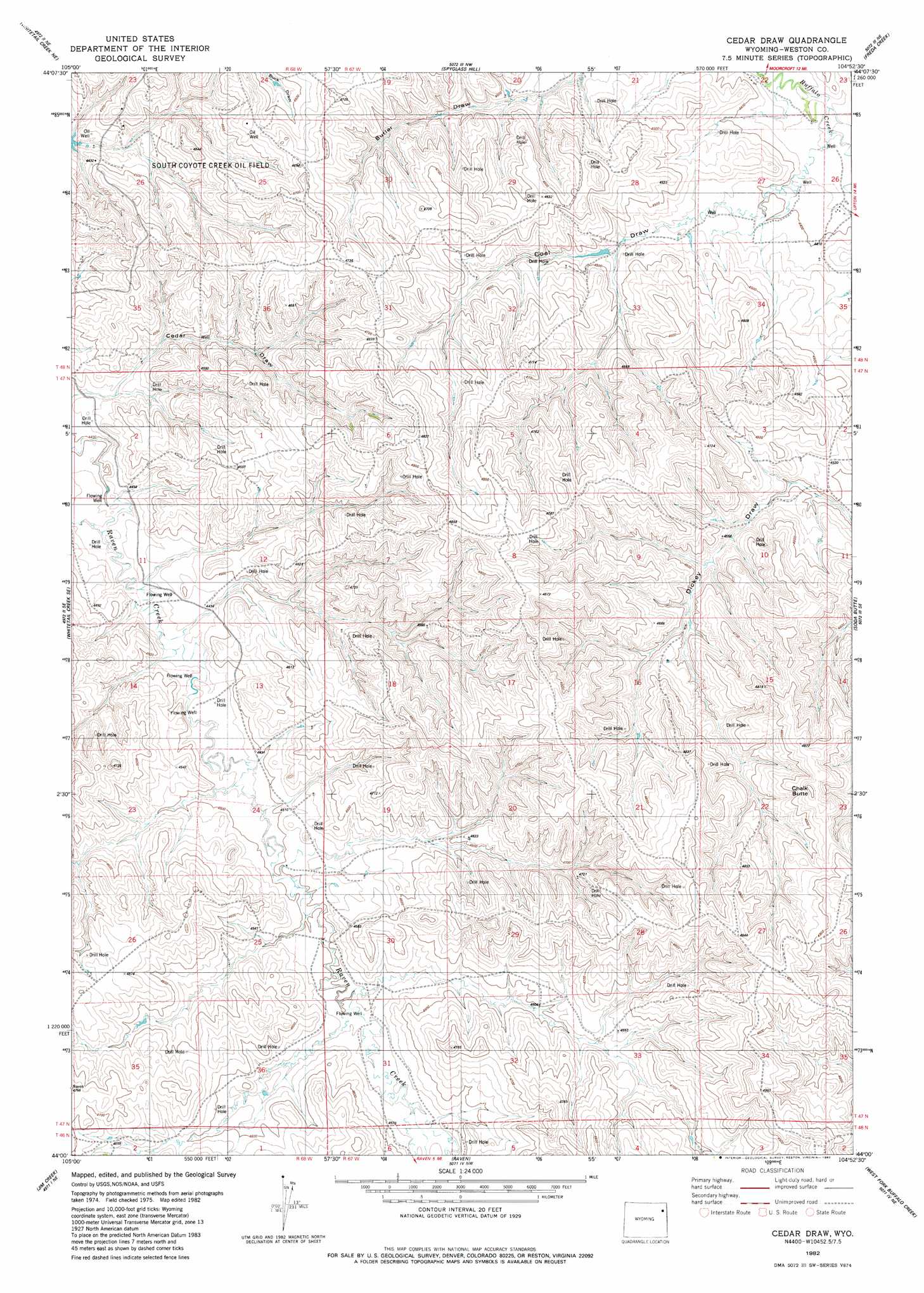
USGS Topo Quad 44104a8 - 1:24,000 scale
| Topo Map Name: | Cedar Draw |
| USGS Topo Quad ID: | 44104a8 |
| Print Size: | ca. 21 1/4" wide x 27" high |
| Southeast Coordinates: | 44° N latitude / 104.875° W longitude |
| Map Center Coordinates: | 44.0625° N latitude / 104.9375° W longitude |
| U.S. State: | WY |
| Filename: | o44104a8.jpg |
| Download Map JPG Image: | Cedar Draw topo map 1:24,000 scale |
| Map Type: | Topographic |
| Topo Series: | 7.5´ |
| Map Scale: | 1:24,000 |
| Source of Map Images: | United States Geological Survey (USGS) |
| Alternate Map Versions: |
Cedar Draw WY 1982, updated 1982 Download PDF Buy paper map Cedar Draw WY 2012 Download PDF Buy paper map Cedar Draw WY 2015 Download PDF Buy paper map |
| FStopo: | US Forest Service topo Cedar Draw is available: Download FStopo PDF Download FStopo TIF |
1:24,000 Topo Quads surrounding Cedar Draw
Rozet |
Rozet Se |
Moorcroft |
Grasshopper Butte |
Iron Mountain |
Coon Track Creek |
Whitetail Creek Ne |
Spyglass Hill |
Freda Creek |
Thornton |
Whitetail Creek |
Whitetail Creek Se |
Cedar Draw |
Soda Butte |
Upton West |
Rough Creek |
Jim Creek |
Raven |
West Fork Buffalo Creek |
Sheep Canyon Creek West |
Open A Ranch |
Buck Creek |
Wildlife Draw West |
Wildlife Draw East |
Fairview |
> Back to 44104a1 at 1:100,000 scale
> Back to 44104a1 at 1:250,000 scale
> Back to U.S. Topo Maps home
Cedar Draw topo map: Gazetteer
Cedar Draw: Oilfields
South Coyote Oil Field elevation 1360m 4461′Cedar Draw: Summits
Chalk Butte elevation 1497m 4911′Cedar Draw: Valleys
Alkali Draw elevation 1330m 4363′Coal Draw elevation 1333m 4373′
Cedar Draw digital topo map on disk
Buy this Cedar Draw topo map showing relief, roads, GPS coordinates and other geographical features, as a high-resolution digital map file on DVD:
Eastern Wyoming & Western South Dakota
Buy digital topo maps: Eastern Wyoming & Western South Dakota