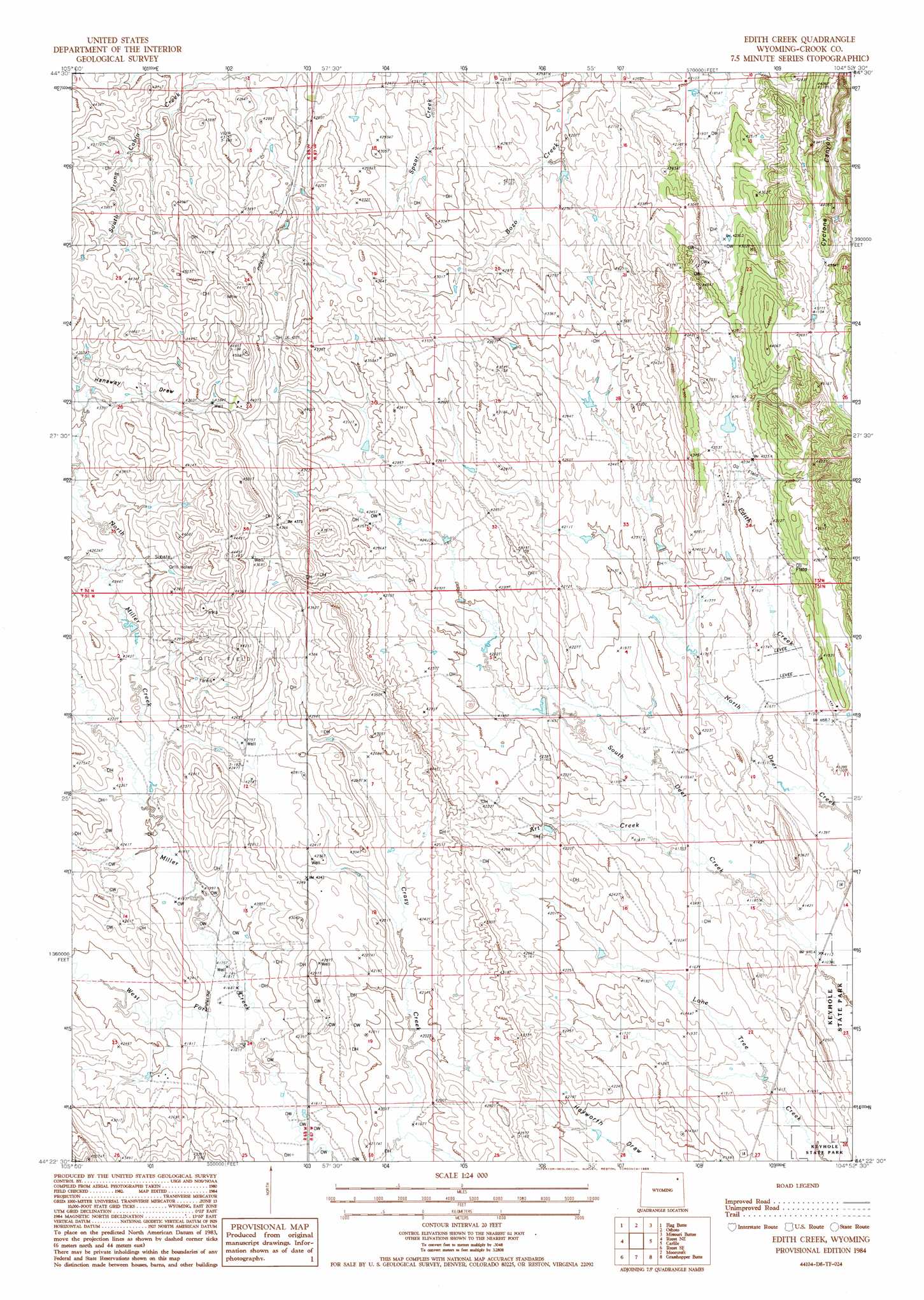
Edith Creek Topo Map Wyoming
To zoom in, hover over the map of Edith Creek
USGS Topo Quad 44104d8 - 1:24,000 scale
| Topo Map Name: | Edith Creek |
| USGS Topo Quad ID: | 44104d8 |
| Print Size: | ca. 21 1/4" wide x 27" high |
| Southeast Coordinates: | 44.375° N latitude / 104.875° W longitude |
| Map Center Coordinates: | 44.4375° N latitude / 104.9375° W longitude |
| U.S. State: | WY |
| Filename: | o44104d8.jpg |
| Download Map JPG Image: | Edith Creek topo map 1:24,000 scale |
| Map Type: | Topographic |
| Topo Series: | 7.5´ |
| Map Scale: | 1:24,000 |
| Source of Map Images: | United States Geological Survey (USGS) |
| Alternate Map Versions: |
Edith Creek WY 1984, updated 1985 Download PDF Buy paper map Edith Creek WY 2012 Download PDF Buy paper map Edith Creek WY 2015 Download PDF Buy paper map |
1:24,000 Topo Quads surrounding Edith Creek
Adon Nw |
Brislawn School |
Garland Hill |
New Haven |
Moore Hill |
Adon |
Flag Butte |
Oshoto |
Missouri Buttes |
Devils Tower |
Rozet Nw |
Rozet Ne |
Edith Creek |
Carlile |
Wonder View |
Rozet |
Rozet Se |
Moorcroft |
Grasshopper Butte |
Iron Mountain |
Coon Track Creek |
Whitetail Creek Ne |
Spyglass Hill |
Freda Creek |
Thornton |
> Back to 44104a1 at 1:100,000 scale
> Back to 44104a1 at 1:250,000 scale
> Back to U.S. Topo Maps home
Edith Creek topo map: Gazetteer
Edith Creek: Streams
Al Creek elevation 1298m 4258′Art Creek elevation 1257m 4124′
Edith Creek elevation 1257m 4124′
North Miller Creek elevation 1281m 4202′
West Fork Miller Creek elevation 1269m 4163′
Edith Creek: Valleys
Hanaway Draw elevation 1310m 4297′Oil Draw elevation 1272m 4173′
Edith Creek digital topo map on disk
Buy this Edith Creek topo map showing relief, roads, GPS coordinates and other geographical features, as a high-resolution digital map file on DVD:
Eastern Wyoming & Western South Dakota
Buy digital topo maps: Eastern Wyoming & Western South Dakota