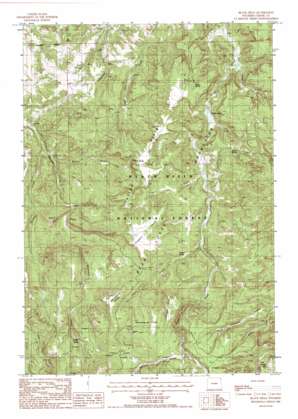
Black Hills Topo Map Wyoming
To zoom in, hover over the map of Black Hills
USGS Topo Quad 44104e4 - 1:24,000 scale
| Topo Map Name: | Black Hills |
| USGS Topo Quad ID: | 44104e4 |
| Print Size: | ca. 21 1/4" wide x 27" high |
| Southeast Coordinates: | 44.5° N latitude / 104.375° W longitude |
| Map Center Coordinates: | 44.5625° N latitude / 104.4375° W longitude |
| U.S. State: | WY |
| Filename: | o44104e4.jpg |
| Download Map JPG Image: | Black Hills topo map 1:24,000 scale |
| Map Type: | Topographic |
| Topo Series: | 7.5´ |
| Map Scale: | 1:24,000 |
| Source of Map Images: | United States Geological Survey (USGS) |
| Alternate Map Versions: |
Black Hills WY 1984, updated 1985 Download PDF Buy paper map Black Hills WY 1984, updated 1985 Download PDF Buy paper map Black Hills WY 2012 Download PDF Buy paper map Black Hills WY 2015 Download PDF Buy paper map |
| FStopo: | US Forest Service topo Black Hills is available: Download FStopo PDF Download FStopo TIF |
1:24,000 Topo Quads surrounding Black Hills
> Back to 44104e1 at 1:100,000 scale
> Back to 44104a1 at 1:250,000 scale
> Back to U.S. Topo Maps home
Black Hills topo map: Gazetteer
Black Hills: Dams
Lake Cook Dam elevation 1452m 4763′Black Hills: Flats
Ledogar Flats elevation 1734m 5688′Massengale Flats elevation 1758m 5767′
Black Hills: Lakes
Cook Lake elevation 1442m 4730′Black Hills: Reservoirs
Lake Cook elevation 1452m 4763′Black Hills: Ridges
Deckelman Ridge elevation 1732m 5682′Ellsbury Divide elevation 1670m 5479′
Taylor Divide elevation 1632m 5354′
Black Hills: Springs
Corral Spring elevation 1743m 5718′Scott Spring elevation 1531m 5022′
Selliez Spring elevation 1539m 5049′
Togus Spring elevation 1566m 5137′
Black Hills: Streams
Deer Creek elevation 1476m 4842′East Fork Blacktail Creek elevation 1392m 4566′
Hershey Creek elevation 1378m 4520′
Little Creek elevation 1393m 4570′
Togus Creek elevation 1539m 5049′
Whitelaw Creek elevation 1714m 5623′
Winchester Creek elevation 1495m 4904′
Black Hills: Summits
Black Hills elevation 1474m 4835′Black Hills digital topo map on disk
Buy this Black Hills topo map showing relief, roads, GPS coordinates and other geographical features, as a high-resolution digital map file on DVD:
Eastern Wyoming & Western South Dakota
Buy digital topo maps: Eastern Wyoming & Western South Dakota


