Seely Topo Map Wyoming
To zoom in, hover over the map of Seely
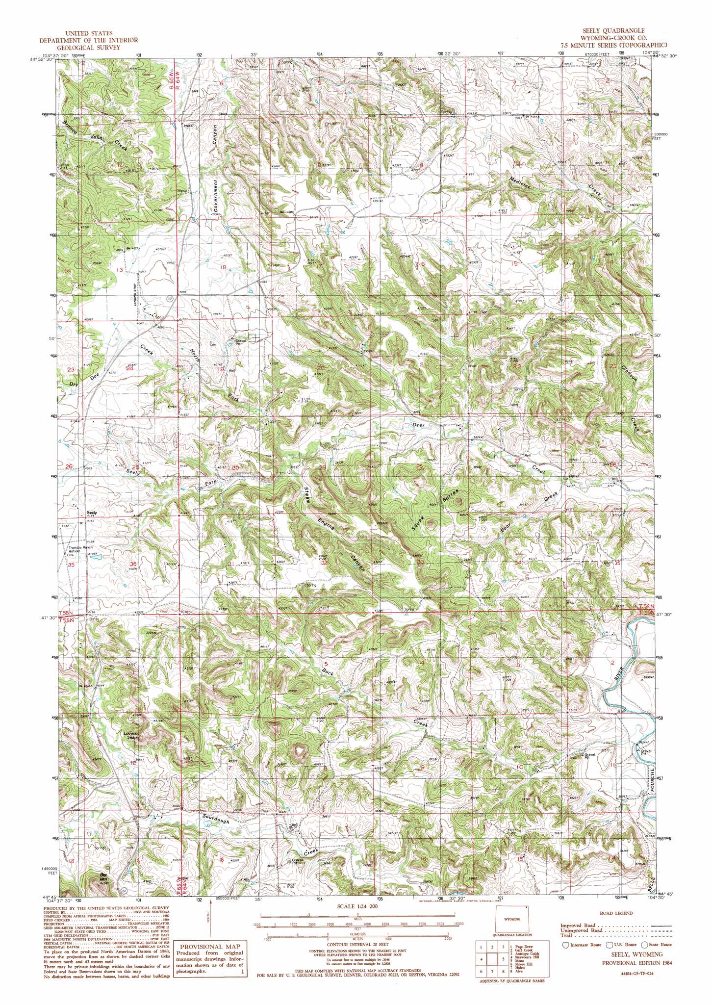
USGS Topo Quad 44104g5 - 1:24,000 scale
| Topo Map Name: | Seely |
| USGS Topo Quad ID: | 44104g5 |
| Print Size: | ca. 21 1/4" wide x 27" high |
| Southeast Coordinates: | 44.75° N latitude / 104.5° W longitude |
| Map Center Coordinates: | 44.8125° N latitude / 104.5625° W longitude |
| U.S. State: | WY |
| Filename: | o44104g5.jpg |
| Download Map JPG Image: | Seely topo map 1:24,000 scale |
| Map Type: | Topographic |
| Topo Series: | 7.5´ |
| Map Scale: | 1:24,000 |
| Source of Map Images: | United States Geological Survey (USGS) |
| Alternate Map Versions: |
Seely WY 1984, updated 1985 Download PDF Buy paper map Seely WY 2012 Download PDF Buy paper map Seely WY 2015 Download PDF Buy paper map |
1:24,000 Topo Quads surrounding Seely
Hammond Se |
Cochran Reservoir |
Gomer Draw |
Alzada |
Sevenmile Creek |
Storm Draw |
Page Draw |
Gaff Creek |
Antelope Gulch |
Devils Run |
Wood Canyon |
Strawberry Hill |
Seely |
Mona |
Stoney Point |
New Haven |
Moore Hill |
Hulett |
Alva |
The Notch |
Missouri Buttes |
Devils Tower |
Sherrard Hill |
Black Hills |
Sugarloaf Mountain |
> Back to 44104e1 at 1:100,000 scale
> Back to 44104a1 at 1:250,000 scale
> Back to U.S. Topo Maps home
Seely topo map: Gazetteer
Seely: Cliffs
Lovers Leap elevation 1220m 4002′Seely: Mines
Cedar Creek Number One Mine elevation 1258m 4127′Davidson Property Mine elevation 1242m 4074′
Seely: Populated Places
Seely elevation 1263m 4143′Seely: Streams
Bear Creek elevation 1137m 3730′Buck Creek elevation 1102m 3615′
Dry Doe Creek elevation 1220m 4002′
North Fork Deer Creek elevation 1195m 3920′
Seely Fork elevation 1224m 4015′
Seely: Summits
Bay Mountain elevation 1320m 4330′Squaw Buttes elevation 1228m 4028′
Seely: Valleys
Steam Engine Canyon elevation 1201m 3940′Seely digital topo map on disk
Buy this Seely topo map showing relief, roads, GPS coordinates and other geographical features, as a high-resolution digital map file on DVD:
Eastern Wyoming & Western South Dakota
Buy digital topo maps: Eastern Wyoming & Western South Dakota