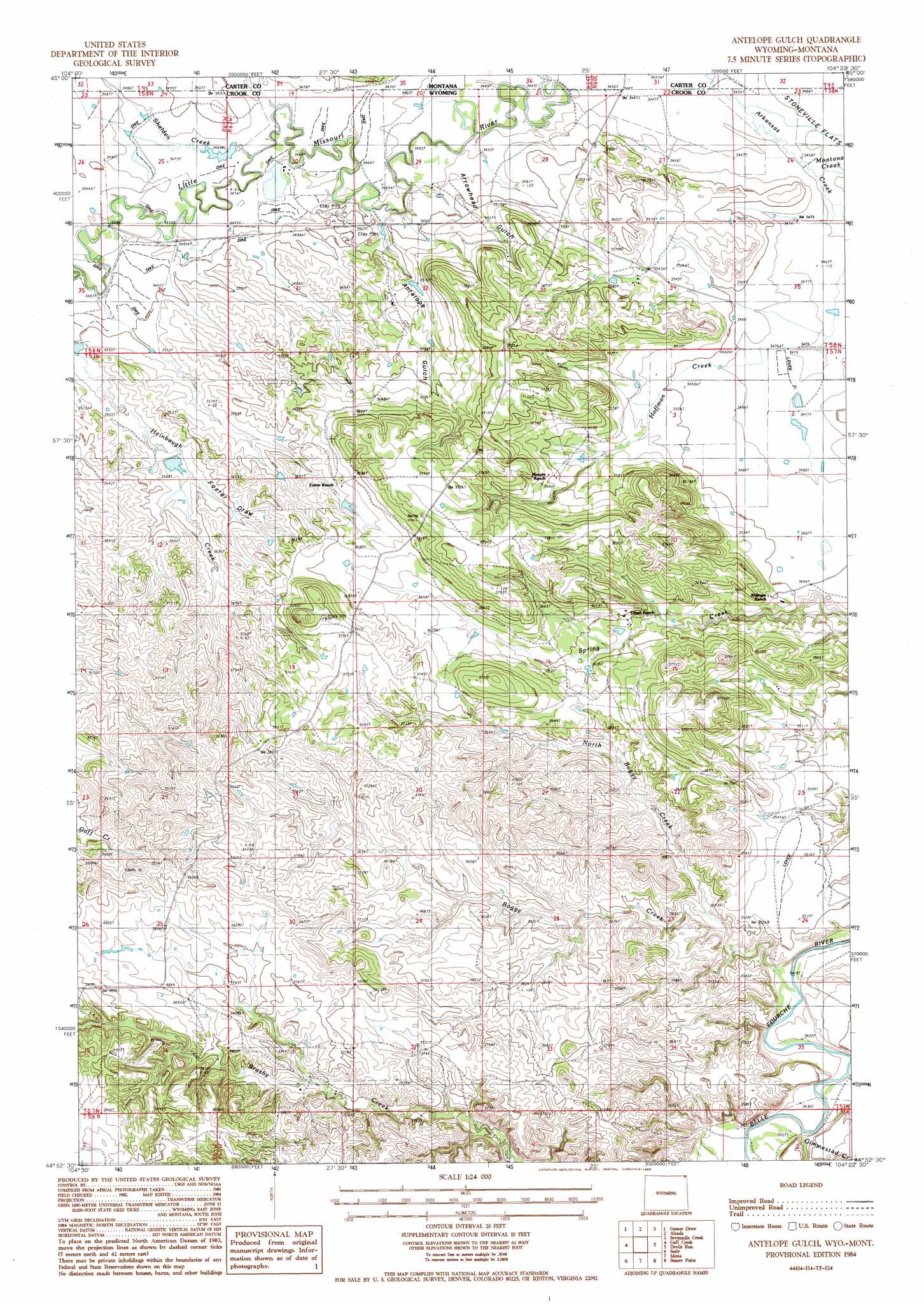
Antelope Gulch Topo Map Wyoming
To zoom in, hover over the map of Antelope Gulch
USGS Topo Quad 44104h4 - 1:24,000 scale
| Topo Map Name: | Antelope Gulch |
| USGS Topo Quad ID: | 44104h4 |
| Print Size: | ca. 21 1/4" wide x 27" high |
| Southeast Coordinates: | 44.875° N latitude / 104.375° W longitude |
| Map Center Coordinates: | 44.9375° N latitude / 104.4375° W longitude |
| U.S. States: | WY, MT |
| Filename: | o44104h4.jpg |
| Download Map JPG Image: | Antelope Gulch topo map 1:24,000 scale |
| Map Type: | Topographic |
| Topo Series: | 7.5´ |
| Map Scale: | 1:24,000 |
| Source of Map Images: | United States Geological Survey (USGS) |
| Alternate Map Versions: |
Antelope Gulch WY 1984, updated 1985 Download PDF Buy paper map Antelope Gulch WY 1984, updated 1986 Download PDF Buy paper map Antelope Gulch WY 2011 Download PDF Buy paper map Antelope Gulch WY 2012 Download PDF Buy paper map Antelope Gulch WY 2015 Download PDF Buy paper map |
1:24,000 Topo Quads surrounding Antelope Gulch
Black Point |
Black Point Ne |
Alzada Nw |
Albion |
Elkhorn Creek West |
Cochran Reservoir |
Gomer Draw |
Alzada |
Sevenmile Creek |
Elkhorn Creek Sw |
Page Draw |
Gaff Creek |
Antelope Gulch |
Devils Run |
Shepard Reservoir |
Strawberry Hill |
Seely |
Mona |
Stoney Point |
Kruger Lake |
Moore Hill |
Hulett |
Alva |
The Notch |
Aladdin |
> Back to 44104e1 at 1:100,000 scale
> Back to 44104a1 at 1:250,000 scale
> Back to U.S. Topo Maps home
Antelope Gulch topo map: Gazetteer
Antelope Gulch: Dams
Banks Creek Dam elevation 1067m 3500′T J Maupin Number 1 Dam elevation 1059m 3474′
Antelope Gulch: Mines
C Cockran Mine elevation 1135m 3723′Antelope Gulch: Reservoirs
Banks Creek Reservoir elevation 1067m 3500′T J Maupin Number 1 Reservoir elevation 1059m 3474′
Antelope Gulch: Streams
Arkansas Creek elevation 1053m 3454′Boggy Creek elevation 1042m 3418′
Gimmestad Creek elevation 1054m 3458′
Heinbaugh Creek elevation 1062m 3484′
Hoffman Creek elevation 1056m 3464′
Montana Creek elevation 1055m 3461′
North Boggy Creek elevation 1054m 3458′
Shelden Creek elevation 1055m 3461′
Antelope Gulch: Valleys
Antelope Gulch elevation 1053m 3454′Arrowhead Gulch elevation 1052m 3451′
Foster Draw elevation 1085m 3559′
Antelope Gulch digital topo map on disk
Buy this Antelope Gulch topo map showing relief, roads, GPS coordinates and other geographical features, as a high-resolution digital map file on DVD:
Eastern Wyoming & Western South Dakota
Buy digital topo maps: Eastern Wyoming & Western South Dakota