Coyote Draw Topo Map Wyoming
To zoom in, hover over the map of Coyote Draw
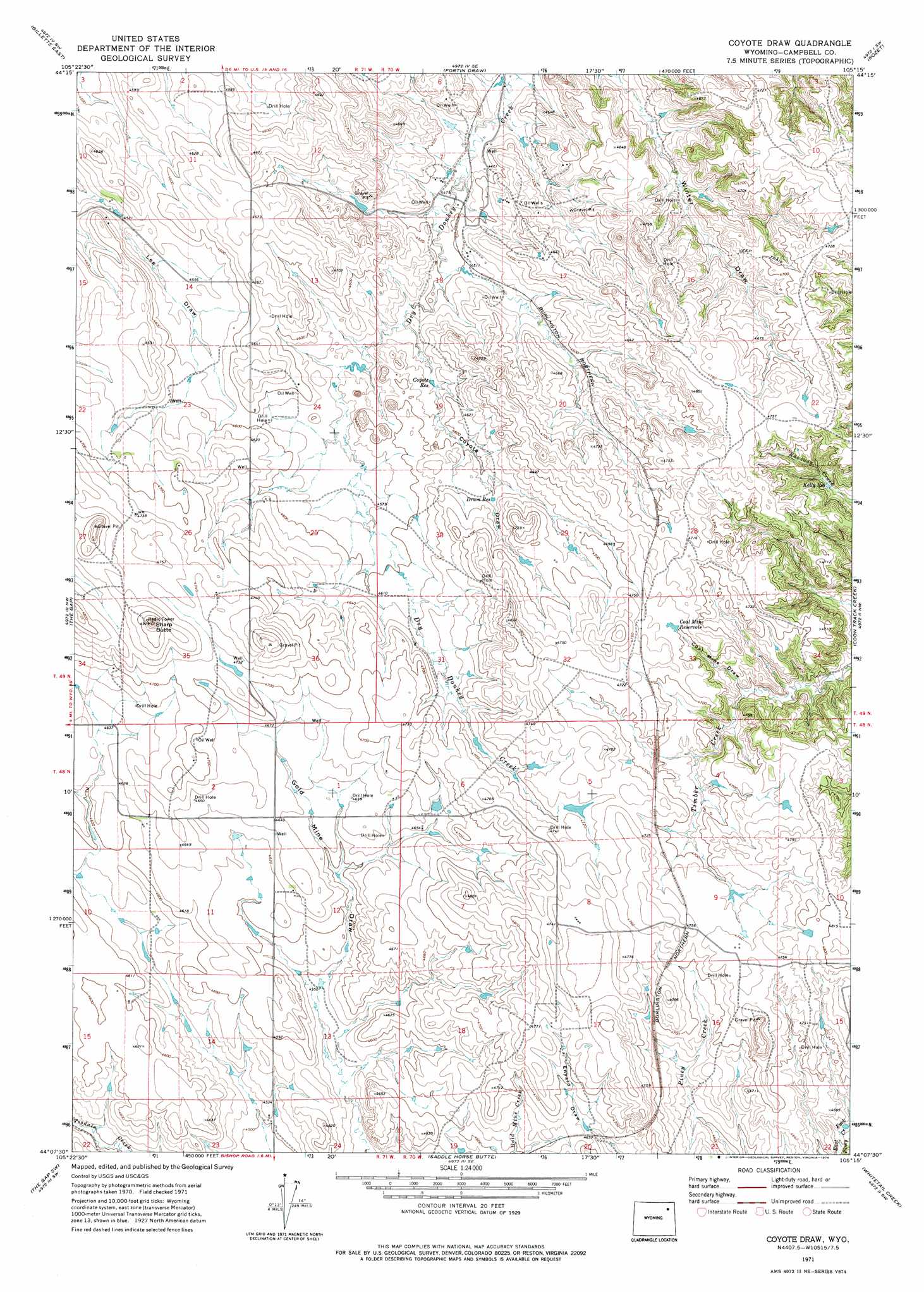
USGS Topo Quad 44105b3 - 1:24,000 scale
| Topo Map Name: | Coyote Draw |
| USGS Topo Quad ID: | 44105b3 |
| Print Size: | ca. 21 1/4" wide x 27" high |
| Southeast Coordinates: | 44.125° N latitude / 105.25° W longitude |
| Map Center Coordinates: | 44.1875° N latitude / 105.3125° W longitude |
| U.S. State: | WY |
| Filename: | o44105b3.jpg |
| Download Map JPG Image: | Coyote Draw topo map 1:24,000 scale |
| Map Type: | Topographic |
| Topo Series: | 7.5´ |
| Map Scale: | 1:24,000 |
| Source of Map Images: | United States Geological Survey (USGS) |
| Alternate Map Versions: |
Coyote Draw WY 1971, updated 1974 Download PDF Buy paper map Coyote Draw WY 2012 Download PDF Buy paper map Coyote Draw WY 2015 Download PDF Buy paper map |
1:24,000 Topo Quads surrounding Coyote Draw
Rawhide School |
Moyer Springs |
Green Hill |
Rozet Nw |
Rozet Ne |
Gillette West |
Gillette East |
Fortin Draw |
Rozet |
Rozet Se |
Appel Butte |
The Gap |
Coyote Draw |
Coon Track Creek |
Whitetail Creek Ne |
Scaper Reservoir |
The Gap Sw |
Saddle Horse Butte |
Whitetail Creek |
Whitetail Creek Se |
Threemile Creek Reservoir |
Eagle Rock |
Neil Butte |
Rough Creek |
Jim Creek |
> Back to 44105a1 at 1:100,000 scale
> Back to 44104a1 at 1:250,000 scale
> Back to U.S. Topo Maps home
Coyote Draw topo map: Gazetteer
Coyote Draw: Dams
Baumfalk Dam elevation 1383m 4537′Truman Dam elevation 1393m 4570′
Coyote Draw: Reservoirs
Baumfalk Reservoir elevation 1383m 4537′Coal Mine Reservoir elevation 1433m 4701′
Coyote Reservoir elevation 1390m 4560′
Drum Reservoir elevation 1412m 4632′
Kelly Reservoir elevation 1390m 4560′
Truman Reservoir elevation 1393m 4570′
Coyote Draw: Summits
Sharp Butte elevation 1498m 4914′Coyote Draw: Valleys
Coal Mine Draw elevation 1402m 4599′Coyote Draw elevation 1378m 4520′
Coyote Draw digital topo map on disk
Buy this Coyote Draw topo map showing relief, roads, GPS coordinates and other geographical features, as a high-resolution digital map file on DVD:
Eastern Wyoming & Western South Dakota
Buy digital topo maps: Eastern Wyoming & Western South Dakota