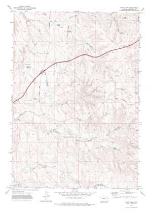
Scott Dam Topo Map Wyoming
To zoom in, hover over the map of Scott Dam
USGS Topo Quad 44105b7 - 1:24,000 scale
| Topo Map Name: | Scott Dam |
| USGS Topo Quad ID: | 44105b7 |
| Print Size: | ca. 21 1/4" wide x 27" high |
| Southeast Coordinates: | 44.125° N latitude / 105.75° W longitude |
| Map Center Coordinates: | 44.1875° N latitude / 105.8125° W longitude |
| U.S. State: | WY |
| Filename: | o44105b7.jpg |
| Download Map JPG Image: | Scott Dam topo map 1:24,000 scale |
| Map Type: | Topographic |
| Topo Series: | 7.5´ |
| Map Scale: | 1:24,000 |
| Source of Map Images: | United States Geological Survey (USGS) |
| Alternate Map Versions: |
Scott Dam WY 1971, updated 1974 Download PDF Buy paper map Scott Dam WY 2012 Download PDF Buy paper map Scott Dam WY 2015 Download PDF Buy paper map |
1:24,000 Topo Quads surrounding Scott Dam
> Back to 44105a1 at 1:100,000 scale
> Back to 44104a1 at 1:250,000 scale
> Back to U.S. Topo Maps home
Scott Dam topo map: Gazetteer
Scott Dam: Bridges
Bridge Dam elevation 1493m 4898′Scott Dam: Dams
Buffalo Wallow Dam elevation 1446m 4744′Chokecherry Dam elevation 1474m 4835′
Lee Mankin Dam elevation 1445m 4740′
Scott Dam: Reservoirs
Alan Reservoir elevation 1429m 4688′Dogtown Reservoir elevation 1417m 4648′
Johnson Reservoir elevation 1437m 4714′
Lee Mankin Reservoir elevation 1445m 4740′
Upper Reservoir elevation 1436m 4711′
Scott Dam: Streams
Middle Prong Dead Horse Creek elevation 1348m 4422′Scott Dam: Summits
Crenshaw Hill elevation 1481m 4858′Scott Dam: Valleys
Johnson Draw elevation 1412m 4632′Upper Bushnell Draw elevation 1410m 4625′
Scott Dam digital topo map on disk
Buy this Scott Dam topo map showing relief, roads, GPS coordinates and other geographical features, as a high-resolution digital map file on DVD:
Eastern Wyoming & Western South Dakota
Buy digital topo maps: Eastern Wyoming & Western South Dakota


