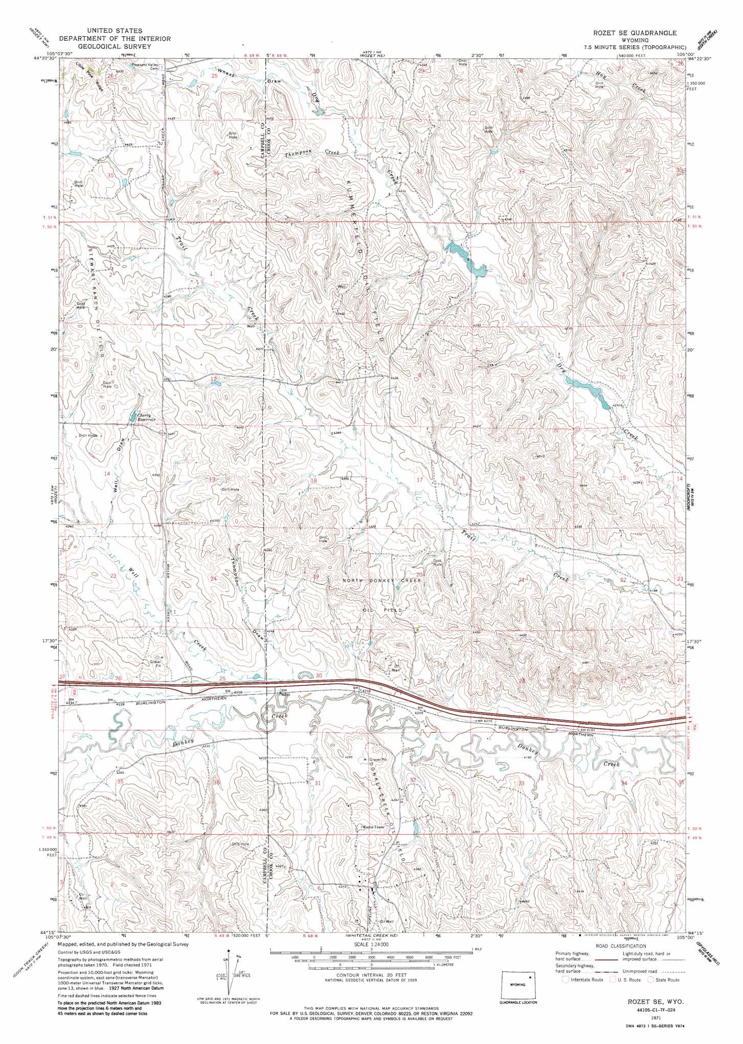
Rozet Se Topo Map Wyoming
To zoom in, hover over the map of Rozet Se
USGS Topo Quad 44105c1 - 1:24,000 scale
| Topo Map Name: | Rozet Se |
| USGS Topo Quad ID: | 44105c1 |
| Print Size: | ca. 21 1/4" wide x 27" high |
| Southeast Coordinates: | 44.25° N latitude / 105° W longitude |
| Map Center Coordinates: | 44.3125° N latitude / 105.0625° W longitude |
| U.S. State: | WY |
| Filename: | o44105c1.jpg |
| Download Map JPG Image: | Rozet Se topo map 1:24,000 scale |
| Map Type: | Topographic |
| Topo Series: | 7.5´ |
| Map Scale: | 1:24,000 |
| Source of Map Images: | United States Geological Survey (USGS) |
| Alternate Map Versions: |
Rozet SE WY 1971, updated 1974 Download PDF Buy paper map Rozet SE WY 1971, updated 1987 Download PDF Buy paper map Rozet SE WY 2012 Download PDF Buy paper map Rozet SE WY 2015 Download PDF Buy paper map |
1:24,000 Topo Quads surrounding Rozet Se
Lone Tree Creek |
Adon |
Flag Butte |
Oshoto |
Missouri Buttes |
Green Hill |
Rozet Nw |
Rozet Ne |
Edith Creek |
Carlile |
Fortin Draw |
Rozet |
Rozet Se |
Moorcroft |
Grasshopper Butte |
Coyote Draw |
Coon Track Creek |
Whitetail Creek Ne |
Spyglass Hill |
Freda Creek |
Saddle Horse Butte |
Whitetail Creek |
Whitetail Creek Se |
Cedar Draw |
Soda Butte |
> Back to 44105a1 at 1:100,000 scale
> Back to 44104a1 at 1:250,000 scale
> Back to U.S. Topo Maps home
Rozet Se topo map: Gazetteer
Rozet Se: Dams
Cox Dam elevation 1275m 4183′Keuhne Dam elevation 1305m 4281′
Phil Dam elevation 1315m 4314′
Raudsep Number 1 Dam elevation 1293m 4242′
Rozet Se: Oilfields
Kummerfeld Oil Field elevation 1341m 4399′North Donkey Creek Oil Field elevation 1341m 4399′
Stewart Ranch Oil Field elevation 1347m 4419′
Rozet Se: Reservoirs
Cherry Reservoir elevation 1308m 4291′Cox Reservoir elevation 1275m 4183′
Keuhne Reservoir elevation 1305m 4281′
Phil Reservoir elevation 1315m 4314′
Raudsep Number 1 Reservoir elevation 1293m 4242′
Rozet Se: Streams
Thompson Creek elevation 1307m 4288′Well Creek elevation 1281m 4202′
Rozet Se: Valleys
Thompson Draw elevation 1286m 4219′Well Draw elevation 1292m 4238′
Wheat Draw elevation 1315m 4314′
Rozet Se digital topo map on disk
Buy this Rozet Se topo map showing relief, roads, GPS coordinates and other geographical features, as a high-resolution digital map file on DVD:
Eastern Wyoming & Western South Dakota
Buy digital topo maps: Eastern Wyoming & Western South Dakota