Oriva Nw Topo Map Wyoming
To zoom in, hover over the map of Oriva Nw
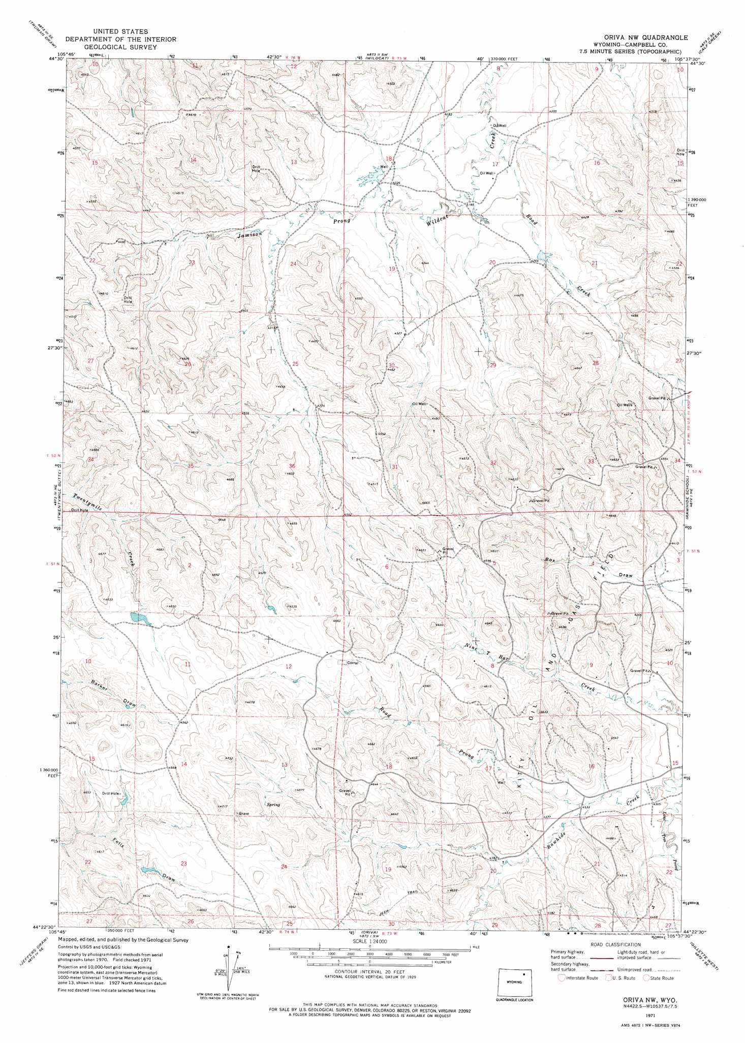
USGS Topo Quad 44105d6 - 1:24,000 scale
| Topo Map Name: | Oriva Nw |
| USGS Topo Quad ID: | 44105d6 |
| Print Size: | ca. 21 1/4" wide x 27" high |
| Southeast Coordinates: | 44.375° N latitude / 105.625° W longitude |
| Map Center Coordinates: | 44.4375° N latitude / 105.6875° W longitude |
| U.S. State: | WY |
| Filename: | o44105d6.jpg |
| Download Map JPG Image: | Oriva Nw topo map 1:24,000 scale |
| Map Type: | Topographic |
| Topo Series: | 7.5´ |
| Map Scale: | 1:24,000 |
| Source of Map Images: | United States Geological Survey (USGS) |
| Alternate Map Versions: |
Oriva NW WY 1971, updated 1974 Download PDF Buy paper map Oriva NW WY 2012 Download PDF Buy paper map Oriva NW WY 2015 Download PDF Buy paper map |
1:24,000 Topo Quads surrounding Oriva Nw
Larey Draw |
Spotted Horse |
Recluse |
Pitch Draw |
Oliver Draw |
Croton |
Truman Draw |
Wildcat |
Calf Creek |
Weston Sw |
Echeta |
Twentymile Butte |
Oriva Nw |
Rawhide School |
Moyer Springs |
Carr Draw |
Jeffers Draw |
Oriva |
Gillette West |
Gillette East |
Morgan Draw |
Scott Dam |
Four Bar J Ranch |
Appel Butte |
The Gap |
> Back to 44105a1 at 1:100,000 scale
> Back to 44104a1 at 1:250,000 scale
> Back to U.S. Topo Maps home
Oriva Nw topo map: Gazetteer
Oriva Nw: Dams
Gupton Dam elevation 1291m 4235′Oriva Nw: Reservoirs
Gupton Reservoir elevation 1291m 4235′Oriva Nw: Streams
Road Creek elevation 1269m 4163′Road Prong elevation 1317m 4320′
Oriva Nw digital topo map on disk
Buy this Oriva Nw topo map showing relief, roads, GPS coordinates and other geographical features, as a high-resolution digital map file on DVD:
Eastern Wyoming & Western South Dakota
Buy digital topo maps: Eastern Wyoming & Western South Dakota