Weston Sw Topo Map Wyoming
To zoom in, hover over the map of Weston Sw
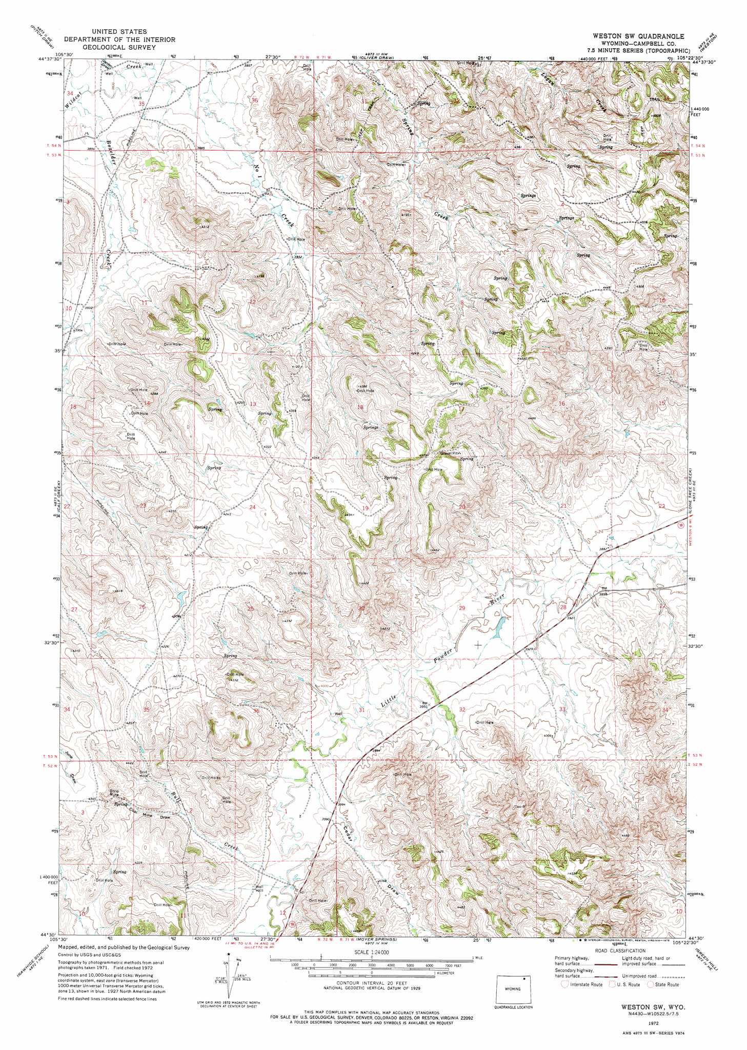
USGS Topo Quad 44105e4 - 1:24,000 scale
| Topo Map Name: | Weston Sw |
| USGS Topo Quad ID: | 44105e4 |
| Print Size: | ca. 21 1/4" wide x 27" high |
| Southeast Coordinates: | 44.5° N latitude / 105.375° W longitude |
| Map Center Coordinates: | 44.5625° N latitude / 105.4375° W longitude |
| U.S. State: | WY |
| Filename: | o44105e4.jpg |
| Download Map JPG Image: | Weston Sw topo map 1:24,000 scale |
| Map Type: | Topographic |
| Topo Series: | 7.5´ |
| Map Scale: | 1:24,000 |
| Source of Map Images: | United States Geological Survey (USGS) |
| Alternate Map Versions: |
Weston SW WY 1972, updated 1975 Download PDF Buy paper map Weston SW WY 2012 Download PDF Buy paper map Weston SW WY 2015 Download PDF Buy paper map |
1:24,000 Topo Quads surrounding Weston Sw
Homestead Draw Sw |
White Tail Butte |
Rocky Butte Sw |
Tuttle Draw |
Bowman Hill |
Recluse |
Pitch Draw |
Oliver Draw |
Weston |
Adon Nw |
Wildcat |
Calf Creek |
Weston Sw |
Lone Tree Creek |
Adon |
Oriva Nw |
Rawhide School |
Moyer Springs |
Green Hill |
Rozet Nw |
Oriva |
Gillette West |
Gillette East |
Fortin Draw |
Rozet |
> Back to 44105e1 at 1:100,000 scale
> Back to 44104a1 at 1:250,000 scale
> Back to U.S. Topo Maps home
Weston Sw topo map: Gazetteer
Weston Sw: Streams
Boxelder Creek elevation 1167m 3828′Bull Creek elevation 1214m 3982′
Weston Sw: Valleys
Cedar Draw elevation 1220m 4002′Coal Mine Draw elevation 1249m 4097′
Garden Draw elevation 1165m 3822′
Weston Sw digital topo map on disk
Buy this Weston Sw topo map showing relief, roads, GPS coordinates and other geographical features, as a high-resolution digital map file on DVD:
Eastern Wyoming & Western South Dakota
Buy digital topo maps: Eastern Wyoming & Western South Dakota