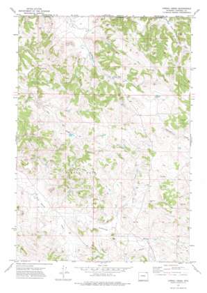
Corral Creek Topo Map Wyoming
To zoom in, hover over the map of Corral Creek
USGS Topo Quad 44105h6 - 1:24,000 scale
| Topo Map Name: | Corral Creek |
| USGS Topo Quad ID: | 44105h6 |
| Print Size: | ca. 21 1/4" wide x 27" high |
| Southeast Coordinates: | 44.875° N latitude / 105.625° W longitude |
| Map Center Coordinates: | 44.9375° N latitude / 105.6875° W longitude |
| U.S. State: | WY |
| Filename: | o44105h6.jpg |
| Download Map JPG Image: | Corral Creek topo map 1:24,000 scale |
| Map Type: | Topographic |
| Topo Series: | 7.5´ |
| Map Scale: | 1:24,000 |
| Source of Map Images: | United States Geological Survey (USGS) |
| Alternate Map Versions: |
Corral Creek WY 1971, updated 1974 Download PDF Buy paper map Corral Creek WY 2012 Download PDF Buy paper map Corral Creek WY 2015 Download PDF Buy paper map |
1:24,000 Topo Quads surrounding Corral Creek
> Back to 44105e1 at 1:100,000 scale
> Back to 44104a1 at 1:250,000 scale
> Back to U.S. Topo Maps home
Corral Creek topo map: Gazetteer
Corral Creek: Dams
Eaton Dam elevation 1245m 4084′Fox Farm Dam elevation 1234m 4048′
J D Dam elevation 1225m 4019′
Sawmill Dam elevation 1263m 4143′
Corral Creek: Mines
Three Fork Canyon Area Number Two Mine elevation 1145m 3756′Corral Creek: Oilfields
Sandbar West Oil Field elevation 1209m 3966′Corral Creek: Reservoirs
Eaton Reservoir elevation 1245m 4084′Fox Farm Reservoir elevation 1234m 4048′
J D Reservoir elevation 1225m 4019′
Sawmill Reservoir elevation 1263m 4143′
Corral Creek: Streams
Armstrong Prong Bitter Creek elevation 1135m 3723′Chalk Prong elevation 1160m 3805′
Corral Creek elevation 1146m 3759′
Quarter Circle Prong Bitter Creek elevation 1127m 3697′
Corral Creek digital topo map on disk
Buy this Corral Creek topo map showing relief, roads, GPS coordinates and other geographical features, as a high-resolution digital map file on DVD:
Eastern Wyoming & Western South Dakota
Buy digital topo maps: Eastern Wyoming & Western South Dakota


