Hazelton Topo Map Wyoming
To zoom in, hover over the map of Hazelton
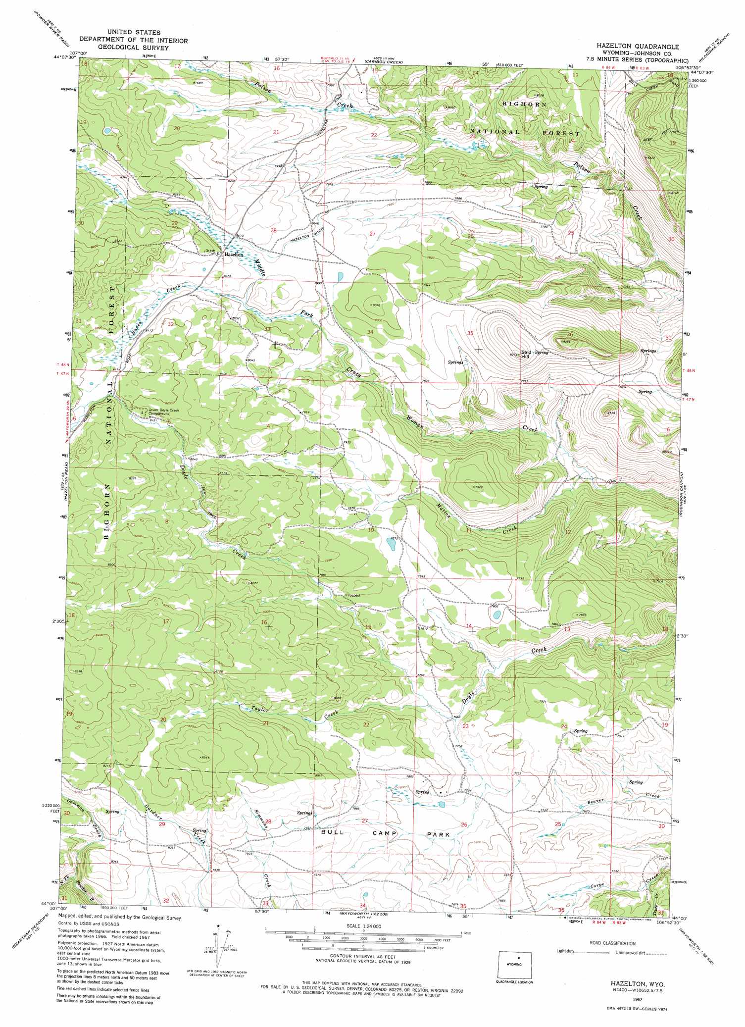
USGS Topo Quad 44106a8 - 1:24,000 scale
| Topo Map Name: | Hazelton |
| USGS Topo Quad ID: | 44106a8 |
| Print Size: | ca. 21 1/4" wide x 27" high |
| Southeast Coordinates: | 44° N latitude / 106.875° W longitude |
| Map Center Coordinates: | 44.0625° N latitude / 106.9375° W longitude |
| U.S. State: | WY |
| Filename: | o44106a8.jpg |
| Download Map JPG Image: | Hazelton topo map 1:24,000 scale |
| Map Type: | Topographic |
| Topo Series: | 7.5´ |
| Map Scale: | 1:24,000 |
| Source of Map Images: | United States Geological Survey (USGS) |
| Alternate Map Versions: |
Hazelton WY 1967, updated 1971 Download PDF Buy paper map Hazelton WY 1993, updated 1997 Download PDF Buy paper map Hazelton WY 2012 Download PDF Buy paper map Hazelton WY 2015 Download PDF Buy paper map |
| FStopo: | US Forest Service topo Hazelton is available: Download FStopo PDF Download FStopo TIF |
1:24,000 Topo Quads surrounding Hazelton
Lake Helen |
Lake Angeline |
Hunter Mesa |
North Ridge |
Buffalo |
Meadowlark Lake |
Powder River Pass |
Caribou Creek |
Klondike Ranch |
T A Ranch |
Onion Gulch |
Hazelton Peak |
Hazelton |
Robinson Canyon |
Purdy Reservoir |
Monument Hill |
Beartrap Meadows |
Packsaddle Canyon |
The Horn |
Schlicht Draw |
Tallon Spring |
Tabletop |
Fraker Mountain |
Mayoworth |
Hibbard Draw |
> Back to 44106a1 at 1:100,000 scale
> Back to 44106a1 at 1:250,000 scale
> Back to U.S. Topo Maps home
Hazelton topo map: Gazetteer
Hazelton: Canals
Hazelton Ditch elevation 2444m 8018′Hazelton: Flats
Bull Camp Park elevation 2380m 7808′Hazelton: Mines
Bull Camp Group Mine elevation 2371m 7778′Top Hand Group Mine elevation 2354m 7723′
Hazelton: Populated Places
Hazelton elevation 2461m 8074′Hazelton: Post Offices
Hazelton Post Office (historical) elevation 2461m 8074′Hazelton: Streams
Basco Creek elevation 2437m 7995′Gammon Creek elevation 2380m 7808′
Mattox Creek elevation 2200m 7217′
Taylor Creek elevation 2343m 7687′
Tepee Creek elevation 2345m 7693′
Hazelton: Summits
Bald Hill elevation 2489m 8166′Hazelton digital topo map on disk
Buy this Hazelton topo map showing relief, roads, GPS coordinates and other geographical features, as a high-resolution digital map file on DVD:
Eastern Wyoming & Western South Dakota
Buy digital topo maps: Eastern Wyoming & Western South Dakota