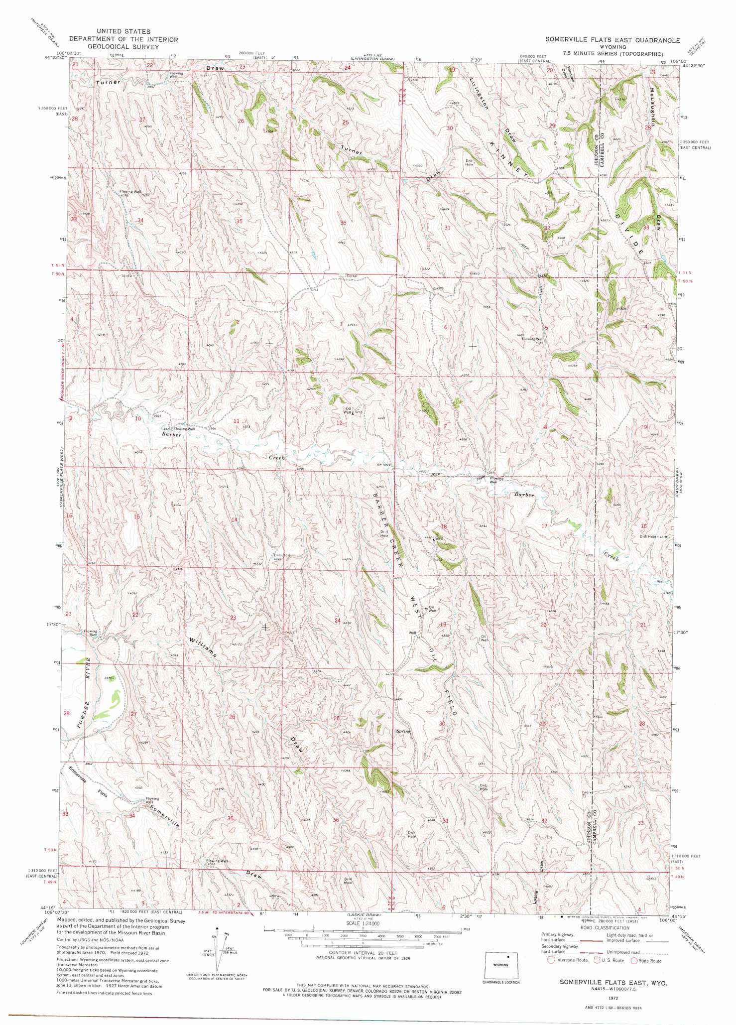
Somerville Flats East Topo Map Wyoming
To zoom in, hover over the map of Somerville Flats East
USGS Topo Quad 44106c1 - 1:24,000 scale
| Topo Map Name: | Somerville Flats East |
| USGS Topo Quad ID: | 44106c1 |
| Print Size: | ca. 21 1/4" wide x 27" high |
| Southeast Coordinates: | 44.25° N latitude / 106° W longitude |
| Map Center Coordinates: | 44.3125° N latitude / 106.0625° W longitude |
| U.S. State: | WY |
| Filename: | o44106c1.jpg |
| Download Map JPG Image: | Somerville Flats East topo map 1:24,000 scale |
| Map Type: | Topographic |
| Topo Series: | 7.5´ |
| Map Scale: | 1:24,000 |
| Source of Map Images: | United States Geological Survey (USGS) |
| Alternate Map Versions: |
Somerville Flats East WY 1972, updated 1975 Download PDF Buy paper map Somerville Flats East WY 2012 Download PDF Buy paper map Somerville Flats East WY 2015 Download PDF Buy paper map |
1:24,000 Topo Quads surrounding Somerville Flats East
Arpan Butte |
Jewell Draw |
Lariat |
Croton |
Truman Draw |
Floate Draw |
Mitchell Draw |
Livingston Draw |
Echeta |
Twentymile Butte |
Bear Draw |
Somerville Flats West |
Somerville Flats East |
Carr Draw |
Jeffers Draw |
Ploessers Draw |
Juniper Draw |
Laskie Draw |
Morgan Draw |
Scott Dam |
Boon |
Bowman Flat |
Negro Butte |
Bogie Draw |
Double Tanks |
> Back to 44106a1 at 1:100,000 scale
> Back to 44106a1 at 1:250,000 scale
> Back to U.S. Topo Maps home
Somerville Flats East topo map: Gazetteer
Somerville Flats East: Dams
Lula Dam elevation 1319m 4327′Somerville Flats East: Flats
Somerville Flats elevation 1211m 3973′Somerville Flats East: Oilfields
Barber Creek West Oil Field elevation 1344m 4409′Somerville Flats East: Reservoirs
Lula Reservoir elevation 1319m 4327′Somerville Flats East: Ridges
Kinney Divide elevation 1405m 4609′Somerville Flats East: Valleys
Williams Draw elevation 1183m 3881′Somerville Flats East digital topo map on disk
Buy this Somerville Flats East topo map showing relief, roads, GPS coordinates and other geographical features, as a high-resolution digital map file on DVD:
Eastern Wyoming & Western South Dakota
Buy digital topo maps: Eastern Wyoming & Western South Dakota