Pine Gulch Topo Map Wyoming
To zoom in, hover over the map of Pine Gulch
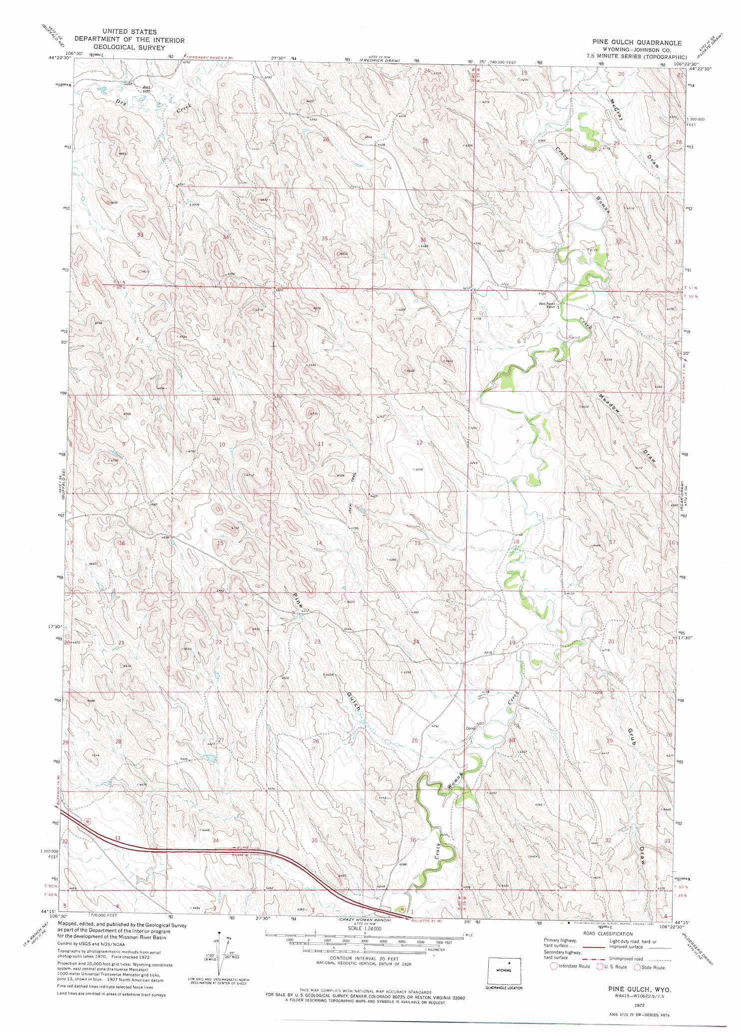
USGS Topo Quad 44106c4 - 1:24,000 scale
| Topo Map Name: | Pine Gulch |
| USGS Topo Quad ID: | 44106c4 |
| Print Size: | ca. 21 1/4" wide x 27" high |
| Southeast Coordinates: | 44.25° N latitude / 106.375° W longitude |
| Map Center Coordinates: | 44.3125° N latitude / 106.4375° W longitude |
| U.S. State: | WY |
| Filename: | o44106c4.jpg |
| Download Map JPG Image: | Pine Gulch topo map 1:24,000 scale |
| Map Type: | Topographic |
| Topo Series: | 7.5´ |
| Map Scale: | 1:24,000 |
| Source of Map Images: | United States Geological Survey (USGS) |
| Alternate Map Versions: |
Pine Gulch WY 1972, updated 1975 Download PDF Buy paper map Pine Gulch WY 2012 Download PDF Buy paper map Pine Gulch WY 2015 Download PDF Buy paper map |
1:24,000 Topo Quads surrounding Pine Gulch
Horse Hill |
Ucross |
Julio Draw |
Arpan Butte |
Jewell Draw |
Lake De Smet East |
Buffalo Ne |
Fredrick Draw |
Floate Draw |
Mitchell Draw |
Buffalo |
Buffalo Se |
Pine Gulch |
Bear Draw |
Somerville Flats West |
T A Ranch |
Ta Ranch Ne |
Crazy Woman Ranch |
Ploessers Draw |
Juniper Draw |
Purdy Reservoir |
Trabing |
Brown Ranch |
Boon |
Bowman Flat |
> Back to 44106a1 at 1:100,000 scale
> Back to 44106a1 at 1:250,000 scale
> Back to U.S. Topo Maps home
Pine Gulch topo map: Gazetteer
Pine Gulch: Dams
Heather Dam elevation 1308m 4291′Lion Dam elevation 1408m 4619′
Pine Gulch: Reservoirs
Heather Reservoir elevation 1308m 4291′Lion Reservoir elevation 1408m 4619′
Pine Gulch: Valleys
Grub Draw elevation 1268m 4160′McCray Draw elevation 1237m 4058′
Meadow Draw elevation 1250m 4101′
Pine Gulch elevation 1284m 4212′
Pine Gulch digital topo map on disk
Buy this Pine Gulch topo map showing relief, roads, GPS coordinates and other geographical features, as a high-resolution digital map file on DVD:
Eastern Wyoming & Western South Dakota
Buy digital topo maps: Eastern Wyoming & Western South Dakota