Ulm Topo Map Wyoming
To zoom in, hover over the map of Ulm
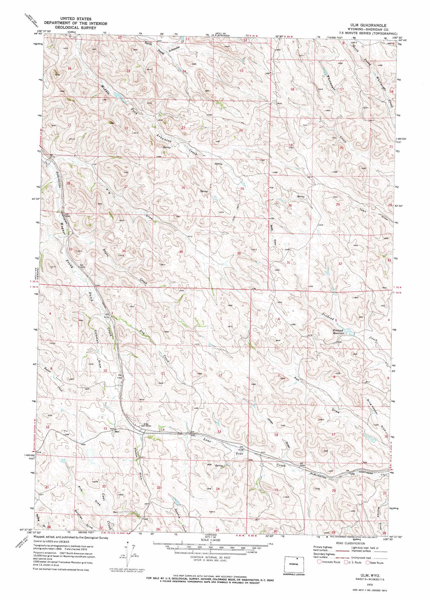
USGS Topo Quad 44106f5 - 1:24,000 scale
| Topo Map Name: | Ulm |
| USGS Topo Quad ID: | 44106f5 |
| Print Size: | ca. 21 1/4" wide x 27" high |
| Southeast Coordinates: | 44.625° N latitude / 106.5° W longitude |
| Map Center Coordinates: | 44.6875° N latitude / 106.5625° W longitude |
| U.S. State: | WY |
| Filename: | o44106f5.jpg |
| Download Map JPG Image: | Ulm topo map 1:24,000 scale |
| Map Type: | Topographic |
| Topo Series: | 7.5´ |
| Map Scale: | 1:24,000 |
| Source of Map Images: | United States Geological Survey (USGS) |
| Alternate Map Versions: |
Ulm WY 1970, updated 1973 Download PDF Buy paper map Ulm WY 2012 Download PDF Buy paper map Ulm WY 2015 Download PDF Buy paper map |
1:24,000 Topo Quads surrounding Ulm
Bar N Draw |
Cedar Canyon |
O T O Ranch |
Roundup Draw |
Box Elder Draw |
Wyarno |
Jones Draw |
S R Springs |
Shuler Draw |
Gardner Gulch |
Buffalo Run Creek |
Verona |
Ulm |
Clearmont |
Leiter |
Banner |
Horse Hill |
Ucross |
Julio Draw |
Arpan Butte |
Lake De Smet West |
Lake De Smet East |
Buffalo Ne |
Fredrick Draw |
Floate Draw |
> Back to 44106e1 at 1:100,000 scale
> Back to 44106a1 at 1:250,000 scale
> Back to U.S. Topo Maps home
Ulm topo map: Gazetteer
Ulm: Dams
Pinhead Dam elevation 1325m 4347′Ulm: Populated Places
Ulm elevation 1364m 4475′Ulm: Reservoirs
Pinhead Reservoir elevation 1322m 4337′Ulm: Streams
Dry Creek elevation 1310m 4297′Middle Fork Arkansas Creek elevation 1260m 4133′
Negro Creek elevation 1279m 4196′
North Prong Arkansas Creek elevation 1259m 4130′
Ulm: Valleys
Brug-lusher Draw elevation 1270m 4166′Coleman Draw elevation 1321m 4333′
Jones Draw elevation 1305m 4281′
P K Draw elevation 1321m 4333′
Prusak Draw elevation 1367m 4484′
Rice Draw elevation 1347m 4419′
Robb Draw elevation 1341m 4399′
Ulm digital topo map on disk
Buy this Ulm topo map showing relief, roads, GPS coordinates and other geographical features, as a high-resolution digital map file on DVD:
Eastern Wyoming & Western South Dakota
Buy digital topo maps: Eastern Wyoming & Western South Dakota