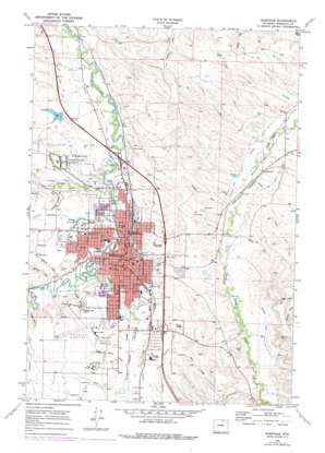
Sheridan Topo Map Wyoming
To zoom in, hover over the map of Sheridan
USGS Topo Quad 44106g8 - 1:24,000 scale
| Topo Map Name: | Sheridan |
| USGS Topo Quad ID: | 44106g8 |
| Print Size: | ca. 21 1/4" wide x 27" high |
| Southeast Coordinates: | 44.75° N latitude / 106.875° W longitude |
| Map Center Coordinates: | 44.8125° N latitude / 106.9375° W longitude |
| U.S. State: | WY |
| Filename: | o44106g8.jpg |
| Download Map JPG Image: | Sheridan topo map 1:24,000 scale |
| Map Type: | Topographic |
| Topo Series: | 7.5´ |
| Map Scale: | 1:24,000 |
| Source of Map Images: | United States Geological Survey (USGS) |
| Alternate Map Versions: |
Sheridan WY 1968, updated 1972 Download PDF Buy paper map Sheridan WY 1968, updated 1978 Download PDF Buy paper map Sheridan WY 1968, updated 1978 Download PDF Buy paper map Sheridan WY 2012 Download PDF Buy paper map Sheridan WY 2015 Download PDF Buy paper map |
1:24,000 Topo Quads surrounding Sheridan
> Back to 44106e1 at 1:100,000 scale
> Back to 44106a1 at 1:250,000 scale
> Back to U.S. Topo Maps home
Sheridan topo map: Gazetteer
Sheridan: Airports
Sheridan County Airport elevation 1215m 3986′Sheridan: Canals
Burn Cleuch Ditch elevation 1177m 3861′Grinnell Livestock Company Ditch elevation 1125m 3690′
Ninemile Ditch elevation 1206m 3956′
Prairie Dog Ditch Number 12 elevation 1134m 3720′
Soldier Creek Ditch elevation 1167m 3828′
Sheridan: Dams
Sheridan Heights Dam elevation 1157m 3795′Windy Draw Dam elevation 1142m 3746′
Sheridan: Mines
Dietz Mine elevation 1120m 3674′Dietz Number Four Mine elevation 1120m 3674′
Dietz Number Six Mine elevation 1122m 3681′
Dietz Number Three Mine elevation 1116m 3661′
Dietz Number Two Mine elevation 1120m 3674′
Martin Prospect Mine elevation 1289m 4229′
Smith Mine elevation 1122m 3681′
Sheridan: Parks
Kendrick Park elevation 1145m 3756′Sheridan Inn National Historical Landmark elevation 1138m 3733′
Thorne Ridge Stadium elevation 1132m 3713′
Sheridan: Populated Places
Sheridan elevation 1141m 3743′Sheridan: Reservoirs
Chapek Reservoir Number 1 elevation 1189m 3900′Chapek Reservoir Number 2 elevation 1178m 3864′
Holly Ponds elevation 1172m 3845′
Hume Ponds elevation 1146m 3759′
Sheridan Heights Reservoir elevation 1157m 3795′
Windy Draw Reservoir elevation 1142m 3746′
Sheridan: Streams
Big Goose Creek elevation 1136m 3727′Dry Creek elevation 1153m 3782′
Little Goose Creek elevation 1140m 3740′
Soldier Creek elevation 1134m 3720′
Sheridan: Valleys
Cemetery Draw elevation 1151m 3776′Chapek Draw elevation 1153m 3782′
Deadman Gulch elevation 1136m 3727′
Demple Draw elevation 1153m 3782′
Flat Draw elevation 1183m 3881′
Gillispie Draw elevation 1165m 3822′
Hamma Draw elevation 1164m 3818′
Hunter Draw elevation 1161m 3809′
Sheridan Heights Draw elevation 1158m 3799′
South Airport Draw elevation 1159m 3802′
Weltner Draw elevation 1153m 3782′
Wiselka Draw elevation 1159m 3802′
Sheridan digital topo map on disk
Buy this Sheridan topo map showing relief, roads, GPS coordinates and other geographical features, as a high-resolution digital map file on DVD:
Eastern Wyoming & Western South Dakota
Buy digital topo maps: Eastern Wyoming & Western South Dakota


