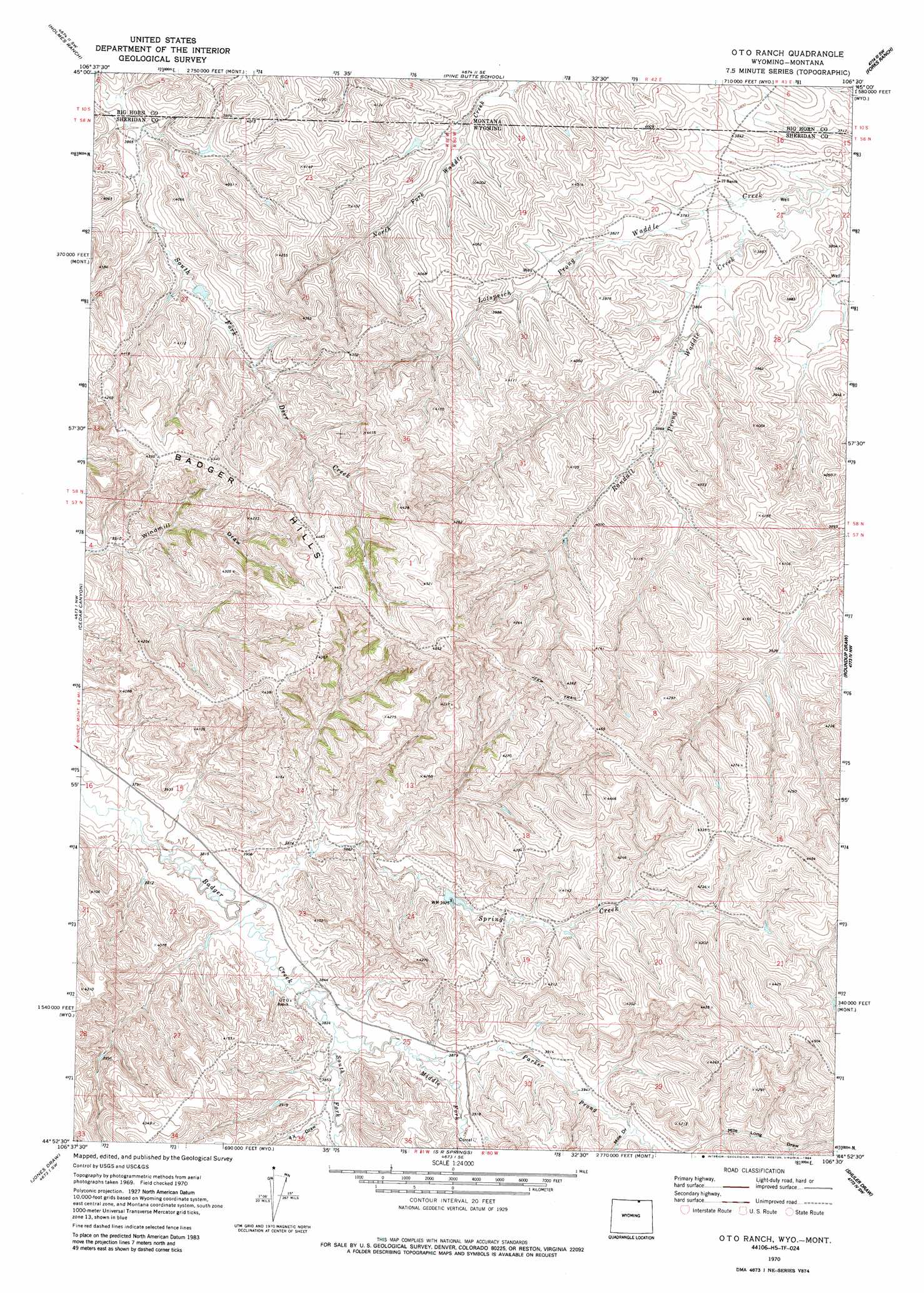
O T O Ranch Topo Map Wyoming
To zoom in, hover over the map of O T O Ranch
USGS Topo Quad 44106h5 - 1:24,000 scale
| Topo Map Name: | O T O Ranch |
| USGS Topo Quad ID: | 44106h5 |
| Print Size: | ca. 21 1/4" wide x 27" high |
| Southeast Coordinates: | 44.875° N latitude / 106.5° W longitude |
| Map Center Coordinates: | 44.9375° N latitude / 106.5625° W longitude |
| U.S. States: | WY, MT |
| Filename: | o44106h5.jpg |
| Download Map JPG Image: | O T O Ranch topo map 1:24,000 scale |
| Map Type: | Topographic |
| Topo Series: | 7.5´ |
| Map Scale: | 1:24,000 |
| Source of Map Images: | United States Geological Survey (USGS) |
| Alternate Map Versions: |
O T O Ranch WY 1970, updated 1973 Download PDF Buy paper map O T O Ranch WY 1970, updated 1984 Download PDF Buy paper map O T O Ranch WY 2011 Download PDF Buy paper map O T O Ranch WY 2012 Download PDF Buy paper map O T O Ranch WY 2015 Download PDF Buy paper map |
1:24,000 Topo Quads surrounding O T O Ranch
Tongue River Dam |
Spring Gulch |
Lacey Gulch |
Stroud Creek |
Hamilton Draw |
Decker |
Holmes Ranch |
Pine Butte School |
Forks Ranch |
Quietus |
Bar N Draw |
Cedar Canyon |
O T O Ranch |
Roundup Draw |
Box Elder Draw |
Wyarno |
Jones Draw |
S R Springs |
Shuler Draw |
Gardner Gulch |
Buffalo Run Creek |
Verona |
Ulm |
Clearmont |
Leiter |
> Back to 44106e1 at 1:100,000 scale
> Back to 44106a1 at 1:250,000 scale
> Back to U.S. Topo Maps home
O T O Ranch topo map: Gazetteer
O T O Ranch: Dams
Fordyce Deer Creek Dam elevation 1225m 4019′O T O Ranch: Reservoirs
Fordyce Deer Creek Reservoir elevation 1225m 4019′O T O Ranch: Streams
Lotspeich Prong Waddle Creek elevation 1135m 3723′Middle Fork Badger Creek elevation 1181m 3874′
Parker Prong Badger Creek elevation 1188m 3897′
South Fork Badger Creek elevation 1168m 3832′
Spring Creek elevation 1159m 3802′
O T O Ranch: Valleys
Four X Draw elevation 1181m 3874′Mile Draw elevation 1208m 3963′
O T O Ranch digital topo map on disk
Buy this O T O Ranch topo map showing relief, roads, GPS coordinates and other geographical features, as a high-resolution digital map file on DVD:
Eastern Wyoming & Western South Dakota
Buy digital topo maps: Eastern Wyoming & Western South Dakota