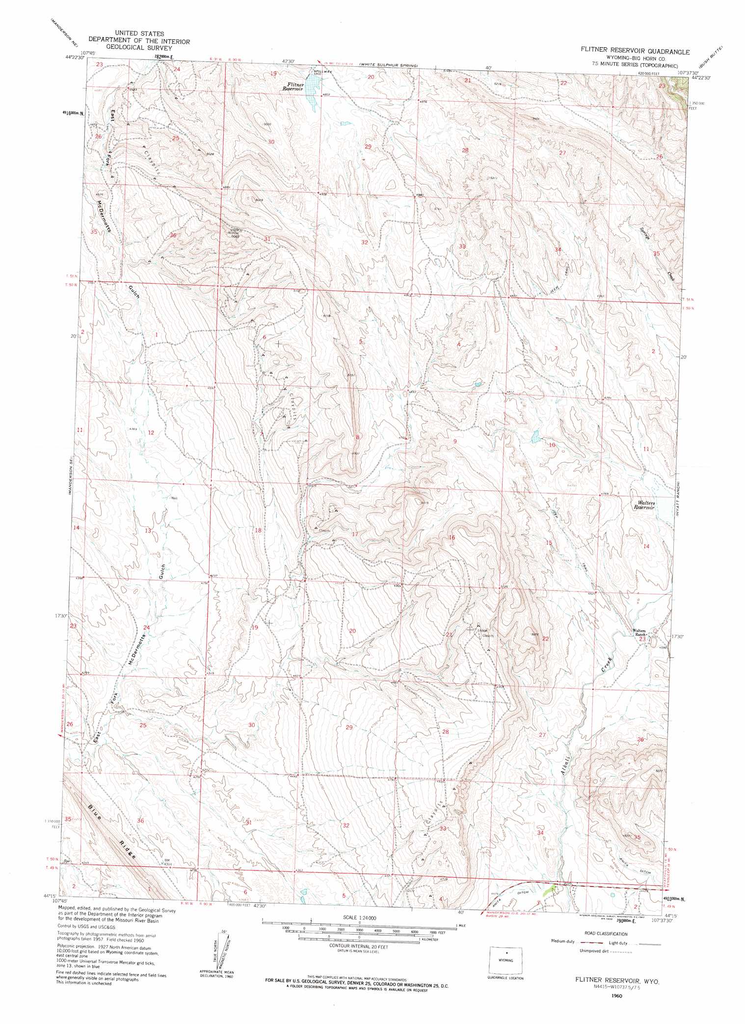
Flitner Reservoir Topo Map Wyoming
To zoom in, hover over the map of Flitner Reservoir
USGS Topo Quad 44107c6 - 1:24,000 scale
| Topo Map Name: | Flitner Reservoir |
| USGS Topo Quad ID: | 44107c6 |
| Print Size: | ca. 21 1/4" wide x 27" high |
| Southeast Coordinates: | 44.25° N latitude / 107.625° W longitude |
| Map Center Coordinates: | 44.3125° N latitude / 107.6875° W longitude |
| U.S. State: | WY |
| Filename: | o44107c6.jpg |
| Download Map JPG Image: | Flitner Reservoir topo map 1:24,000 scale |
| Map Type: | Topographic |
| Topo Series: | 7.5´ |
| Map Scale: | 1:24,000 |
| Source of Map Images: | United States Geological Survey (USGS) |
| Alternate Map Versions: |
Flitner Reservoir WY 1960, updated 1962 Download PDF Buy paper map Flitner Reservoir WY 2012 Download PDF Buy paper map Flitner Reservoir WY 2015 Download PDF Buy paper map |
1:24,000 Topo Quads surrounding Flitner Reservoir
Devils Kitchen |
Shell |
Black Mountain |
Shell Falls |
Shell Reservoir |
Wild Horse Flats |
Manderson Ne |
White Sulphur Spring |
Bush Butte |
Spanish Point |
Manderson |
Manderson Se |
Flitner Reservoir |
Hyatt Ranch |
Allen Draw |
Rairden |
Mcdermotts Butte |
Weintz Draw |
Hyattville |
Pierce Draw |
Worland |
Worland Se |
Broom Draw |
Wild Horse Hill |
Ten Sleep |
> Back to 44107a1 at 1:100,000 scale
> Back to 44106a1 at 1:250,000 scale
> Back to U.S. Topo Maps home
Flitner Reservoir topo map: Gazetteer
Flitner Reservoir: Canals
Anita Ditch elevation 1376m 4514′Flitner Reservoir: Dams
Walters Dam elevation 1424m 4671′Flitner Reservoir: Mines
Anomaly Number Four Mine elevation 1518m 4980′Flitner Reservoir: Reservoirs
Flitner Reservoir elevation 1464m 4803′Walters Reservoir elevation 1424m 4671′
Flitner Reservoir digital topo map on disk
Buy this Flitner Reservoir topo map showing relief, roads, GPS coordinates and other geographical features, as a high-resolution digital map file on DVD:
Eastern Wyoming & Western South Dakota
Buy digital topo maps: Eastern Wyoming & Western South Dakota