Manderson Ne Topo Map Wyoming
To zoom in, hover over the map of Manderson Ne
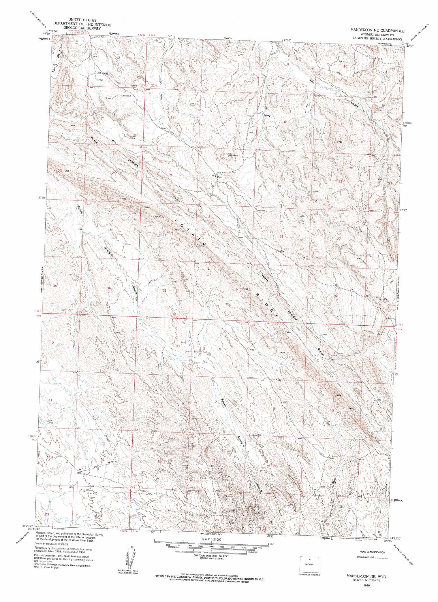
USGS Topo Quad 44107d7 - 1:24,000 scale
| Topo Map Name: | Manderson Ne |
| USGS Topo Quad ID: | 44107d7 |
| Print Size: | ca. 21 1/4" wide x 27" high |
| Southeast Coordinates: | 44.375° N latitude / 107.75° W longitude |
| Map Center Coordinates: | 44.4375° N latitude / 107.8125° W longitude |
| U.S. State: | WY |
| Filename: | o44107d7.jpg |
| Download Map JPG Image: | Manderson Ne topo map 1:24,000 scale |
| Map Type: | Topographic |
| Topo Series: | 7.5´ |
| Map Scale: | 1:24,000 |
| Source of Map Images: | United States Geological Survey (USGS) |
| Alternate Map Versions: |
Manderson NE WY 1960, updated 1962 Download PDF Buy paper map Manderson NE WY 2012 Download PDF Buy paper map Manderson NE WY 2015 Download PDF Buy paper map |
1:24,000 Topo Quads surrounding Manderson Ne
Alkali Creek |
Bear Creek Ranch |
Leavitt Reservoir |
Hidden Tepee Creek |
Granite Pass |
Greybull North |
Devils Kitchen |
Shell |
Black Mountain |
Shell Falls |
Greybull South |
Wild Horse Flats |
Manderson Ne |
White Sulphur Spring |
Bush Butte |
Orchard Bench |
Manderson |
Manderson Se |
Flitner Reservoir |
Hyatt Ranch |
Schuster Flats Ne |
Rairden |
Mcdermotts Butte |
Weintz Draw |
Hyattville |
> Back to 44107a1 at 1:100,000 scale
> Back to 44106a1 at 1:250,000 scale
> Back to U.S. Topo Maps home
Manderson Ne topo map: Gazetteer
Manderson Ne: Mines
Mudstone Claims Mine elevation 1261m 4137′Mudstone Claims Mine elevation 1314m 4311′
Potato Ridge Mine elevation 1491m 4891′
Reeves Ranch Mine elevation 1333m 4373′
Sanguine Claim Mine elevation 1340m 4396′
Sanguine Number Twelve Mine elevation 1340m 4396′
Shell Creek Prospect Mine elevation 1313m 4307′
Manderson Ne: Ridges
Potato Ridge elevation 1416m 4645′Manderson Ne digital topo map on disk
Buy this Manderson Ne topo map showing relief, roads, GPS coordinates and other geographical features, as a high-resolution digital map file on DVD:
Eastern Wyoming & Western South Dakota
Buy digital topo maps: Eastern Wyoming & Western South Dakota