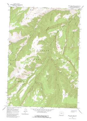
Bull Elk Park Topo Map Wyoming
To zoom in, hover over the map of Bull Elk Park
USGS Topo Quad 44107h6 - 1:24,000 scale
| Topo Map Name: | Bull Elk Park |
| USGS Topo Quad ID: | 44107h6 |
| Print Size: | ca. 21 1/4" wide x 27" high |
| Southeast Coordinates: | 44.875° N latitude / 107.625° W longitude |
| Map Center Coordinates: | 44.9375° N latitude / 107.6875° W longitude |
| U.S. State: | WY |
| Filename: | o44107h6.jpg |
| Download Map JPG Image: | Bull Elk Park topo map 1:24,000 scale |
| Map Type: | Topographic |
| Topo Series: | 7.5´ |
| Map Scale: | 1:24,000 |
| Source of Map Images: | United States Geological Survey (USGS) |
| Alternate Map Versions: |
Bull Elk Park WY 1964, updated 1968 Download PDF Buy paper map Bull Elk Park WY 1964, updated 1980 Download PDF Buy paper map Bull Elk Park WY 1993, updated 1997 Download PDF Buy paper map Bull Elk Park WY 2012 Download PDF Buy paper map Bull Elk Park WY 2015 Download PDF Buy paper map |
| FStopo: | US Forest Service topo Bull Elk Park is available: Download FStopo PDF Download FStopo TIF |
1:24,000 Topo Quads surrounding Bull Elk Park
> Back to 44107e1 at 1:100,000 scale
> Back to 44106a1 at 1:250,000 scale
> Back to U.S. Topo Maps home
Bull Elk Park topo map: Gazetteer
Bull Elk Park: Flats
Bull Elk Park elevation 2281m 7483′Deer Park elevation 1696m 5564′
Bull Elk Park: Parks
Bull Elk Park Natural Area elevation 2283m 7490′Bull Elk Park: Springs
Bear Spring elevation 2430m 7972′Hidden Spring elevation 2317m 7601′
Willow Spring elevation 1969m 6459′
Bull Elk Park: Streams
Bear Trap Creek elevation 1696m 5564′Crater Creek elevation 2097m 6879′
Cub Creek elevation 1883m 6177′
Dry Fork Little Bighorn River elevation 1636m 5367′
Elkhorn Creek elevation 1342m 4402′
Mann Creek elevation 1680m 5511′
Pumpkin Creek elevation 1680m 5511′
Taylor Creek elevation 1748m 5734′
Wagon Box Creek elevation 2068m 6784′
Bull Elk Park: Summits
Fisher Mountain elevation 2183m 7162′Leaky Mountain elevation 2467m 8093′
Bull Elk Park: Trails
Dry Fork Trail elevation 2031m 6663′Little Horn Trail elevation 1713m 5620′
Bull Elk Park: Valleys
Dark Canyon elevation 1706m 5597′Kettle Gulch elevation 1355m 4445′
Short Canyon elevation 1435m 4708′
Short Canyon elevation 1435m 4708′
Whiskey Gulch elevation 1463m 4799′
Bull Elk Park digital topo map on disk
Buy this Bull Elk Park topo map showing relief, roads, GPS coordinates and other geographical features, as a high-resolution digital map file on DVD:
Eastern Wyoming & Western South Dakota
Buy digital topo maps: Eastern Wyoming & Western South Dakota


