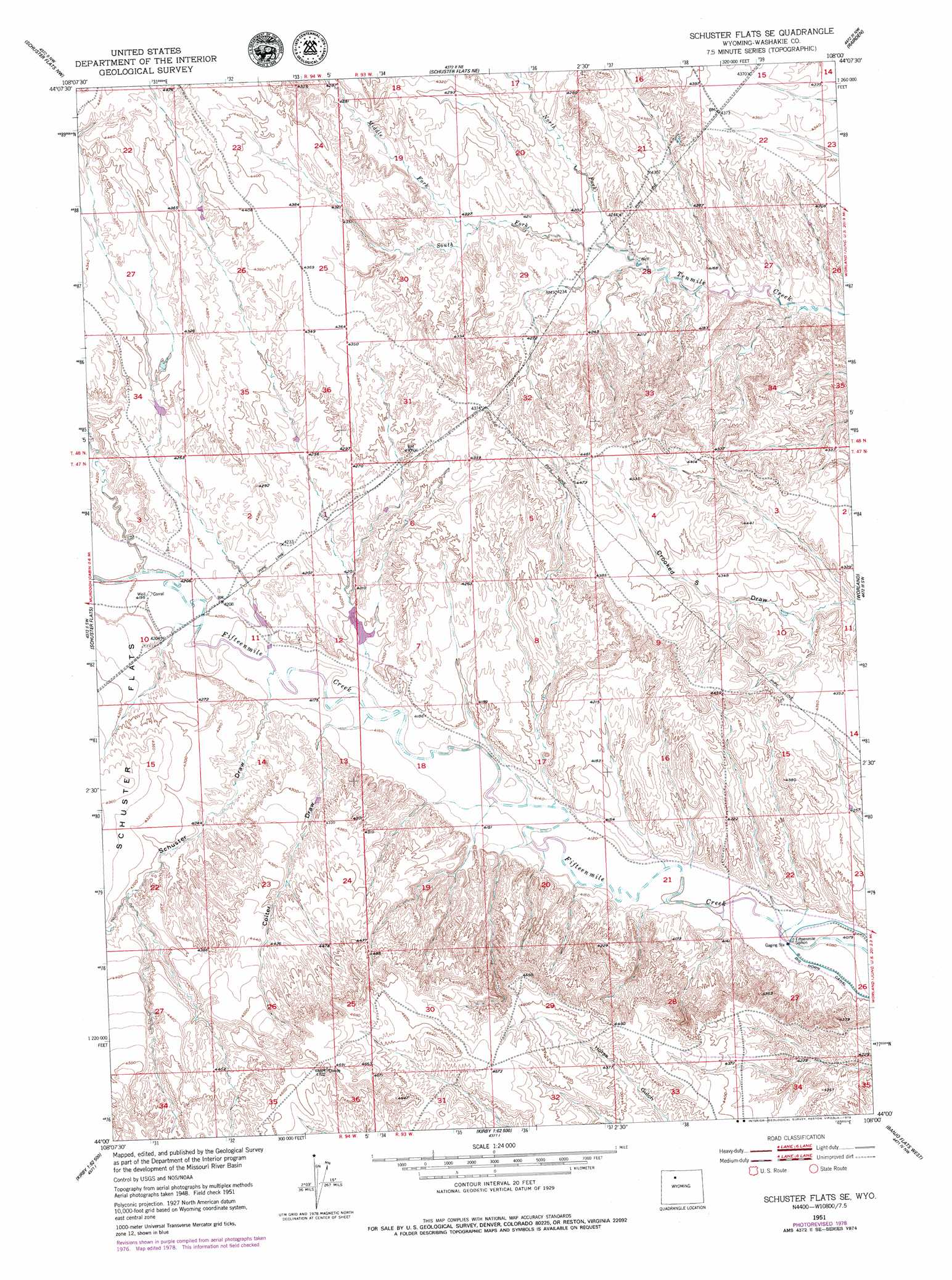
Schuster Flats Se Topo Map Wyoming
To zoom in, hover over the map of Schuster Flats Se
USGS Topo Quad 44108a1 - 1:24,000 scale
| Topo Map Name: | Schuster Flats Se |
| USGS Topo Quad ID: | 44108a1 |
| Print Size: | ca. 21 1/4" wide x 27" high |
| Southeast Coordinates: | 44° N latitude / 108° W longitude |
| Map Center Coordinates: | 44.0625° N latitude / 108.0625° W longitude |
| U.S. State: | WY |
| Filename: | o44108a1.jpg |
| Download Map JPG Image: | Schuster Flats Se topo map 1:24,000 scale |
| Map Type: | Topographic |
| Topo Series: | 7.5´ |
| Map Scale: | 1:24,000 |
| Source of Map Images: | United States Geological Survey (USGS) |
| Alternate Map Versions: |
Schuster Flats SE WY 1951, updated 1953 Download PDF Buy paper map Schuster Flats SE WY 1951, updated 1978 Download PDF Buy paper map Schuster Flats SE WY 1951, updated 1979 Download PDF Buy paper map Schuster Flats SE WY 2012 Download PDF Buy paper map Schuster Flats SE WY 2015 Download PDF Buy paper map |
1:24,000 Topo Quads surrounding Schuster Flats Se
Wardel Reservoir |
Jones Reservoir |
Orchard Bench |
Manderson |
Manderson Se |
Sucker Dam |
Schuster Flats Nw |
Schuster Flats Ne |
Rairden |
Mcdermotts Butte |
Dutch Nick Flat |
Schuster Flats |
Schuster Flats Se |
Worland |
Worland Se |
Blue Mesa East |
Chimney Gulch |
Neiber |
Banjo Flats West |
Banjo Flats East |
Little Sand Draw |
Kirby |
Cedar Mountain |
Zimmerman Buttes |
Henry Draw |
> Back to 44108a1 at 1:100,000 scale
> Back to 44108a1 at 1:250,000 scale
> Back to U.S. Topo Maps home
Schuster Flats Se topo map: Gazetteer
Schuster Flats Se: Canals
Fifteenmile Siphon elevation 1244m 4081′Schuster Flats Se: Dams
Sand Butte Detention Dam elevation 1277m 4189′Wide Draw Detention Dam elevation 1275m 4183′
Schuster Flats Se: Reservoirs
Sand Butte Reservoir elevation 1277m 4189′Wide Draw Reservoir elevation 1275m 4183′
Schuster Flats Se: Streams
Middle Fork Tenmile Creek elevation 1289m 4229′North Fork Tenmile Creek elevation 1274m 4179′
Schuster Flats Se: Valleys
Colter Draw elevation 1266m 4153′Schuster Draw elevation 1272m 4173′
Schuster Flats Se digital topo map on disk
Buy this Schuster Flats Se topo map showing relief, roads, GPS coordinates and other geographical features, as a high-resolution digital map file on DVD: