Pitchfork Topo Map Wyoming
To zoom in, hover over the map of Pitchfork
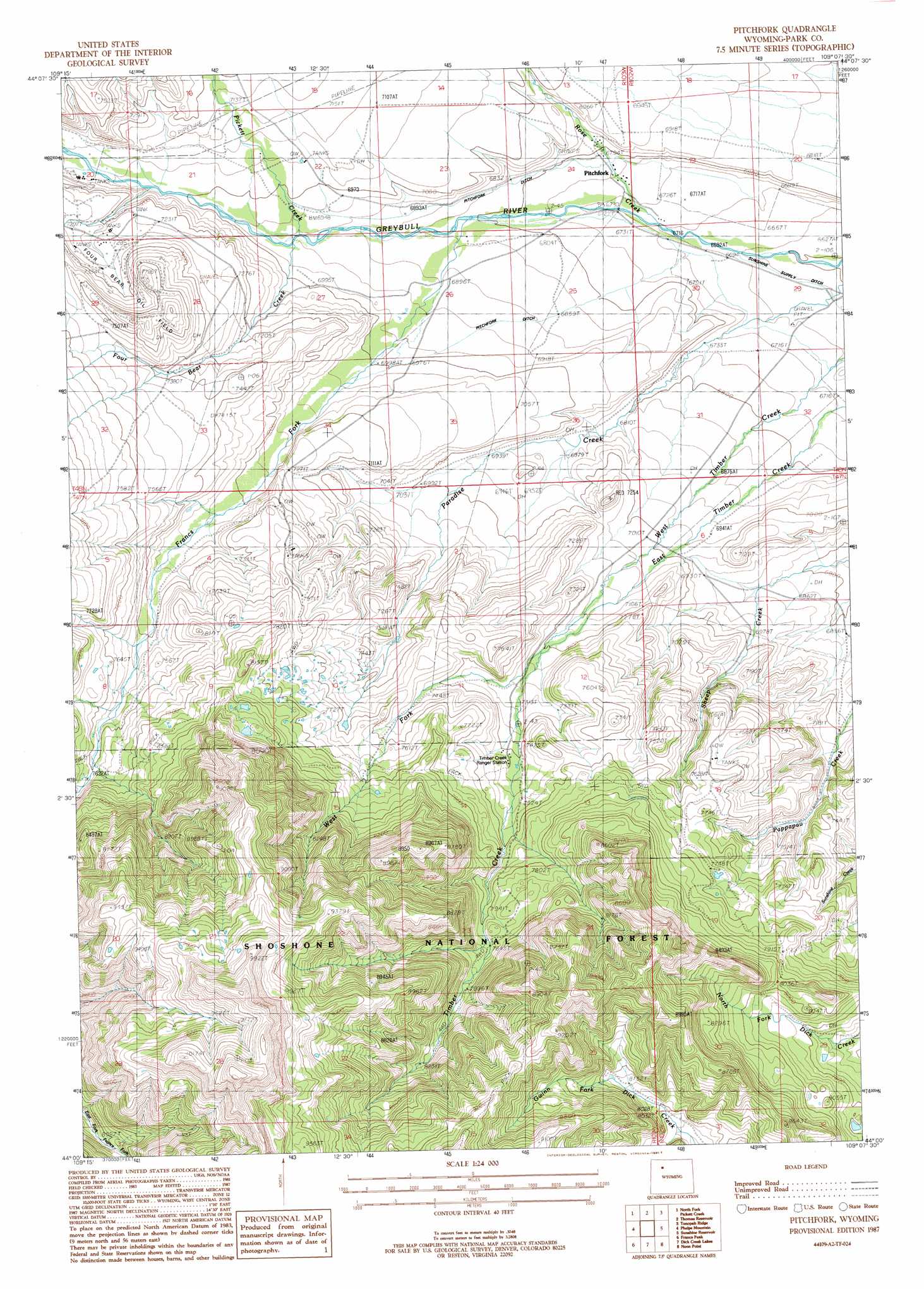
USGS Topo Quad 44109a2 - 1:24,000 scale
| Topo Map Name: | Pitchfork |
| USGS Topo Quad ID: | 44109a2 |
| Print Size: | ca. 21 1/4" wide x 27" high |
| Southeast Coordinates: | 44° N latitude / 109.125° W longitude |
| Map Center Coordinates: | 44.0625° N latitude / 109.1875° W longitude |
| U.S. State: | WY |
| Filename: | o44109a2.jpg |
| Download Map JPG Image: | Pitchfork topo map 1:24,000 scale |
| Map Type: | Topographic |
| Topo Series: | 7.5´ |
| Map Scale: | 1:24,000 |
| Source of Map Images: | United States Geological Survey (USGS) |
| Alternate Map Versions: |
Pitchfork WY 1987, updated 1988 Download PDF Buy paper map Pitchfork WY 1991, updated 1997 Download PDF Buy paper map Pitchfork WY 2012 Download PDF Buy paper map Pitchfork WY 2015 Download PDF Buy paper map |
| FStopo: | US Forest Service topo Pitchfork is available: Download FStopo PDF Download FStopo TIF |
1:24,000 Topo Quads surrounding Pitchfork
Twin Creek |
Belknap Creek |
Devils Tooth |
Horner Creek |
Elk Butte |
Aldrich Basin |
North Fork Pickett Creek |
Thomas Reservoir |
Tonopah Ridge |
Meeteetse West |
Irish Rock |
Phelps Mountain |
Pitchfork |
Sunshine Reservoir |
Iron Creek |
Mount Burwell |
Francs Peak |
Dick Creek Lakes |
Noon Point |
Soapy Dale Peak |
Wiggins Peak |
Dunrud Peak |
Twin Peaks |
Cottonwood Peak |
Milk Creek |
> Back to 44109a1 at 1:100,000 scale
> Back to 44108a1 at 1:250,000 scale
> Back to U.S. Topo Maps home
Pitchfork topo map: Gazetteer
Pitchfork: Canals
Pitchfork Ditch elevation 2107m 6912′Pitchfork Ditch elevation 2090m 6856′
Pitchfork: Oilfields
Four Bear Oil Field elevation 2299m 7542′Pitchfork: Streams
Four Bear Creek elevation 2112m 6929′Francs Fork elevation 2077m 6814′
Kay Creek elevation 2357m 7732′
Pickett Creek elevation 2108m 6916′
Rose Creek elevation 2047m 6715′
Timber Creek elevation 2188m 7178′
West Fork Timber Creek elevation 2215m 7267′
Pitchfork digital topo map on disk
Buy this Pitchfork topo map showing relief, roads, GPS coordinates and other geographical features, as a high-resolution digital map file on DVD: