Thorofare Plateau Topo Map Wyoming
To zoom in, hover over the map of Thorofare Plateau
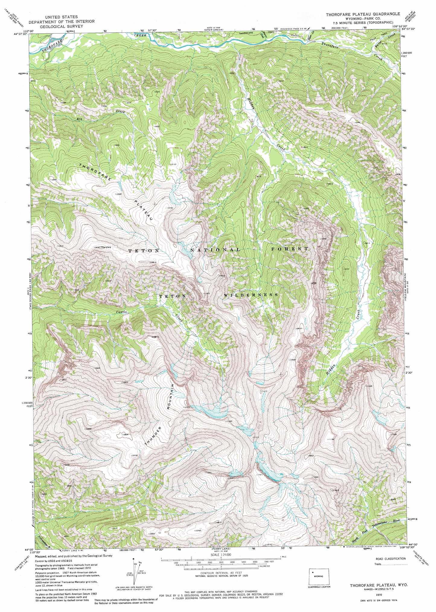
USGS Topo Quad 44109a8 - 1:24,000 scale
| Topo Map Name: | Thorofare Plateau |
| USGS Topo Quad ID: | 44109a8 |
| Print Size: | ca. 21 1/4" wide x 27" high |
| Southeast Coordinates: | 44° N latitude / 109.875° W longitude |
| Map Center Coordinates: | 44.0625° N latitude / 109.9375° W longitude |
| U.S. State: | WY |
| Filename: | o44109a8.jpg |
| Download Map JPG Image: | Thorofare Plateau topo map 1:24,000 scale |
| Map Type: | Topographic |
| Topo Series: | 7.5´ |
| Map Scale: | 1:24,000 |
| Source of Map Images: | United States Geological Survey (USGS) |
| Alternate Map Versions: |
Thorofare Plateau WY 1970, updated 1973 Download PDF Buy paper map Thorofare Plateau WY 1970, updated 1981 Download PDF Buy paper map Thorofare Plateau WY 1996, updated 1998 Download PDF Buy paper map Thorofare Plateau WY 2012 Download PDF Buy paper map Thorofare Plateau WY 2015 Download PDF Buy paper map |
| FStopo: | US Forest Service topo Thorofare Plateau is available: Download FStopo PDF Download FStopo TIF |
1:24,000 Topo Quads surrounding Thorofare Plateau
Trail Lake |
Eagle Peak |
Pinnacle Mountain |
Sheep Mesa |
Lake Creek |
Badger Creek |
The Trident |
Open Creek |
Thorofare Buttes |
Clouds Home Peak |
Two Ocean Pass |
Yellowstone Point |
Thorofare Plateau |
Yellow Mountain |
Fall Creek |
Joy Peak |
Crater Lake |
Ferry Lake |
Younts Peak |
Hardluck Mountain |
Angle Mountain |
Togwotee Pass |
Dundee Meadows |
Shoshone Pass |
Five Pockets |
> Back to 44109a1 at 1:100,000 scale
> Back to 44108a1 at 1:250,000 scale
> Back to U.S. Topo Maps home
Thorofare Plateau topo map: Gazetteer
Thorofare Plateau: Areas
Thorofare Plateau elevation 3100m 10170′Thorofare Plateau: Streams
Butte Creek elevation 2524m 8280′Hidden Creek elevation 2482m 8143′
Pass Creek elevation 2500m 8202′
Scatter Creek elevation 2488m 8162′
Thorofare Plateau: Summits
Thunder Mountain elevation 3535m 11597′Thorofare Plateau digital topo map on disk
Buy this Thorofare Plateau topo map showing relief, roads, GPS coordinates and other geographical features, as a high-resolution digital map file on DVD: