Clouds Home Peak Topo Map Wyoming
To zoom in, hover over the map of Clouds Home Peak
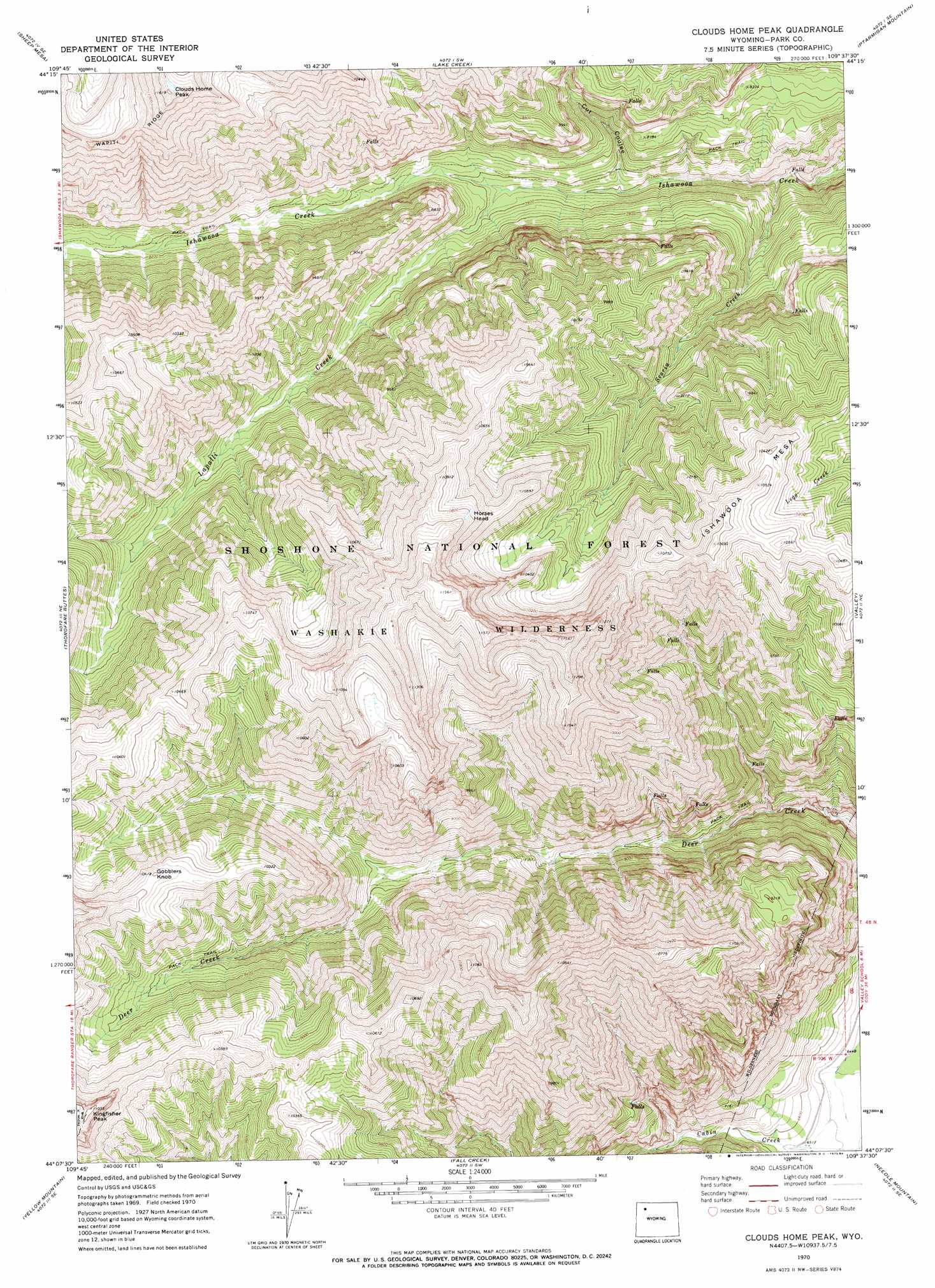
USGS Topo Quad 44109b6 - 1:24,000 scale
| Topo Map Name: | Clouds Home Peak |
| USGS Topo Quad ID: | 44109b6 |
| Print Size: | ca. 21 1/4" wide x 27" high |
| Southeast Coordinates: | 44.125° N latitude / 109.625° W longitude |
| Map Center Coordinates: | 44.1875° N latitude / 109.6875° W longitude |
| U.S. State: | WY |
| Filename: | o44109b6.jpg |
| Download Map JPG Image: | Clouds Home Peak topo map 1:24,000 scale |
| Map Type: | Topographic |
| Topo Series: | 7.5´ |
| Map Scale: | 1:24,000 |
| Source of Map Images: | United States Geological Survey (USGS) |
| Alternate Map Versions: |
Clouds Home Peak WY 1970, updated 1973 Download PDF Buy paper map Clouds Home Peak WY 1970, updated 1984 Download PDF Buy paper map Clouds Home Peak WY 1991, updated 1996 Download PDF Buy paper map Clouds Home Peak WY 2012 Download PDF Buy paper map Clouds Home Peak WY 2015 Download PDF Buy paper map |
| FStopo: | US Forest Service topo Clouds Home Peak is available: Download FStopo PDF Download FStopo TIF |
1:24,000 Topo Quads surrounding Clouds Home Peak
Eagle Creek |
Chimney Rock |
Clayton Mountain |
Flag Peak |
Wapiti |
Pinnacle Mountain |
Sheep Mesa |
Lake Creek |
Ptarmigan Mountain |
Twin Creek |
Open Creek |
Thorofare Buttes |
Clouds Home Peak |
Valley |
Aldrich Basin |
Thorofare Plateau |
Yellow Mountain |
Fall Creek |
Needle Mountain |
Irish Rock |
Ferry Lake |
Younts Peak |
Hardluck Mountain |
Emerald Lake |
Mount Burwell |
> Back to 44109a1 at 1:100,000 scale
> Back to 44108a1 at 1:250,000 scale
> Back to U.S. Topo Maps home
Clouds Home Peak topo map: Gazetteer
Clouds Home Peak: Streams
Cabin Creek elevation 1971m 6466′Lapalli Creek elevation 2292m 7519′
Seclusion Creek elevation 2953m 9688′
Seoria Creek elevation 2160m 7086′
Clouds Home Peak: Summits
Clouds Home Peak elevation 3537m 11604′Gobblers Knob elevation 3158m 10360′
Horses Head elevation 3317m 10882′
Ishawooa Mesa elevation 3196m 10485′
Kingfisher Peak elevation 3357m 11013′
Clouds Home Peak: Valleys
Cut Coulee elevation 2244m 7362′Clouds Home Peak digital topo map on disk
Buy this Clouds Home Peak topo map showing relief, roads, GPS coordinates and other geographical features, as a high-resolution digital map file on DVD: