Twin Creek Topo Map Wyoming
To zoom in, hover over the map of Twin Creek
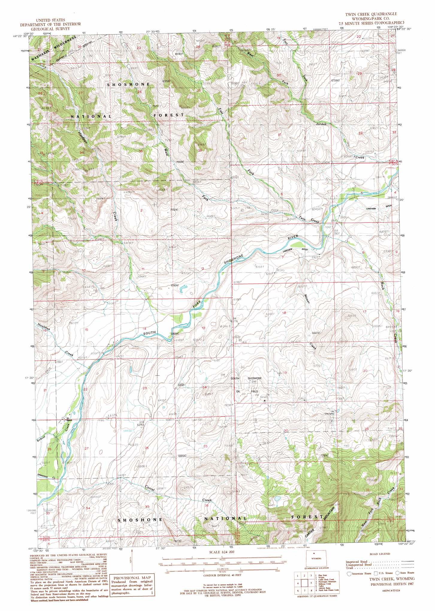
USGS Topo Quad 44109c4 - 1:24,000 scale
| Topo Map Name: | Twin Creek |
| USGS Topo Quad ID: | 44109c4 |
| Print Size: | ca. 21 1/4" wide x 27" high |
| Southeast Coordinates: | 44.25° N latitude / 109.375° W longitude |
| Map Center Coordinates: | 44.3125° N latitude / 109.4375° W longitude |
| U.S. State: | WY |
| Filename: | o44109c4.jpg |
| Download Map JPG Image: | Twin Creek topo map 1:24,000 scale |
| Map Type: | Topographic |
| Topo Series: | 7.5´ |
| Map Scale: | 1:24,000 |
| Source of Map Images: | United States Geological Survey (USGS) |
| Alternate Map Versions: |
Twin Creek WY 1987, updated 1988 Download PDF Buy paper map Twin Creek WY 1991, updated 1997 Download PDF Buy paper map Twin Creek WY 2012 Download PDF Buy paper map Twin Creek WY 2015 Download PDF Buy paper map |
| FStopo: | US Forest Service topo Twin Creek is available: Download FStopo PDF Download FStopo TIF |
1:24,000 Topo Quads surrounding Twin Creek
Jaggar Peak |
Dead Indian Peak |
Jim Mountain |
Logan Mountain |
Shoshone Canyon |
Clayton Mountain |
Flag Peak |
Wapiti |
Castle Rock Creek |
Irma Flats |
Lake Creek |
Ptarmigan Mountain |
Twin Creek |
Belknap Creek |
Devils Tooth |
Clouds Home Peak |
Valley |
Aldrich Basin |
North Fork Pickett Creek |
Thomas Reservoir |
Fall Creek |
Needle Mountain |
Irish Rock |
Phelps Mountain |
Pitchfork |
> Back to 44109a1 at 1:100,000 scale
> Back to 44108a1 at 1:250,000 scale
> Back to U.S. Topo Maps home
Twin Creek topo map: Gazetteer
Twin Creek: Dams
Modglin Dam elevation 1996m 6548′Twin Creek: Oilfields
South Shoshone Oil Field elevation 2054m 6738′Twin Creek: Reservoirs
Modglin Reservoir elevation 1996m 6548′Twin Creek: Streams
Bobcat Creek elevation 1839m 6033′Buttonhole Creek elevation 1977m 6486′
Corral Creek elevation 1852m 6076′
East Fork Jordan Creek elevation 2018m 6620′
East Fork Twin Creek elevation 1845m 6053′
Hardpan Creek elevation 1817m 5961′
Houlihan Creek elevation 1834m 6017′
Ishawooa Creek elevation 1847m 6059′
Mower Creek elevation 1799m 5902′
Rock Creek elevation 1794m 5885′
Twin Creek elevation 1790m 5872′
West Fork Jordan Creek elevation 2018m 6620′
West Fork Twin Creek elevation 1845m 6053′
Twin Creek digital topo map on disk
Buy this Twin Creek topo map showing relief, roads, GPS coordinates and other geographical features, as a high-resolution digital map file on DVD: