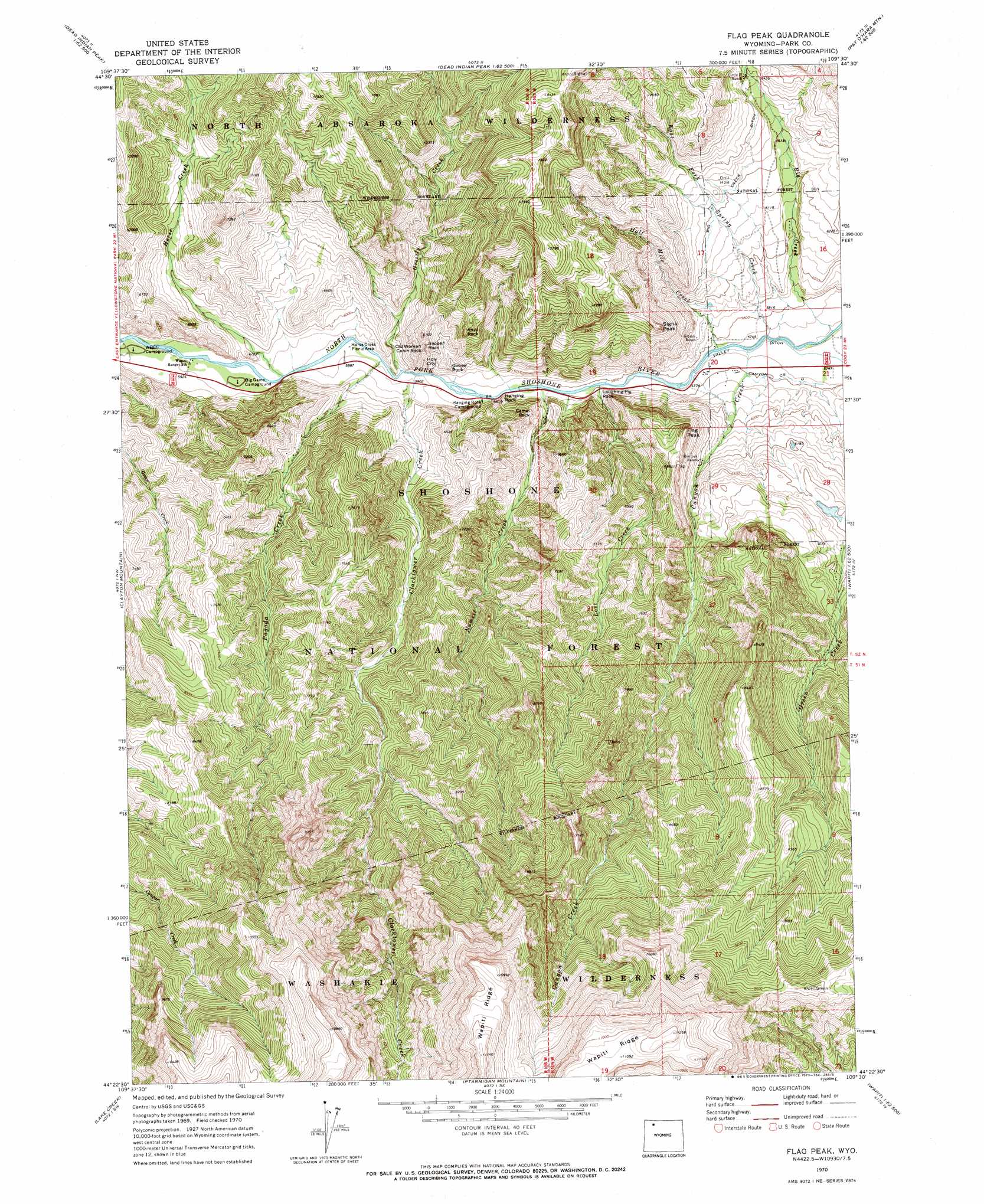
Flag Peak Topo Map Wyoming
To zoom in, hover over the map of Flag Peak
USGS Topo Quad 44109d5 - 1:24,000 scale
| Topo Map Name: | Flag Peak |
| USGS Topo Quad ID: | 44109d5 |
| Print Size: | ca. 21 1/4" wide x 27" high |
| Southeast Coordinates: | 44.375° N latitude / 109.5° W longitude |
| Map Center Coordinates: | 44.4375° N latitude / 109.5625° W longitude |
| U.S. State: | WY |
| Filename: | o44109d5.jpg |
| Download Map JPG Image: | Flag Peak topo map 1:24,000 scale |
| Map Type: | Topographic |
| Topo Series: | 7.5´ |
| Map Scale: | 1:24,000 |
| Source of Map Images: | United States Geological Survey (USGS) |
| Alternate Map Versions: |
Flag Peak WY 1970, updated 1973 Download PDF Buy paper map Flag Peak WY 1991, updated 1997 Download PDF Buy paper map Flag Peak WY 2012 Download PDF Buy paper map Flag Peak WY 2015 Download PDF Buy paper map |
| FStopo: | US Forest Service topo Flag Peak is available: Download FStopo PDF Download FStopo TIF |
1:24,000 Topo Quads surrounding Flag Peak
Stinkingwater Peak |
Geers Point |
Elkhorn Peak |
Dead Indian Meadows |
Pat O' Hara Mountain |
Sunlight Peak |
Jaggar Peak |
Dead Indian Peak |
Jim Mountain |
Logan Mountain |
Chimney Rock |
Clayton Mountain |
Flag Peak |
Wapiti |
Castle Rock Creek |
Sheep Mesa |
Lake Creek |
Ptarmigan Mountain |
Twin Creek |
Belknap Creek |
Thorofare Buttes |
Clouds Home Peak |
Valley |
Aldrich Basin |
North Fork Pickett Creek |
> Back to 44109a1 at 1:100,000 scale
> Back to 44108a1 at 1:250,000 scale
> Back to U.S. Topo Maps home
Flag Peak topo map: Gazetteer
Flag Peak: Canals
Big Creek Ditch elevation 1899m 6230′Canyon Creek Ditch elevation 1763m 5784′
Valley Ditch elevation 1747m 5731′
Flag Peak: Pillars
Anvil Rock elevation 2030m 6660′Camel Rock elevation 1906m 6253′
Goose Rock elevation 1848m 6062′
Hanging Rock elevation 1893m 6210′
Laughing Pig Rock elevation 1905m 6250′
Old Woman Cabin Rock elevation 1948m 6391′
Slipper Rock elevation 1943m 6374′
Flag Peak: Streams
Big Creek elevation 1744m 5721′Canyon Creek elevation 1748m 5734′
Clocktower Creek elevation 1785m 5856′
East Fork Spring Creek elevation 1746m 5728′
Grizzly Creek elevation 1788m 5866′
Half Mile Creek elevation 1748m 5734′
Horse Creek elevation 1796m 5892′
Lost Creek elevation 1768m 5800′
Nameit Creek elevation 1769m 5803′
Pagoda Creek elevation 1785m 5856′
Flag Peak: Summits
Flag Peak elevation 2100m 6889′Holy City elevation 1855m 6085′
Signal Peak elevation 2136m 7007′
Flag Peak digital topo map on disk
Buy this Flag Peak topo map showing relief, roads, GPS coordinates and other geographical features, as a high-resolution digital map file on DVD: