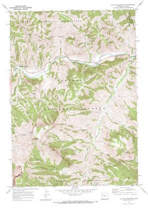
Clayton Mountain Topo Map Wyoming
To zoom in, hover over the map of Clayton Mountain
USGS Topo Quad 44109d6 - 1:24,000 scale
| Topo Map Name: | Clayton Mountain |
| USGS Topo Quad ID: | 44109d6 |
| Print Size: | ca. 21 1/4" wide x 27" high |
| Southeast Coordinates: | 44.375° N latitude / 109.625° W longitude |
| Map Center Coordinates: | 44.4375° N latitude / 109.6875° W longitude |
| U.S. State: | WY |
| Filename: | o44109d6.jpg |
| Download Map JPG Image: | Clayton Mountain topo map 1:24,000 scale |
| Map Type: | Topographic |
| Topo Series: | 7.5´ |
| Map Scale: | 1:24,000 |
| Source of Map Images: | United States Geological Survey (USGS) |
| Alternate Map Versions: |
Clayton Mountain WY 1970, updated 1973 Download PDF Buy paper map Clayton Mountain WY 1991, updated 1997 Download PDF Buy paper map Clayton Mountain WY 2012 Download PDF Buy paper map Clayton Mountain WY 2015 Download PDF Buy paper map |
| FStopo: | US Forest Service topo Clayton Mountain is available: Download FStopo PDF Download FStopo TIF |
1:24,000 Topo Quads surrounding Clayton Mountain
> Back to 44109a1 at 1:100,000 scale
> Back to 44108a1 at 1:250,000 scale
> Back to U.S. Topo Maps home
Clayton Mountain topo map: Gazetteer
Clayton Mountain: Mines
Sweetwater Creek Mine elevation 2134m 7001′Clayton Mountain: Parks
Clearwater Picnic Area elevation 1836m 6023′Clayton Mountain: Streams
Aspen Creek elevation 1848m 6062′Blackwater Creek elevation 1876m 6154′
Blind Creek elevation 2038m 6686′
Clearwater Creek elevation 1830m 6003′
Cougar Creek elevation 1902m 6240′
Elk Fork elevation 1816m 5958′
Frost Creek elevation 1967m 6453′
Grace Creek elevation 1824m 5984′
Icy Creek elevation 2030m 6660′
June Creek elevation 1858m 6095′
Moss Creek elevation 1860m 6102′
Sweetwater Creek elevation 1816m 5958′
Clayton Mountain: Summits
Clayton Mountain elevation 3039m 9970′Double Mountain elevation 3307m 10849′
Post Point elevation 2759m 9051′
Clayton Mountain digital topo map on disk
Buy this Clayton Mountain topo map showing relief, roads, GPS coordinates and other geographical features, as a high-resolution digital map file on DVD:


