Pat O' Hara Mountain Topo Map Wyoming
To zoom in, hover over the map of Pat O' Hara Mountain
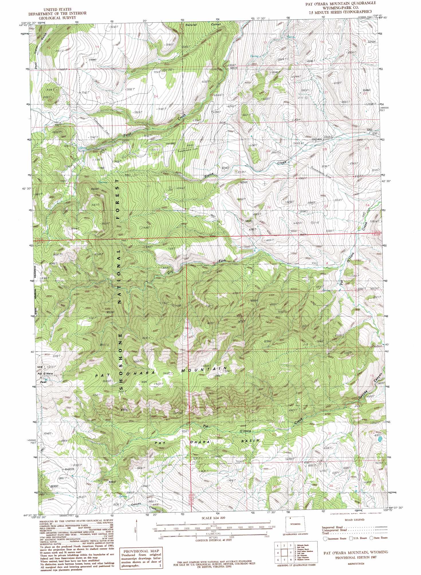
USGS Topo Quad 44109f3 - 1:24,000 scale
| Topo Map Name: | Pat O' Hara Mountain |
| USGS Topo Quad ID: | 44109f3 |
| Print Size: | ca. 21 1/4" wide x 27" high |
| Southeast Coordinates: | 44.625° N latitude / 109.25° W longitude |
| Map Center Coordinates: | 44.6875° N latitude / 109.3125° W longitude |
| U.S. State: | WY |
| Filename: | o44109f3.jpg |
| Download Map JPG Image: | Pat O' Hara Mountain topo map 1:24,000 scale |
| Map Type: | Topographic |
| Topo Series: | 7.5´ |
| Map Scale: | 1:24,000 |
| Source of Map Images: | United States Geological Survey (USGS) |
| Alternate Map Versions: |
Pat O' Hara Mountain WY 1987, updated 1987 Download PDF Buy paper map Pat O' Hara Mountain WY 1991, updated 1997 Download PDF Buy paper map Pat O' Hara Mountain WY 2012 Download PDF Buy paper map Pat O' Hara Mountain WY 2015 Download PDF Buy paper map |
| FStopo: | US Forest Service topo Pat O' Hara Mountain is available: Download FStopo PDF Download FStopo TIF |
1:24,000 Topo Quads surrounding Pat O' Hara Mountain
Beartooth Butte |
Deep Lake |
North Bennett Creek |
Clark |
Badger Basin |
Windy Mountain |
Dillworth Bench |
Bald Peak |
Chapman Bench |
Badlands Hills |
Elkhorn Peak |
Dead Indian Meadows |
Pat O' Hara Mountain |
Goff Lake |
Eaglenest Basin |
Dead Indian Peak |
Jim Mountain |
Logan Mountain |
Shoshone Canyon |
Cody |
Flag Peak |
Wapiti |
Castle Rock Creek |
Irma Flats |
Indian Pass |
> Back to 44109e1 at 1:100,000 scale
> Back to 44108a1 at 1:250,000 scale
> Back to U.S. Topo Maps home
Pat O' Hara Mountain topo map: Gazetteer
Pat O' Hara Mountain: Basins
Natural Corral elevation 1960m 6430′Pat O'Hara Basin elevation 2108m 6916′
Pat O' Hara Mountain: Mines
Iron King Claims elevation 1867m 6125′Pat O' Hara Mountain: Streams
Dry Fork elevation 1628m 5341′Pat O' Hara Mountain: Summits
Pat O'Hara Mountain elevation 2858m 9376′Pat O'Hara Peak elevation 3026m 9927′
Pat O' Hara Mountain: Valleys
Oxyoke Canyon elevation 1741m 5711′Pat O' Hara Mountain digital topo map on disk
Buy this Pat O' Hara Mountain topo map showing relief, roads, GPS coordinates and other geographical features, as a high-resolution digital map file on DVD: