Elkhorn Peak Topo Map Wyoming
To zoom in, hover over the map of Elkhorn Peak
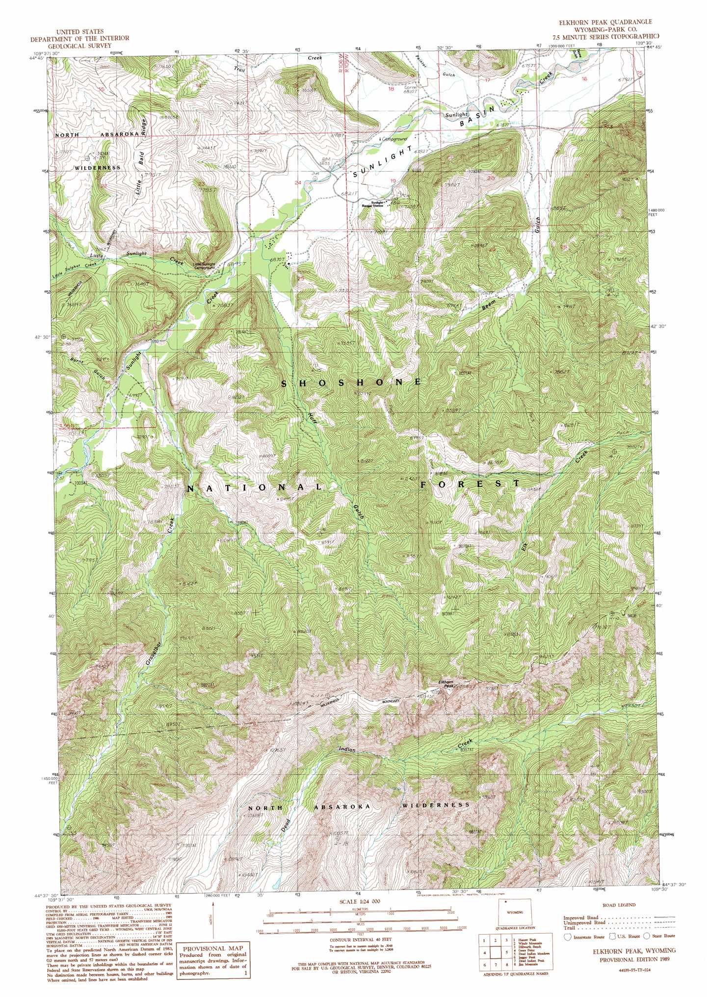
USGS Topo Quad 44109f5 - 1:24,000 scale
| Topo Map Name: | Elkhorn Peak |
| USGS Topo Quad ID: | 44109f5 |
| Print Size: | ca. 21 1/4" wide x 27" high |
| Southeast Coordinates: | 44.625° N latitude / 109.5° W longitude |
| Map Center Coordinates: | 44.6875° N latitude / 109.5625° W longitude |
| U.S. State: | WY |
| Filename: | o44109f5.jpg |
| Download Map JPG Image: | Elkhorn Peak topo map 1:24,000 scale |
| Map Type: | Topographic |
| Topo Series: | 7.5´ |
| Map Scale: | 1:24,000 |
| Source of Map Images: | United States Geological Survey (USGS) |
| Alternate Map Versions: |
Elkhorn Peak WY 1989, updated 1989 Download PDF Buy paper map Elkhorn Peak WY 1991, updated 1997 Download PDF Buy paper map Elkhorn Peak WY 2012 Download PDF Buy paper map Elkhorn Peak WY 2015 Download PDF Buy paper map |
| FStopo: | US Forest Service topo Elkhorn Peak is available: Download FStopo PDF Download FStopo TIF |
1:24,000 Topo Quads surrounding Elkhorn Peak
Jim Smith Peak |
Muddy Creek |
Beartooth Butte |
Deep Lake |
North Bennett Creek |
Hurricane Mesa |
Hunter Peak |
Windy Mountain |
Dillworth Bench |
Bald Peak |
Stinkingwater Peak |
Geers Point |
Elkhorn Peak |
Dead Indian Meadows |
Pat O' Hara Mountain |
Sunlight Peak |
Jaggar Peak |
Dead Indian Peak |
Jim Mountain |
Logan Mountain |
Chimney Rock |
Clayton Mountain |
Flag Peak |
Wapiti |
Castle Rock Creek |
> Back to 44109e1 at 1:100,000 scale
> Back to 44108a1 at 1:250,000 scale
> Back to U.S. Topo Maps home
Elkhorn Peak topo map: Gazetteer
Elkhorn Peak: Basins
Sunlight Basin elevation 2060m 6758′Elkhorn Peak: Gaps
Deweys Gateway elevation 2101m 6893′Elkhorn Peak: Ridges
Little Bald Ridge elevation 2453m 8047′Elkhorn Peak: Streams
Gravelbar Creek elevation 2118m 6948′Little Sulphur Creek elevation 2150m 7053′
Little Sunlight Creek elevation 2097m 6879′
Trail Creek elevation 2094m 6870′
Elkhorn Peak: Summits
Elkhorn Peak elevation 3210m 10531′Elkhorn Peak: Valleys
Beem Gulch elevation 2072m 6797′Burnt Gulch elevation 2127m 6978′
Huff Gulch elevation 2108m 6916′
Painter Gulch elevation 2066m 6778′
White Mountain Gulch elevation 2049m 6722′
Elkhorn Peak digital topo map on disk
Buy this Elkhorn Peak topo map showing relief, roads, GPS coordinates and other geographical features, as a high-resolution digital map file on DVD: