Hurricane Mesa Topo Map Wyoming
To zoom in, hover over the map of Hurricane Mesa
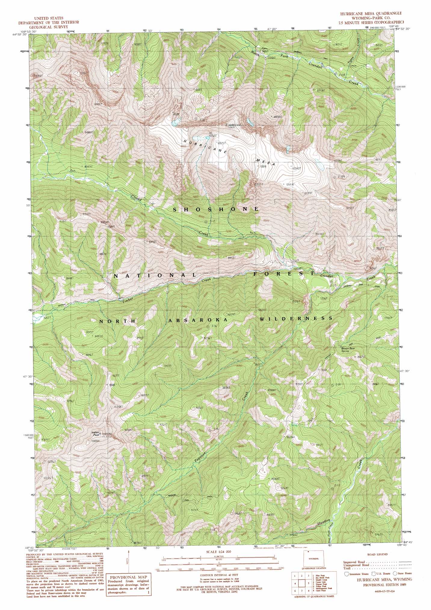
USGS Topo Quad 44109g7 - 1:24,000 scale
| Topo Map Name: | Hurricane Mesa |
| USGS Topo Quad ID: | 44109g7 |
| Print Size: | ca. 21 1/4" wide x 27" high |
| Southeast Coordinates: | 44.75° N latitude / 109.75° W longitude |
| Map Center Coordinates: | 44.8125° N latitude / 109.8125° W longitude |
| U.S. State: | WY |
| Filename: | o44109g7.jpg |
| Download Map JPG Image: | Hurricane Mesa topo map 1:24,000 scale |
| Map Type: | Topographic |
| Topo Series: | 7.5´ |
| Map Scale: | 1:24,000 |
| Source of Map Images: | United States Geological Survey (USGS) |
| Alternate Map Versions: |
Hurricane Mesa WY 1989, updated 1989 Download PDF Buy paper map Hurricane Mesa WY 1991, updated 1997 Download PDF Buy paper map Hurricane Mesa WY 2012 Download PDF Buy paper map Hurricane Mesa WY 2015 Download PDF Buy paper map |
| FStopo: | US Forest Service topo Hurricane Mesa is available: Download FStopo PDF Download FStopo TIF |
1:24,000 Topo Quads surrounding Hurricane Mesa
Cutoff Mountain |
Cooke City |
Fossil Lake |
Castle Mountain |
Silver Run Peak |
Abiathar Peak |
Pilot Peak |
Jim Smith Peak |
Muddy Creek |
Beartooth Butte |
Wahb Springs |
Canoe Lake |
Hurricane Mesa |
Hunter Peak |
Windy Mountain |
Little Saddle Mountain |
Pollux Peak |
Stinkingwater Peak |
Geers Point |
Elkhorn Peak |
Cathedral Peak |
Pahaska Tepee |
Sunlight Peak |
Jaggar Peak |
Dead Indian Peak |
> Back to 44109e1 at 1:100,000 scale
> Back to 44108a1 at 1:250,000 scale
> Back to U.S. Topo Maps home
Hurricane Mesa topo map: Gazetteer
Hurricane Mesa: Springs
Brown Bear Spring elevation 2558m 8392′Hurricane Mesa: Streams
Closed Creek elevation 2143m 7030′One Hunt Creek elevation 2269m 7444′
Papoose Creek elevation 2110m 6922′
Tepee Creek elevation 2189m 7181′
Timber Creek elevation 2143m 7030′
Hurricane Mesa: Summits
Hurricane Mesa elevation 3191m 10469′Indian Peak elevation 3329m 10921′
Hurricane Mesa: Trails
Crandall Trail elevation 2269m 7444′Papoose Trail elevation 2745m 9005′
Hurricane Mesa digital topo map on disk
Buy this Hurricane Mesa topo map showing relief, roads, GPS coordinates and other geographical features, as a high-resolution digital map file on DVD: