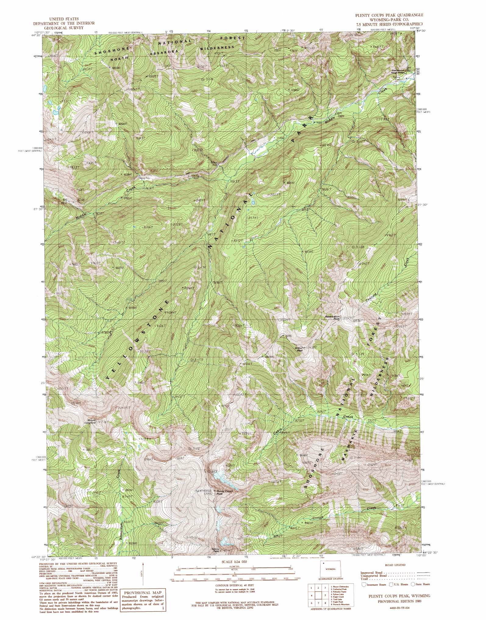
Plenty Coups Peak Topo Map Wyoming
To zoom in, hover over the map of Plenty Coups Peak
USGS Topo Quad 44110d1 - 1:24,000 scale
| Topo Map Name: | Plenty Coups Peak |
| USGS Topo Quad ID: | 44110d1 |
| Print Size: | ca. 21 1/4" wide x 27" high |
| Southeast Coordinates: | 44.375° N latitude / 110° W longitude |
| Map Center Coordinates: | 44.4375° N latitude / 110.0625° W longitude |
| U.S. State: | WY |
| Filename: | o44110d1.jpg |
| Download Map JPG Image: | Plenty Coups Peak topo map 1:24,000 scale |
| Map Type: | Topographic |
| Topo Series: | 7.5´ |
| Map Scale: | 1:24,000 |
| Source of Map Images: | United States Geological Survey (USGS) |
| Alternate Map Versions: |
Plenty Coups Peak WY 1989, updated 1989 Download PDF Buy paper map Plenty Coups Peak WY 1991, updated 1997 Download PDF Buy paper map Plenty Coups Peak WY 2012 Download PDF Buy paper map Plenty Coups Peak WY 2015 Download PDF Buy paper map |
| FStopo: | US Forest Service topo Plenty Coups Peak is available: Download FStopo PDF Download FStopo TIF |
1:24,000 Topo Quads surrounding Plenty Coups Peak
White Lake |
Pelican Cone |
Little Saddle Mountain |
Pollux Peak |
Stinkingwater Peak |
Lake Butte |
Mount Chittenden |
Cathedral Peak |
Pahaska Tepee |
Sunlight Peak |
Frank Island |
Sylvan Lake |
Plenty Coups Peak |
Eagle Creek |
Chimney Rock |
Alder Lake |
Trail Lake |
Eagle Peak |
Pinnacle Mountain |
Sheep Mesa |
Crooked Creek |
Badger Creek |
The Trident |
Open Creek |
Thorofare Buttes |
> Back to 44110a1 at 1:100,000 scale
> Back to 44110a1 at 1:250,000 scale
> Back to U.S. Topo Maps home
Plenty Coups Peak topo map: Gazetteer
Plenty Coups Peak: Summits
Arthur Peak elevation 3159m 10364′Atkins Peak elevation 3331m 10928′
Mount Langford elevation 3238m 10623′
Plenty Coups Peak elevation 3330m 10925′
Reservation Peak elevation 3236m 10616′
Plenty Coups Peak digital topo map on disk
Buy this Plenty Coups Peak topo map showing relief, roads, GPS coordinates and other geographical features, as a high-resolution digital map file on DVD: