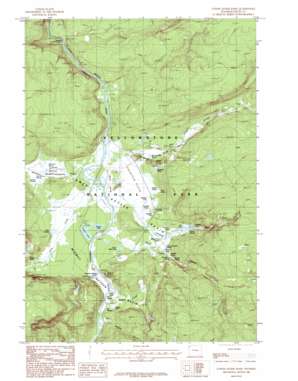
Lower Geyser Basin Topo Map Wyoming
To zoom in, hover over the map of Lower Geyser Basin
USGS Topo Quad 44110e7 - 1:24,000 scale
| Topo Map Name: | Lower Geyser Basin |
| USGS Topo Quad ID: | 44110e7 |
| Print Size: | ca. 21 1/4" wide x 27" high |
| Southeast Coordinates: | 44.5° N latitude / 110.75° W longitude |
| Map Center Coordinates: | 44.5625° N latitude / 110.8125° W longitude |
| U.S. State: | WY |
| Filename: | o44110e7.jpg |
| Download Map JPG Image: | Lower Geyser Basin topo map 1:24,000 scale |
| Map Type: | Topographic |
| Topo Series: | 7.5´ |
| Map Scale: | 1:24,000 |
| Source of Map Images: | United States Geological Survey (USGS) |
| Alternate Map Versions: |
Lower Geyser Basin WY 1986, updated 1986 Download PDF Buy paper map Lower Geyser Basin WY 1986, updated 1986 Download PDF Buy paper map Lower Geyser Basin WY 2012 Download PDF Buy paper map Lower Geyser Basin WY 2015 Download PDF Buy paper map |
1:24,000 Topo Quads surrounding Lower Geyser Basin
> Back to 44110e1 at 1:100,000 scale
> Back to 44110a1 at 1:250,000 scale
> Back to U.S. Topo Maps home
Lower Geyser Basin topo map: Gazetteer
Lower Geyser Basin: Basins
Culex Basin elevation 2233m 7326′Lower Geyser Basin elevation 2203m 7227′
Midway Geyser Basin elevation 2207m 7240′
Pocket Basin elevation 2191m 7188′
Lower Geyser Basin: Cliffs
Midway Bluff elevation 2254m 7395′Lower Geyser Basin: Falls
Cascades of the Firehole elevation 2165m 7103′Fairy Falls elevation 2334m 7657′
Lower Geyser Basin: Flats
Fountain Flats elevation 2199m 7214′Sentinel Meadows elevation 2196m 7204′
Lower Geyser Basin: Lakes
Excelsior Geyser Crater elevation 2212m 7257′Feather Lake elevation 2202m 7224′
Firehole Lake elevation 2249m 7378′
Goose Lake elevation 2202m 7224′
Goose Lakes elevation 2203m 7227′
Hot Lake elevation 2247m 7372′
Lower Basin Lake elevation 2213m 7260′
Rush Lake elevation 2200m 7217′
Surprise Pool elevation 2233m 7326′
Lower Geyser Basin: Springs
Bath Spring elevation 2196m 7204′Bead Geyser elevation 2239m 7345′
Bellefontaine Geyser elevation 2246m 7368′
Black Warrior Springs elevation 2197m 7208′
Boulder Spring elevation 2195m 7201′
Broken Egg Spring elevation 2220m 7283′
Buffalo Pool elevation 2234m 7329′
Buffalo Spring elevation 2189m 7181′
Catfish Geyser elevation 2209m 7247′
Celestine Pool elevation 2224m 7296′
Clepsydra Geyser elevation 2211m 7253′
Fairy Springs elevation 2207m 7240′
Firehole Spring elevation 2200m 7217′
Five Sisters Springs elevation 2245m 7365′
Flat Cone Spring elevation 2194m 7198′
Flood Geyser elevation 2235m 7332′
Flood Group Springs elevation 2199m 7214′
Fountain Geyser elevation 2211m 7253′
Fountain Group elevation 2210m 7250′
Fountain Group Springs elevation 2211m 7253′
Fountain Paint Pot elevation 2227m 7306′
Gentian Pool elevation 2210m 7250′
Grand Prismatic Spring elevation 2216m 7270′
Great Fountain Geyser elevation 2240m 7349′
Grizzly Pool elevation 2220m 7283′
Jelly Spring elevation 2212m 7257′
Kidney Geyser elevation 2204m 7230′
Lone Spring elevation 2207m 7240′
Midway Picnic Ground Springs elevation 2215m 7267′
Morning Mist Springs elevation 2204m 7230′
Mound Spring elevation 2198m 7211′
Narcissus Geyser elevation 2244m 7362′
Octopus Spring elevation 2238m 7342′
Ojo Caliente Spring elevation 2189m 7181′
Old Bath Lake elevation 2244m 7362′
Pink Cone elevation 2233m 7326′
Porcupine Hill Geyser elevation 2207m 7240′
Quagmire Group elevation 2218m 7276′
Quagmire Group Springs elevation 2249m 7378′
Queens Laundry elevation 2199m 7214′
Rabbit Creek Group Springs elevation 2242m 7355′
Red Terrace Spring elevation 2203m 7227′
River Geyser elevation 2209m 7247′
River Group elevation 2191m 7188′
Snort Spring elevation 2214m 7263′
Spindle Geyser elevation 2239m 7345′
Spray Geyser elevation 2226m 7303′
Steady Geyser elevation 2248m 7375′
Steady Geyser elevation 2212m 7257′
Steep Cone elevation 2203m 7227′
Till Geyser elevation 2220m 7283′
Tromp Spring elevation 2205m 7234′
Turquoise Pool elevation 2212m 7257′
White Creek Group Springs elevation 2306m 7565′
White Dome Geyser elevation 2226m 7303′
Young Hopeful Geyser elevation 2212m 7257′
Zomar Spring elevation 2252m 7388′
Lower Geyser Basin: Streams
Fairy Creek elevation 2189m 7181′Mallard Creek elevation 2210m 7250′
Nez Perce Creek elevation 2183m 7162′
Rabbit Creek elevation 2208m 7244′
Sentinel Creek elevation 2189m 7181′
Tangled Creek elevation 2196m 7204′
White Creek elevation 2196m 7204′
Lower Geyser Basin: Summits
Porcupine Hills elevation 2247m 7372′Lower Geyser Basin digital topo map on disk
Buy this Lower Geyser Basin topo map showing relief, roads, GPS coordinates and other geographical features, as a high-resolution digital map file on DVD:


