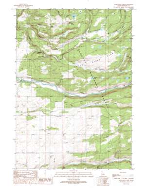
Porcupine Lake Topo Map Idaho
To zoom in, hover over the map of Porcupine Lake
USGS Topo Quad 44111a2 - 1:24,000 scale
| Topo Map Name: | Porcupine Lake |
| USGS Topo Quad ID: | 44111a2 |
| Print Size: | ca. 21 1/4" wide x 27" high |
| Southeast Coordinates: | 44° N latitude / 111.125° W longitude |
| Map Center Coordinates: | 44.0625° N latitude / 111.1875° W longitude |
| U.S. State: | ID |
| Filename: | o44111a2.jpg |
| Download Map JPG Image: | Porcupine Lake topo map 1:24,000 scale |
| Map Type: | Topographic |
| Topo Series: | 7.5´ |
| Map Scale: | 1:24,000 |
| Source of Map Images: | United States Geological Survey (USGS) |
| Alternate Map Versions: |
Porcupine Lake ID 1989, updated 1989 Download PDF Buy paper map Porcupine Lake ID 2011 Download PDF Buy paper map Porcupine Lake ID 2013 Download PDF Buy paper map |
| FStopo: | US Forest Service topo Porcupine Lake is available: Download FStopo PDF Download FStopo TIF |
1:24,000 Topo Quads surrounding Porcupine Lake
> Back to 44111a1 at 1:100,000 scale
> Back to 44110a1 at 1:250,000 scale
> Back to U.S. Topo Maps home
Porcupine Lake topo map: Gazetteer
Porcupine Lake: Areas
Falls River Ridge elevation 1847m 6059′Porcupine Lake: Flats
Bear Meadow elevation 1831m 6007′Porcupine Lake: Lakes
Bear Lake elevation 1823m 5980′Porcupine Lake: Reservoirs
Cub Lake elevation 1830m 6003′Lower Goose Lake elevation 1848m 6062′
Porcupine Lake elevation 1837m 6026′
Tule Lake elevation 1848m 6062′
Porcupine Lake: Streams
Beaver Creek elevation 1776m 5826′Boone Creek elevation 1769m 5803′
Boone Creek elevation 1772m 5813′
Conant Creek elevation 1789m 5869′
Elk Creek elevation 1789m 5869′
Granite Creek elevation 1784m 5853′
Porcupine Creek elevation 1680m 5511′
Rising Creek elevation 1721m 5646′
Sawmill Creek elevation 1750m 5741′
Schaefer Creek elevation 1750m 5741′
Shaefer Creek elevation 1744m 5721′
Spring Creek elevation 1708m 5603′
Wyoming Creek elevation 1813m 5948′
Wyoming Creek elevation 1813m 5948′
Porcupine Lake: Valleys
Cart Hollow elevation 1761m 5777′Moose Draw elevation 1681m 5515′
Porcupine Lake digital topo map on disk
Buy this Porcupine Lake topo map showing relief, roads, GPS coordinates and other geographical features, as a high-resolution digital map file on DVD:


