Hatchery Butte Topo Map Idaho
To zoom in, hover over the map of Hatchery Butte
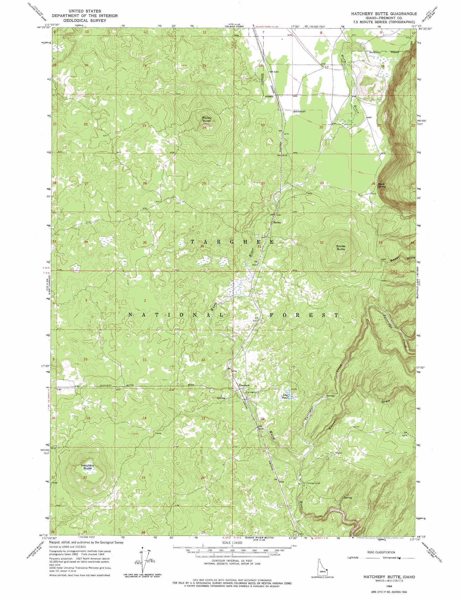
USGS Topo Quad 44111c3 - 1:24,000 scale
| Topo Map Name: | Hatchery Butte |
| USGS Topo Quad ID: | 44111c3 |
| Print Size: | ca. 21 1/4" wide x 27" high |
| Southeast Coordinates: | 44.25° N latitude / 111.25° W longitude |
| Map Center Coordinates: | 44.3125° N latitude / 111.3125° W longitude |
| U.S. State: | ID |
| Filename: | o44111c3.jpg |
| Download Map JPG Image: | Hatchery Butte topo map 1:24,000 scale |
| Map Type: | Topographic |
| Topo Series: | 7.5´ |
| Map Scale: | 1:24,000 |
| Source of Map Images: | United States Geological Survey (USGS) |
| Alternate Map Versions: |
Hatchery Butte ID 1964, updated 1965 Download PDF Buy paper map Hatchery Butte ID 1964, updated 1974 Download PDF Buy paper map Hatchery Butte ID 2011 Download PDF Buy paper map Hatchery Butte ID 2013 Download PDF Buy paper map |
| FStopo: | US Forest Service topo Hatchery Butte is available: Download FStopo PDF Download FStopo TIF |
1:24,000 Topo Quads surrounding Hatchery Butte
Mount Jefferson |
Sawtell Peak |
Big Springs |
Reas Pass |
Jack Straw Basin |
Icehouse Creek |
Island Park Dam |
Island Park |
Latham Spring |
Buffalo Lake Ne |
Bishop Mountain |
Last Chance |
Hatchery Butte |
Big Grassy |
Buffalo Lake |
Blue Creek Reservoir |
Lookout Butte |
Snake River Butte |
Warm River Butte |
Bechler Falls |
Lemon Lake |
Ashton |
Warm River |
Porcupine Lake |
Sheep Falls |
> Back to 44111a1 at 1:100,000 scale
> Back to 44110a1 at 1:250,000 scale
> Back to U.S. Topo Maps home
Hatchery Butte topo map: Gazetteer
Hatchery Butte: Lakes
Lily Pond elevation 1868m 6128′Hatchery Butte: Populated Places
Eccles elevation 1906m 6253′Pineview elevation 1871m 6138′
Hatchery Butte: Springs
Black Spring elevation 1914m 6279′Hatchery Butte: Streams
Partridge Creek elevation 1846m 6056′Hatchery Butte: Summits
Eccles Butte elevation 1985m 6512′Hatchery Butte elevation 1951m 6400′
Ripley Butte elevation 1967m 6453′
Hatchery Butte: Valleys
Baker Draw elevation 1919m 6295′Survey Draw elevation 1850m 6069′
Hatchery Butte digital topo map on disk
Buy this Hatchery Butte topo map showing relief, roads, GPS coordinates and other geographical features, as a high-resolution digital map file on DVD: