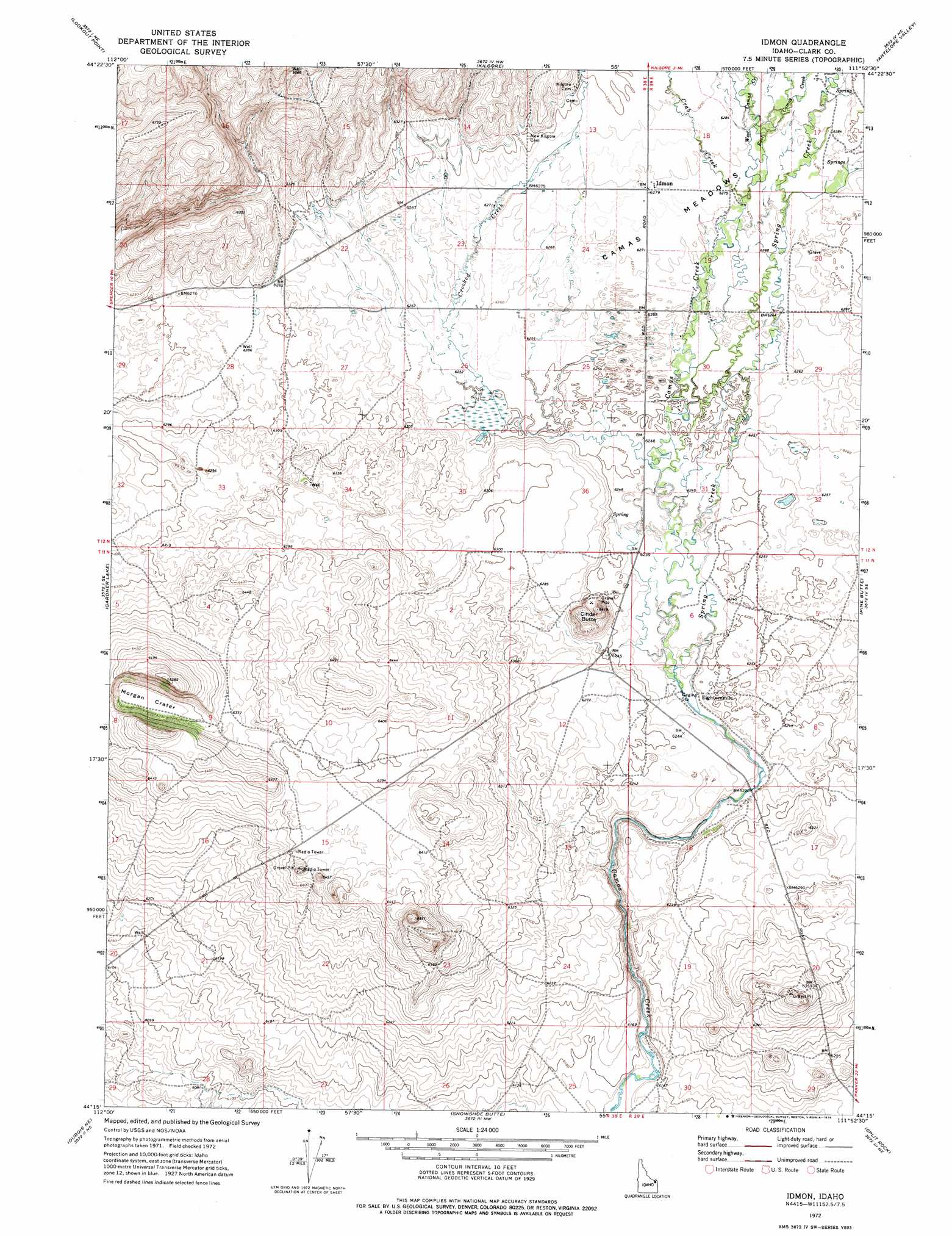
Idmon Topo Map Idaho
To zoom in, hover over the map of Idmon
USGS Topo Quad 44111c8 - 1:24,000 scale
| Topo Map Name: | Idmon |
| USGS Topo Quad ID: | 44111c8 |
| Print Size: | ca. 21 1/4" wide x 27" high |
| Southeast Coordinates: | 44.25° N latitude / 111.875° W longitude |
| Map Center Coordinates: | 44.3125° N latitude / 111.9375° W longitude |
| U.S. State: | ID |
| Filename: | o44111c8.jpg |
| Download Map JPG Image: | Idmon topo map 1:24,000 scale |
| Map Type: | Topographic |
| Topo Series: | 7.5´ |
| Map Scale: | 1:24,000 |
| Source of Map Images: | United States Geological Survey (USGS) |
| Alternate Map Versions: |
Idmon ID 1972, updated 1976 Download PDF Buy paper map Idmon ID 2010 Download PDF Buy paper map Idmon ID 2013 Download PDF Buy paper map |
1:24,000 Topo Quads surrounding Idmon
Corral Creek |
Big Table Mountain |
Winslow Creek |
Slide Mountain |
Upper Red Rock Lake |
Spencer North |
Lookout Point |
Kilgore |
Antelope Valley |
Sheridan Reservoir |
Spencer South |
Gardner Lake |
Idmon |
Pine Butte |
Crystal Butte |
Dubois |
Dubois Ne |
Snowshoe Butte |
Split Rock |
Split Butte |
Camas |
Dubois Se |
Big Grassy Ridge |
Big Grassy Ridge Se |
Black Knoll |
> Back to 44111a1 at 1:100,000 scale
> Back to 44110a1 at 1:250,000 scale
> Back to U.S. Topo Maps home
Idmon topo map: Gazetteer
Idmon: Craters
Morgan Crater elevation 1932m 6338′Idmon: Populated Places
Eighteenmile elevation 1900m 6233′Idmon elevation 1915m 6282′
Idmon: Streams
Crab Creek elevation 1912m 6272′Crooked Creek elevation 1904m 6246′
East Camas Creek elevation 1914m 6279′
Saw Creek elevation 1916m 6286′
Spring Creek elevation 1900m 6233′
West Camas Creek elevation 1915m 6282′
Idmon: Summits
Cinder Butte elevation 1957m 6420′Idmon digital topo map on disk
Buy this Idmon topo map showing relief, roads, GPS coordinates and other geographical features, as a high-resolution digital map file on DVD: