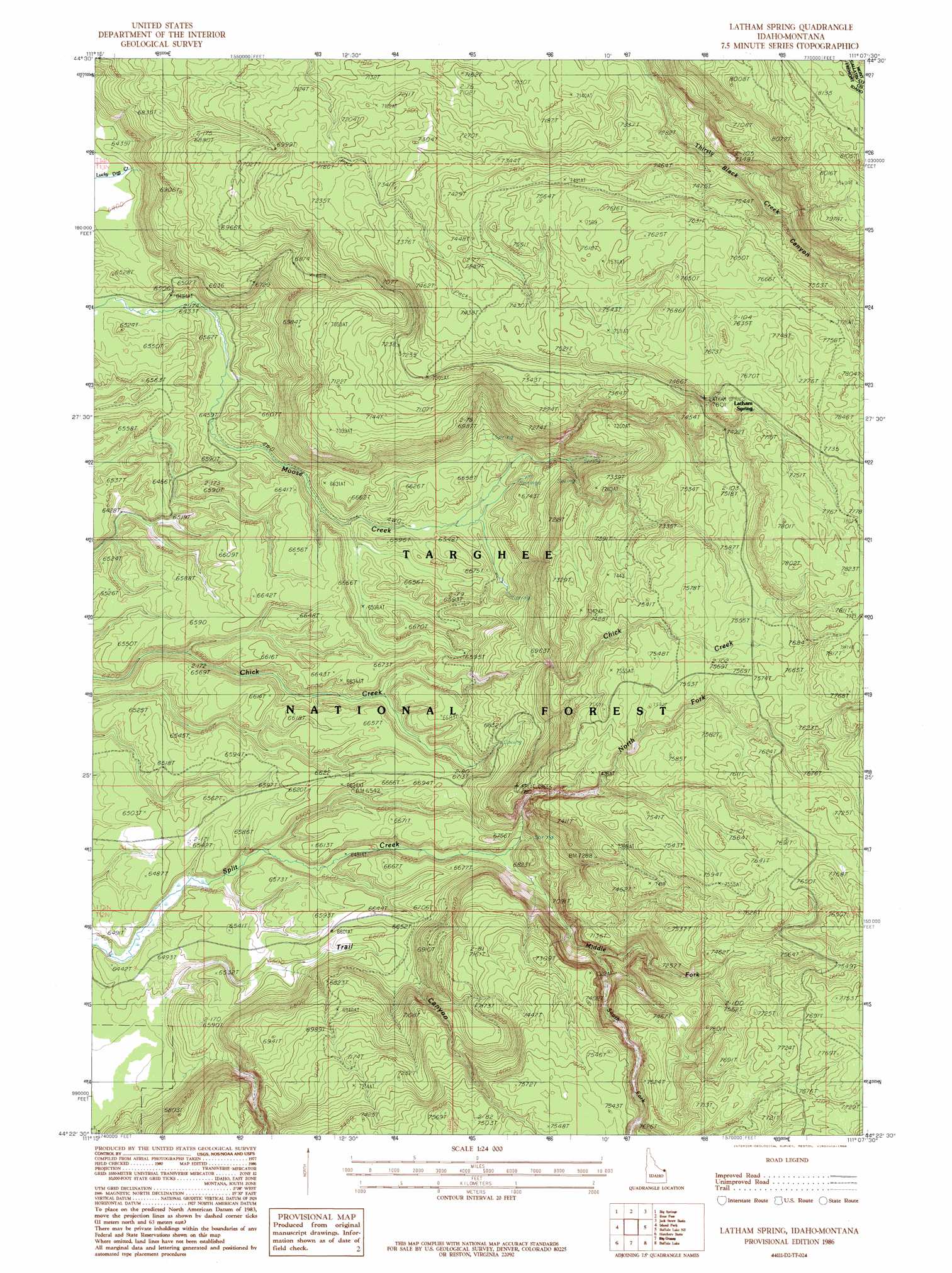
Latham Spring Topo Map Idaho
To zoom in, hover over the map of Latham Spring
USGS Topo Quad 44111d2 - 1:24,000 scale
| Topo Map Name: | Latham Spring |
| USGS Topo Quad ID: | 44111d2 |
| Print Size: | ca. 21 1/4" wide x 27" high |
| Southeast Coordinates: | 44.375° N latitude / 111.125° W longitude |
| Map Center Coordinates: | 44.4375° N latitude / 111.1875° W longitude |
| U.S. States: | ID, MT |
| Filename: | o44111d2.jpg |
| Download Map JPG Image: | Latham Spring topo map 1:24,000 scale |
| Map Type: | Topographic |
| Topo Series: | 7.5´ |
| Map Scale: | 1:24,000 |
| Source of Map Images: | United States Geological Survey (USGS) |
| Alternate Map Versions: |
Latham Spring ID 1986, updated 1986 Download PDF Buy paper map Latham Spring ID 2000, updated 2005 Download PDF Buy paper map Latham Spring ID 2011 Download PDF Buy paper map Latham Spring ID 2013 Download PDF Buy paper map |
| FStopo: | US Forest Service topo Latham Spring is available: Download FStopo PDF Download FStopo TIF |
1:24,000 Topo Quads surrounding Latham Spring
Targhee Peak |
Targhee Pass |
Madison Arm |
West Yellowstone |
Mount Jackson |
Sawtell Peak |
Big Springs |
Reas Pass |
Jack Straw Basin |
Buffalo Meadows |
Island Park Dam |
Island Park |
Latham Spring |
Buffalo Lake Ne |
Summit Lake |
Last Chance |
Hatchery Butte |
Big Grassy |
Buffalo Lake |
Trischman Knob |
Lookout Butte |
Snake River Butte |
Warm River Butte |
Bechler Falls |
Cave Falls |
> Back to 44111a1 at 1:100,000 scale
> Back to 44110a1 at 1:250,000 scale
> Back to U.S. Topo Maps home
Latham Spring topo map: Gazetteer
Latham Spring: Springs
Latham Spring elevation 2337m 7667′Latham Spring: Streams
Middle Fork Split Creek elevation 2008m 6587′North Fork Split Creek elevation 2060m 6758′
South Fork Split Creek elevation 2088m 6850′
Latham Spring: Valleys
Trail Canyon elevation 1939m 6361′Latham Spring digital topo map on disk
Buy this Latham Spring topo map showing relief, roads, GPS coordinates and other geographical features, as a high-resolution digital map file on DVD: