Island Park Topo Map Idaho
To zoom in, hover over the map of Island Park
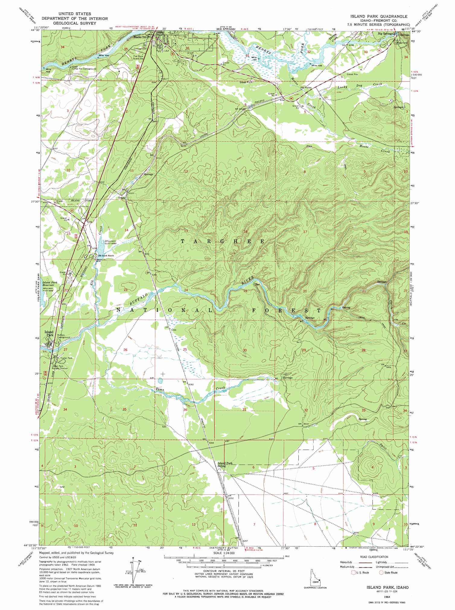
USGS Topo Quad 44111d3 - 1:24,000 scale
| Topo Map Name: | Island Park |
| USGS Topo Quad ID: | 44111d3 |
| Print Size: | ca. 21 1/4" wide x 27" high |
| Southeast Coordinates: | 44.375° N latitude / 111.25° W longitude |
| Map Center Coordinates: | 44.4375° N latitude / 111.3125° W longitude |
| U.S. State: | ID |
| Filename: | o44111d3.jpg |
| Download Map JPG Image: | Island Park topo map 1:24,000 scale |
| Map Type: | Topographic |
| Topo Series: | 7.5´ |
| Map Scale: | 1:24,000 |
| Source of Map Images: | United States Geological Survey (USGS) |
| Alternate Map Versions: |
Island Park ID 1964, updated 1965 Download PDF Buy paper map Island Park ID 1964, updated 1976 Download PDF Buy paper map Island Park ID 1964, updated 1986 Download PDF Buy paper map Island Park ID 2011 Download PDF Buy paper map Island Park ID 2013 Download PDF Buy paper map |
| FStopo: | US Forest Service topo Island Park is available: Download FStopo PDF Download FStopo TIF |
1:24,000 Topo Quads surrounding Island Park
Hidden Lake Bench |
Targhee Peak |
Targhee Pass |
Madison Arm |
West Yellowstone |
Mount Jefferson |
Sawtell Peak |
Big Springs |
Reas Pass |
Jack Straw Basin |
Icehouse Creek |
Island Park Dam |
Island Park |
Latham Spring |
Buffalo Lake Ne |
Bishop Mountain |
Last Chance |
Hatchery Butte |
Big Grassy |
Buffalo Lake |
Blue Creek Reservoir |
Lookout Butte |
Snake River Butte |
Warm River Butte |
Bechler Falls |
> Back to 44111a1 at 1:100,000 scale
> Back to 44110a1 at 1:250,000 scale
> Back to U.S. Topo Maps home
Island Park topo map: Gazetteer
Island Park: Populated Places
Big Springs elevation 1950m 6397′Island Park elevation 1918m 6292′
Trude elevation 1927m 6322′
Island Park: Post Offices
Big Springs Post Office (historical) elevation 1950m 6397′Island Park Post Office (historical) elevation 1918m 6292′
Macks Inn Post Office elevation 1950m 6397′
Trude Post Office (historical) elevation 1927m 6322′
Island Park: Streams
Chick Creek elevation 1937m 6354′Elk Creek elevation 1915m 6282′
Henrys Lake Outlet elevation 1947m 6387′
Lucky Dog Creek elevation 1949m 6394′
Moose Creek elevation 1947m 6387′
Split Creek elevation 1930m 6332′
Thirsty Creek elevation 1948m 6391′
Toms Creek elevation 1914m 6279′
Island Park digital topo map on disk
Buy this Island Park topo map showing relief, roads, GPS coordinates and other geographical features, as a high-resolution digital map file on DVD: